Super Typhoon Francisco
Super Typhoon Francisco became the third Category 5 tropical cyclone of 2013 on 19 October 2013, as it intesified over the West Pacific Ocean northwest of Guam. 4-km resolution MTSAT-2 10.8 µm IR channel images (above; click image to play animation) showed the evolution and track of the eye of Francisco during the 17-19 October period (the island of Guam is in the lower right corner of the images). Note the trochoidal motion or “wobble” that is exhibited by the eye of the tropical cyclone as it tracked northwestward – this is caused by changes within the inner core structure of the storm, such as convective asymmetries.
1-km resolution MTSAT-2 0.73 µm visible channel images (below; click image to play animation) revealed better details of the eye and eyewall structure during the daylight portion of 18-19 October. The lowering October sun angle tended to more brightly illumimate the sloped surface of the northern quadrant of the eye.
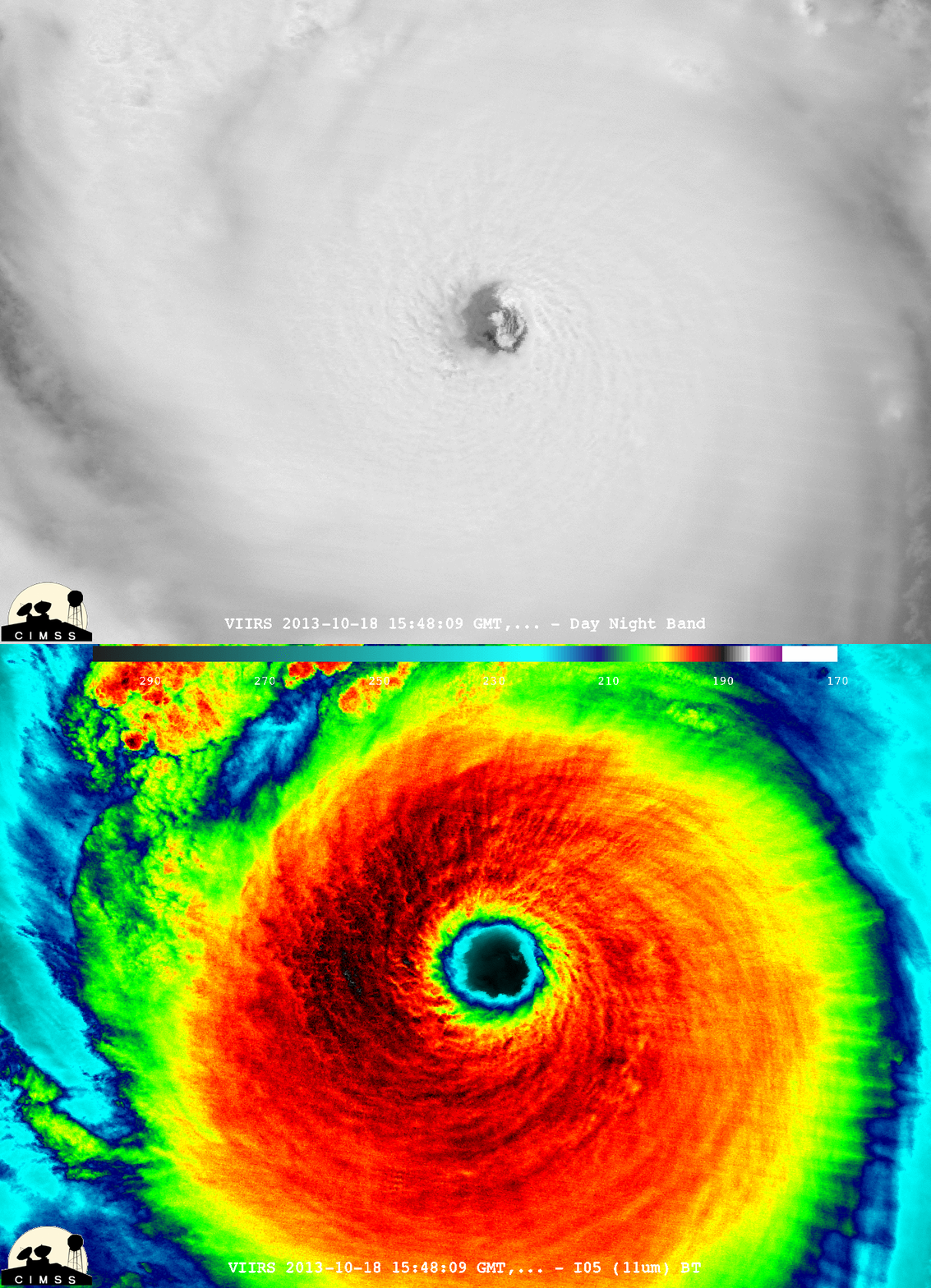
A McIDAS-V comparison of 375-meter resolution Suomi NPP VIIRS 0.7 µm Day/Night Band and 11.45 µm thermal IR channel images at 15:48 UTC on 18 October (below; images courtesy of William Straka, CIMSS) showed a good example of the so-called “stadium effect”: the eye diameter appeared larger on the VIIRS IR image than on the corresponding “visible image at night” from the VIIRS Day/Night Band, because the clouds along the edges of the eye were steeply sloping outward with height.


