Snow streaks across the Great Lakes region
MODIS true color and false color images from the SSEC MODIS Today site (above) displayed a number of mesoscale snow streaks across parts of the Great Lakes region on 18 November 2008. The snow on the ground (as well as any clouds) appear as white features on the true color imagery — on the false-color imagery, any snow cover on the ground (as well as ice crystal clouds aloft) appear as cyan-colored features (in contrast to supercooled sater droplet clouds, which appear as varying shades of white). Many of the snow streaks across parts of Wisconsin, Michigan, Indiana, and Ohio were on the order of 10 miles (19 km) or less in width.
A surge of cold arctic air on the previous day helped to initiate widespread snow showers across much of the Great Lakes region, which produced the narrow snowfall streaks. There was also significant lake-effect snowfall to the lee of the Greak Lakes –Â snowfall amounts were as high as 22.0 inches at Trenary in the Upper Peninsula of Michigan, 10.5 inches at Gile in far northern Wisconsin, and 9.8 inches at Moorestown in the southwestern part of Lower Michigan. Extensive snow cover can be seen across far southwestern Lower Michigan and far northern Indiana on the MODIS images, along with an elongated lake-effect cloud band stretching north to south across Lake Michigan.
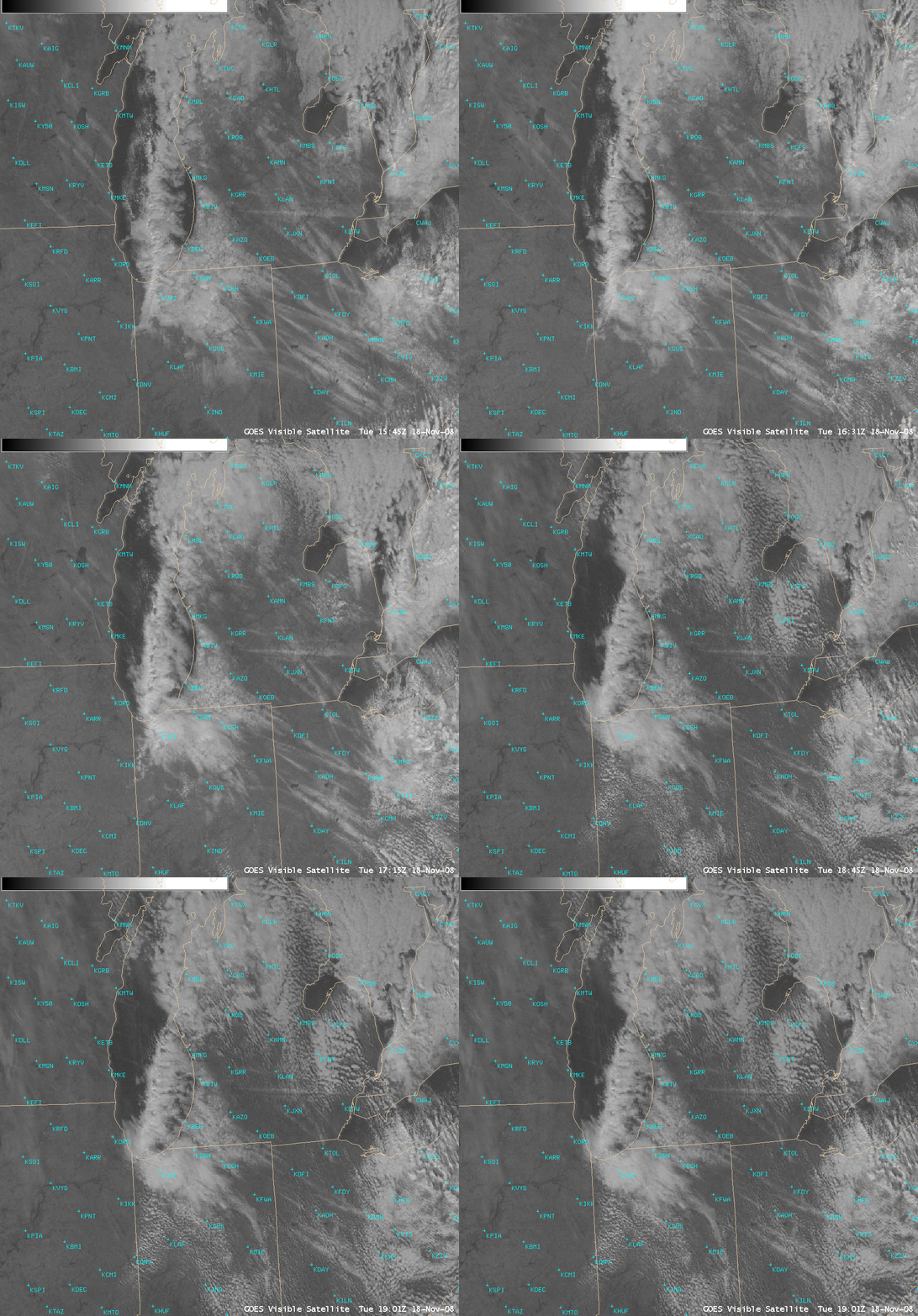
AWIPS images of the GOES-12 visible channel (above) showed that many of the snow streaks began to melt during the late morning and early afternoon hours.


