Severe thunderstorms over northeastern Montana
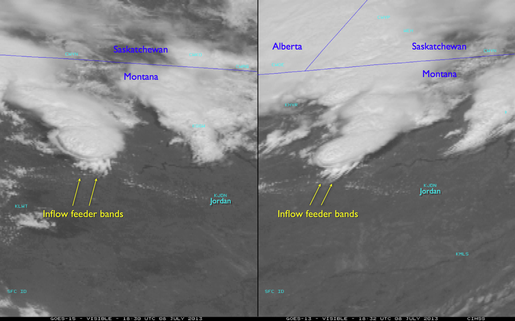
Severe thunderstorms developed during the afternoon hours across parts of northeastern Montana on 08 July 2013. A comparison of McIDAS images of 1-km resolution GOES-15 (GOES-West) and GOES-13 (GOES-East) 0.63 µm visible channel data (above; click image to play animation) showed the early stages of development of the storm that went on to produce large hail (up to 3 inches in diameter) and straight-line winds from a macroburst gusting as high as an estimated 95 mph (SPC storm reports | NWS Glasgow public information statement). Some locations also received heavy rain (as much as 1.87 inches in a 1 hour period) that produced flash flooding. One interesting feature seen on the visible imagery was a region of inflow feeder bands along the southern flank of the developing thunderstorm as it was northwest of Jordan (station identifier KJDN).
AWIPS images of 4-km resolution GOES-13 10.7 µm IR channel data with overlays of SPC storm reports (below; click image to play animation) revealed the formation of an “enhanced-V” storm top signature with the storm as it was north of Jordan, which is usually an indicator that a storm is or is about to produce severe weather in the form of large hail, tornadoes, or damaging winds.
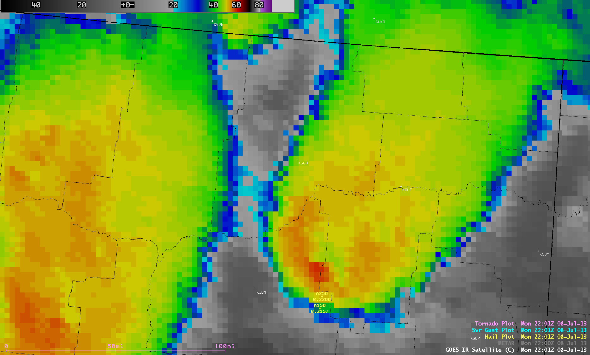
GOES-13 10.7 µm IR channel images with hail and severe wind gust reports (click image to play animation)
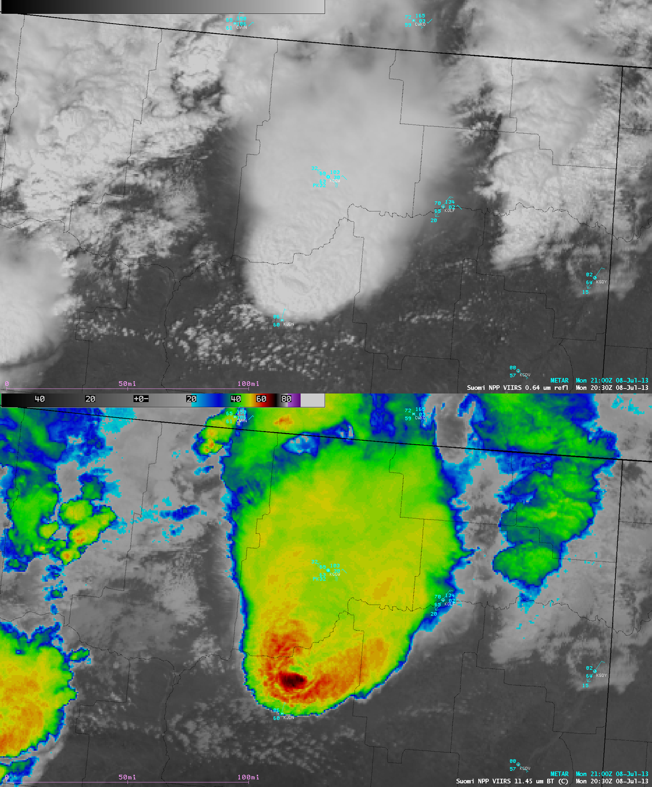
A closer view using 375-meter resolution (projected onto a 1-km AWIPS grid) Suomi NPP VIIRS 0.64 µm visible channel and 11.45 µm IR channel data at 20:30 UTC (below) showed a textbook example of a well-defined enhanced-V signature on the IR image. The coldest cloud-top IR brightness temperature in the overshooting top region was -69º C (black color enhancement), while the IR brightness temperature in the nearby upstream “warm wake” region was -44º C (darker green color enhancement), making for an impressively large 25º C “delta-T” value. About 1 hour later this storm began to produce 1.75 inch diameter hail in Garfield county (north of Jordan).
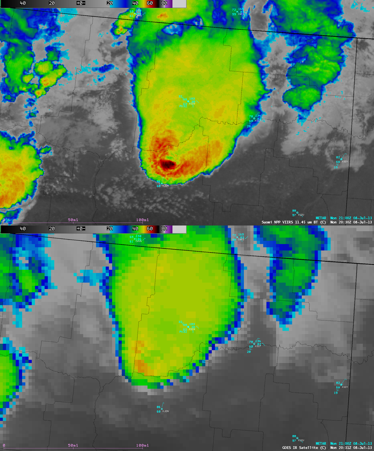
A comparison of the VIIRS IR image with the corresponding GOES-13 IR image (below) demonstrated the advantages of using polar-orbiter satellite date for severe storm identification: (1) with higher spatial resolution, severe storm signatures such as the “enhanced-V” are much better defined, and (2) there is minimal “parallax shift” associated with the large viewing angle from geostationary satellites positioned over the Equator.
===== 10 July Update =====
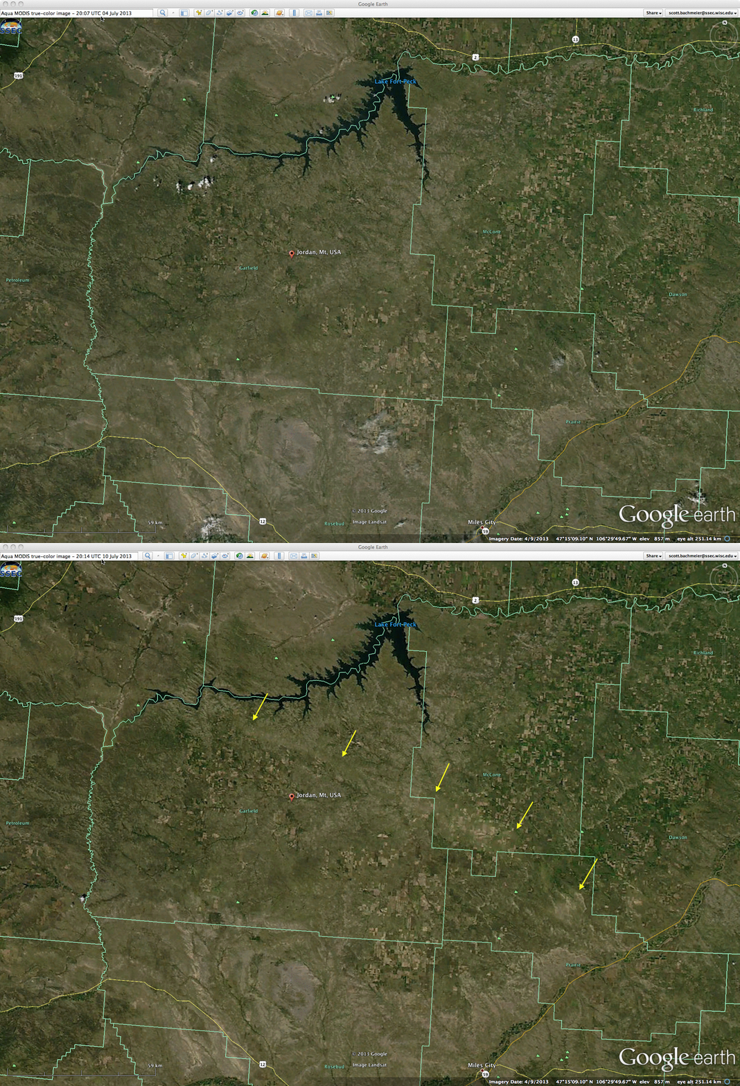
A comparison of before (04 July) and after (10 July) 250-meter resolution MODIS true-color Red/Green/Blue (RGB) images from the SSEC MODIS Today site (below; displayed using Google Earth) revealed the extensive hail damage swath that was located from the north and northeast to the east and southeast of Jordan, Montana (yellow arrows). At its widest point in far southern McCone county, the hail swath appeared to be at least 10-12 km (6-7 miles) wide.


