GOES-14 Super Rapid Scan (1-minute interval) images
The GOES-14 satellite was placed into Super Rapid Scan Operations for GOES-R (SRSOR) mode to monitor the development of severe weather over a rare SPC High Risk region on 12 June 2013. In SRSOR mode, images were available at 1-minute intervals (compared to the routine 15-minute image interval). The development of numerous large thunderstorms can be seen on GOES-14 SRSOR 0.63 µm visible channel images (above; click image to play animation; also available as a QuickTime movie). These storms produced tornadoes, large hail, and damaging winds across parts of Minnesota, Iowa, Wisconsin, and Illinois (SPC storm reports). One item of interest revealed on the 1-minute imagery was the appearance of “inflow feeder band” clouds that were developing along the western edge of the large thunderstorm located over northeastern Iowa during the 20:15 – 20:58 UTC time period; without the 1-minute temporal resolution, such subtle mesoscale features would be difficult if not impossible to identify on conventional 15-minute imagery. Numerous overshooting tops could also be seen on some of the larger storms.
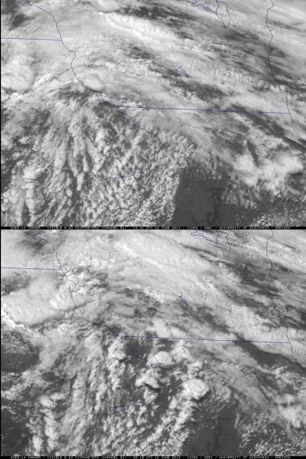
During the SRSOR period, there were breaks in the 1-minute interval coverage to allow for tasks such as satellite “station-keeping” –Â and the longest break occurred between 19:41 UTC and 20:15 UTC (below). You can see that during this particular 34-minute period, considerable convective development occurred in areas such as northwestern Illinois. With current Routine GOES scanning schedules, there is a similar 30-minute gap in coverage over the Continental US (CONUS) which occurs every 3 hours during a full disk scan of the Earth. It is important to note that with the Advanced Baseline Imager (ABI) instrument on the next-generation GOES-R satellite there will be no such long gaps in the imagery — in fact, during high-impact weather events such as this one, images will be available over special mesoscale sectors every 30 seconds.
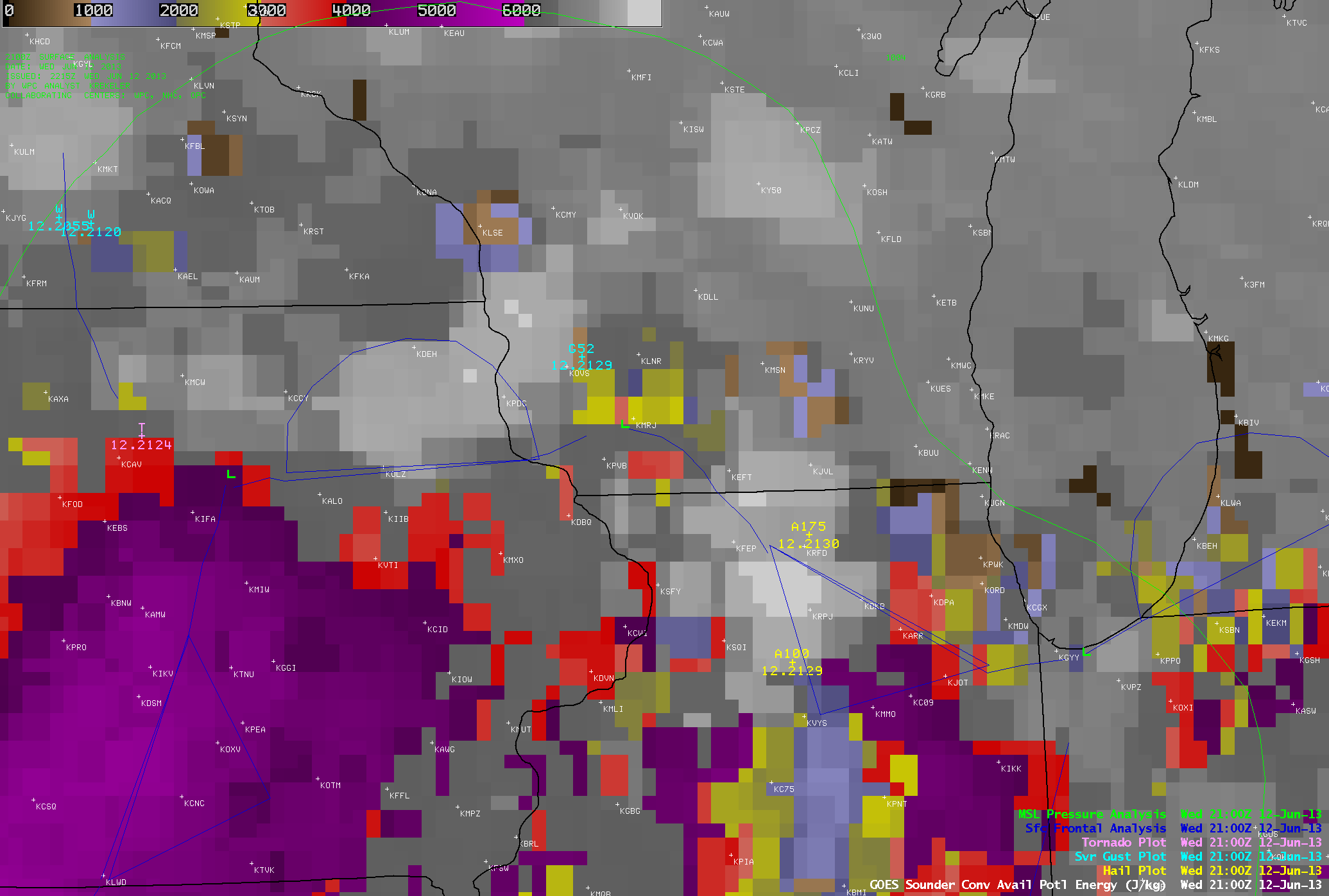
The GOES-13 sounder Convective Available Potential Energy (CAPE) derived product (below; click image to play animation) showed that there was considerable instability (CAPE values of 4000-5000 J/kg, violet color enhancement) that developed during the afternoon hours across much of southeastern Iowa and northern Illinois, in the warm sector of the area of low pressure that was developing over northeastern Iowa.

GOES-13 sounder Convective Available Potential Energy (CAPE) product (click image to play animation)


