“Southerly surge” of stratus along the coast of California
McIDAS images of GOES-15 0.63 µm visible channel data (above; click image to play animation) revealed a well-defined “southerly surge” of stratus clouds, which were moving northward along the coast of the Big Sur region of central California on 22 April 2013.
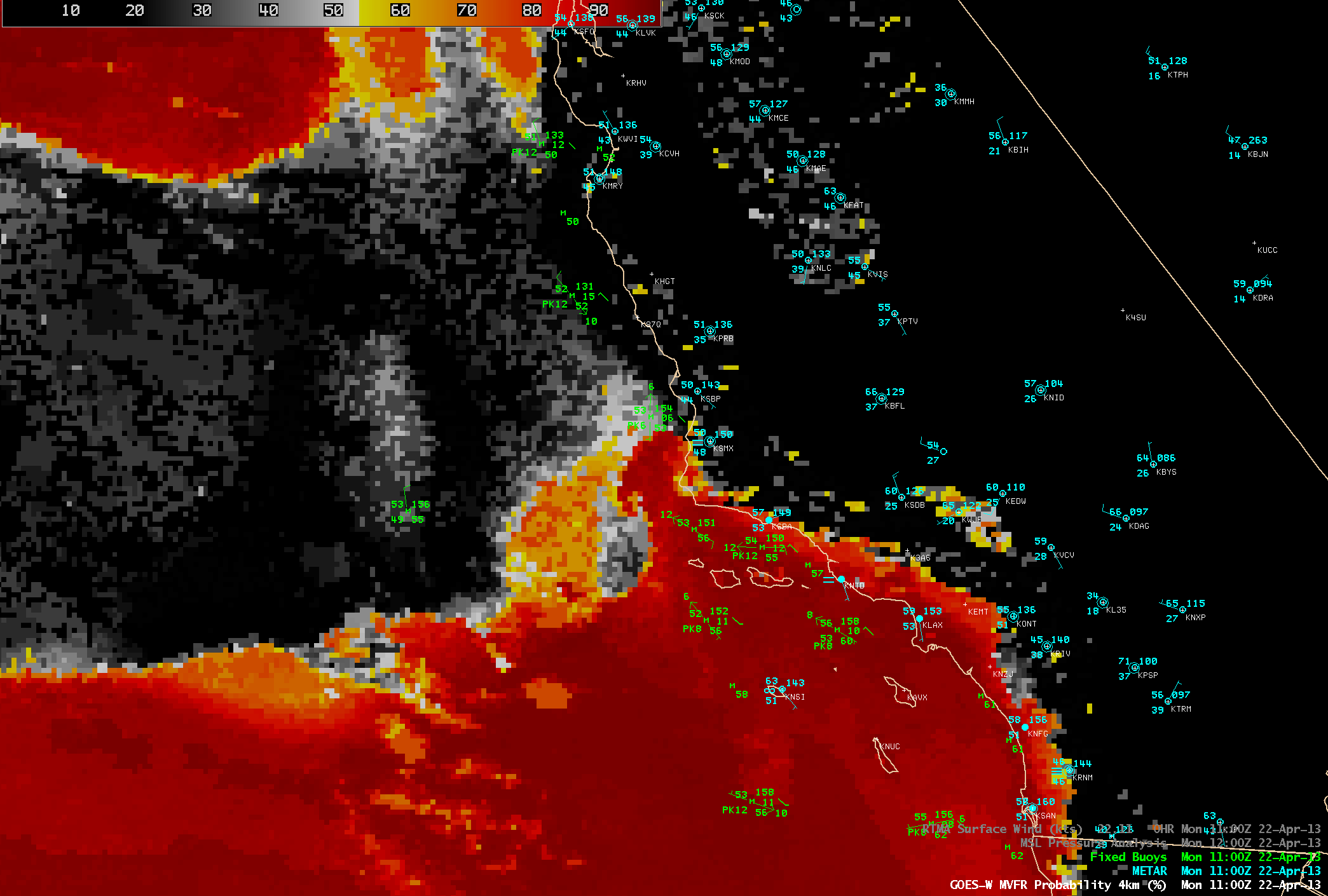
AWIPS images of the GOES-R Marginal Visual Flight Rules (MVFR) product algorithm applied to GOES-15 data (below; click image to play animation) showed the northward progression of the narrow band of stratus clouds, as a mesoscale reversal in the boundary layer winds just off the coast (from northerly, to southerly) was seen in the buoy data.
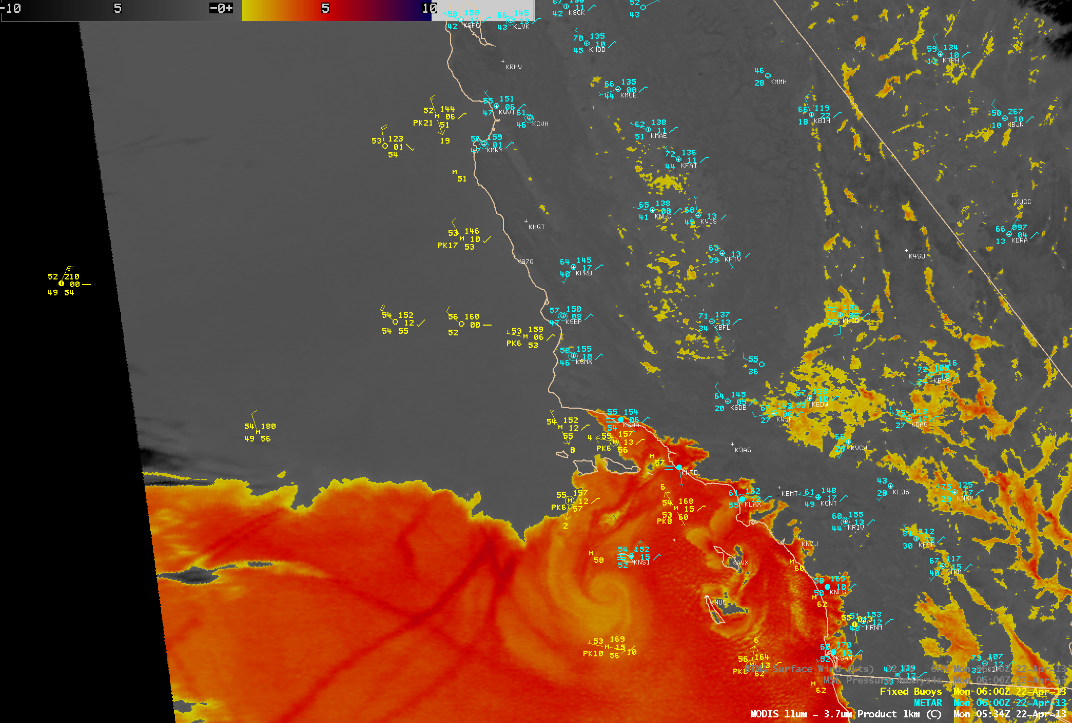
A 1-km resolution MODIS 11-3.7 µm IR brightness temperature difference (BTD) “fog/stratus product” image at 05:34 UTC or 10:34 PM local time (below) showed the initial stages of the southerly surge stratus cloud feature, in the Santa Barbara Channel north of the Channel Islands off the coast of southern California (and south of Point Conception). Farther offshore, the BTD image also displayed a well-defined eddy and a few ship tracks embedded within the marine boundary layer stratus clouds.
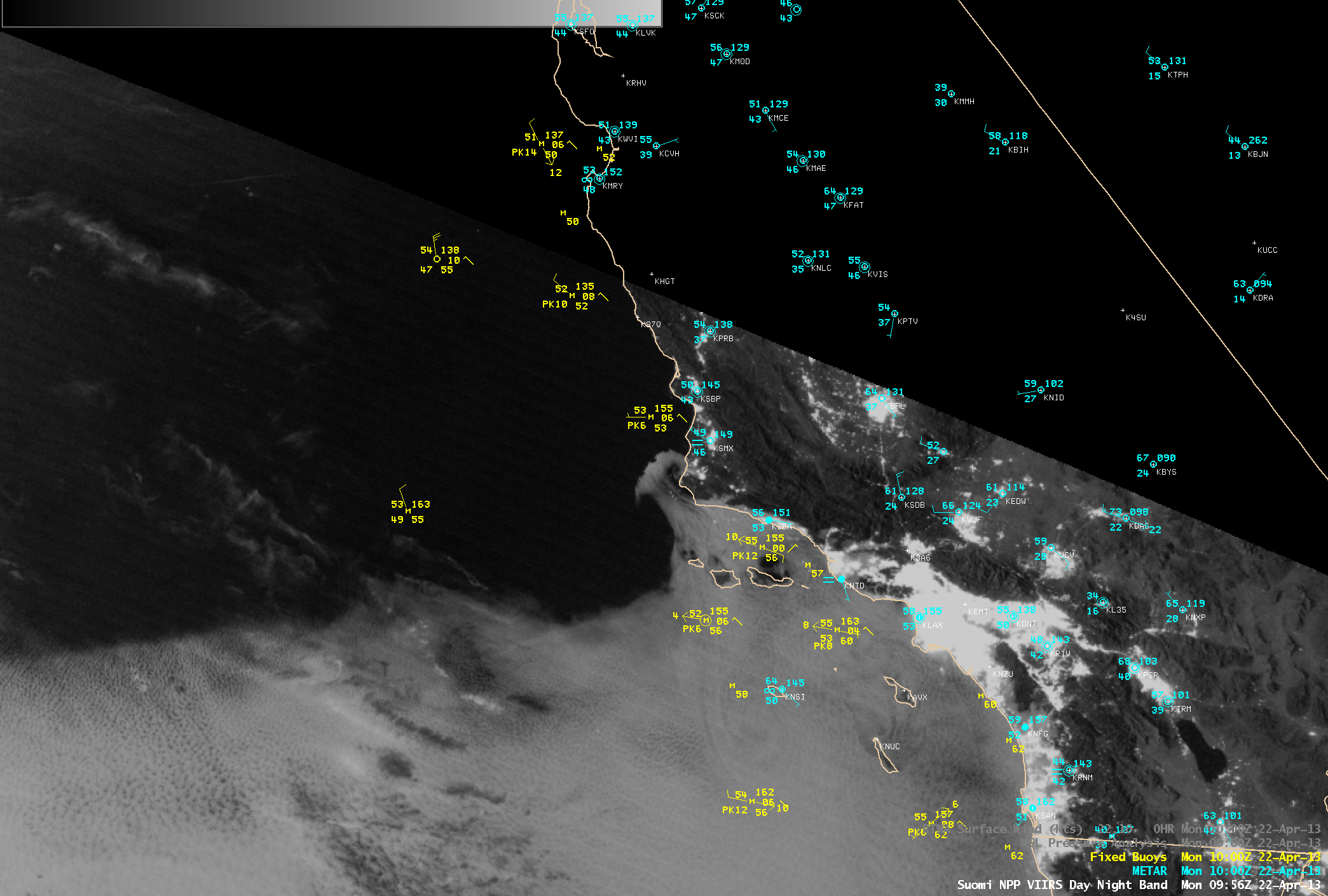
Several hours later, a 1-km resolution Suomi NPP VIIRS 0.7 µm Day/Night Band (DNB) image at 09:56 UTC or 2:26 AM local time (below) indicated that the leading edge of the southerly surge stratus cloud feature had moved to the north of Point Conception. This demonstrates that the VIIRS DNB can provide a “visible image at night”, given sufficient illumination by the Moon (or other light sources). On this night the Moon was in the waxing gibbous phase, at 95% full.
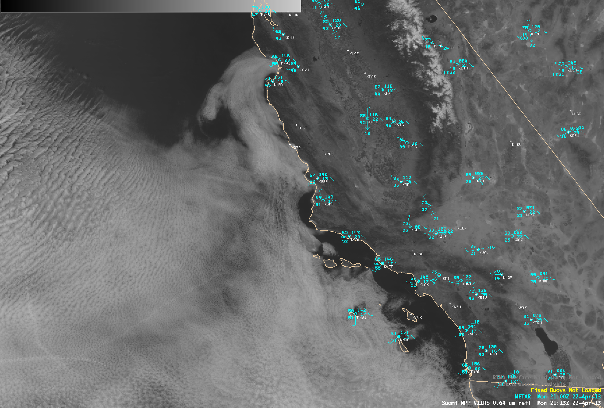
A Suomi NPP VIIRS 0.64 µm visible channel image at 21:13 UTC or 2:13 PM local time (below) showed leading edge of the southward surge stratus feature as it was curving eastward into the Monterey Bay area. Not far to the north, San Francisco reached a record high temperature of 83º F.
===== 23 April Update =====
A comparison of 1-km resolution Suomi NPP VIIRS 0.7 µm Day/Night Band and IR brightness temperature difference (BTD) “Fog/stratus product” images at 09:28 UTC or 2:29 AM local time (below) showed that the leading edge of the southerly surge stratus clouds had progressed just to the north of Point Reyes. Once again, the BTD image revealed the presence of cloud eddies and ship tracks within the marine boundary layer stratus clouds.
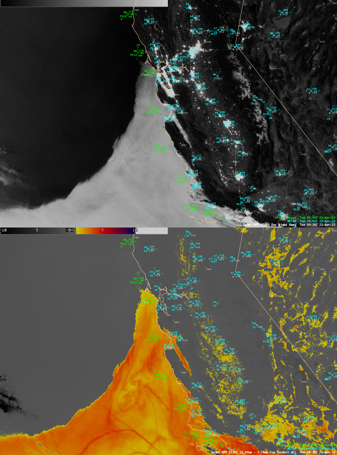
Suomi NPP VIIRS 0.7 µm Day/Night Band and IR brightness temperature difference “Fog/stratus product” images


