Snow cover across the northeastern US
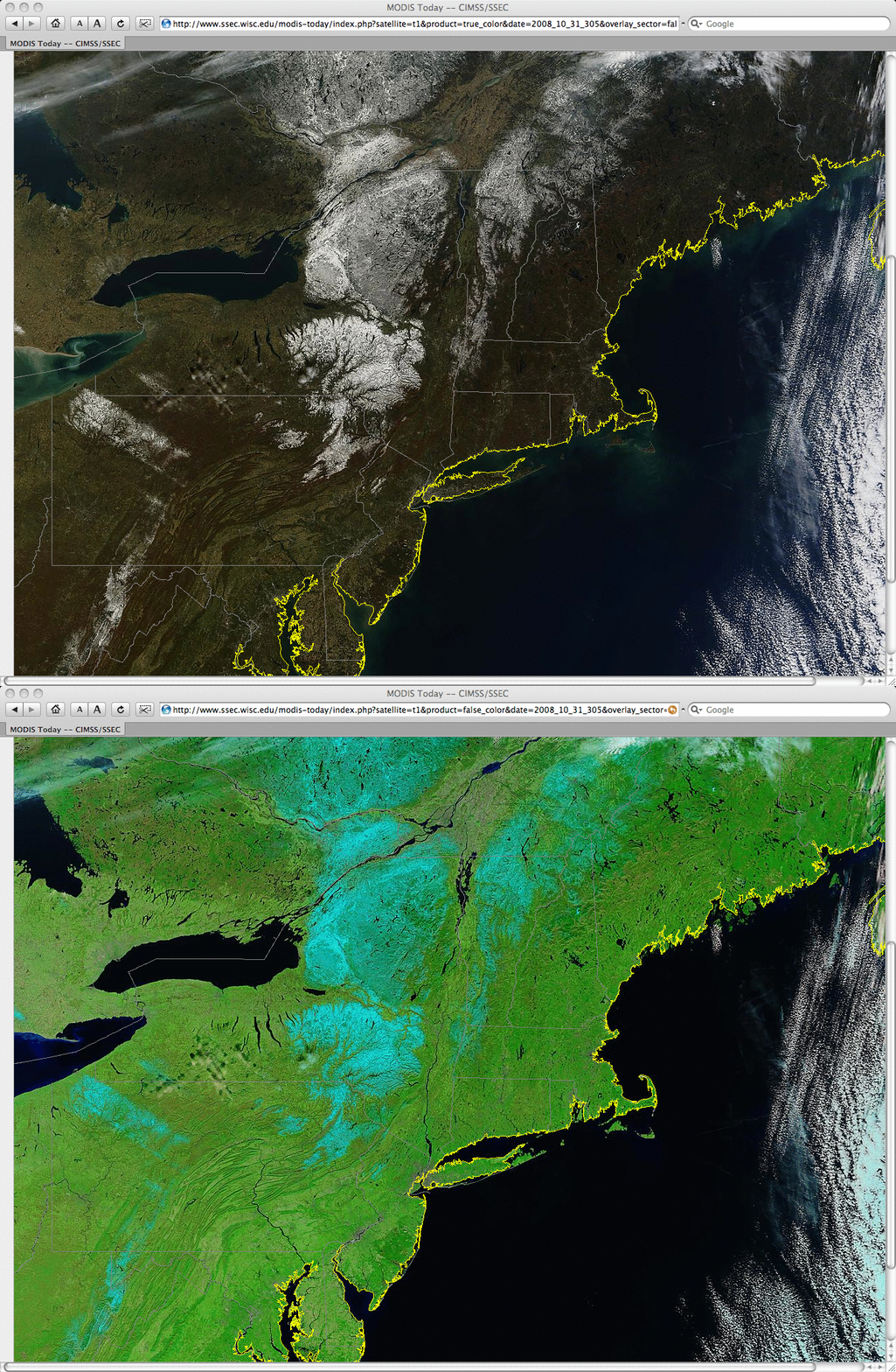
MODIS true color and false color images from the SSEC MODIS Today site (above) showed the extent of snow cover that remained on the ground on the morning of 31 October 2008, following a large early-season snow storm that affected much of the northeastern US and southeastern Canada several days earlier. Snow cover appeared as lighter blue features on the false color image (in contrast to supercooled water droplet clouds, which appeared as shades of white on both the true color and false color images). Total snowfall amounts across the region were as high as 25.6 inches at Roxbury, New York and 16.0 inches at Mountain Lake, Pennsylvania — and 2-3 inches of snow were reported as far south as Kentucky and North Carolina (in the higher elevations of the Appalachians). Also, note the broad swath of lake-effect snow cover that was oriented northwest-to-southeast across western Pennsylvania, downwind of Lake Erie.
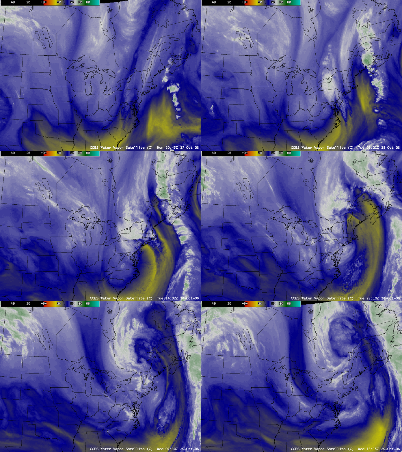
AWIPS images of the GOES-12 water vapor channel (below) showed the development of the storm during the 28 October – 29 October period.


