Blowing dust in the Four Corners region of the US
Strong southwesterly winds ahead of an advancing cold front caused large areas of blowing dust across parts of the “Four Corners” region of the western US on 16 April 2013. Wind gusts were as high as 68 mph at Winslow, Arizona — and Interstate 40 was closed between Winslow and Winona, as visibility was reduced to 50 feet at times in some areas. McIDAS images of 1-km resolution GOES-13 0.63 µm visible channel data (above; click image to play animation) showed the growth of large plumes of blowing dust during the day, with primary source regions appearing in northeastern Arizona and northwestern New Mexico.
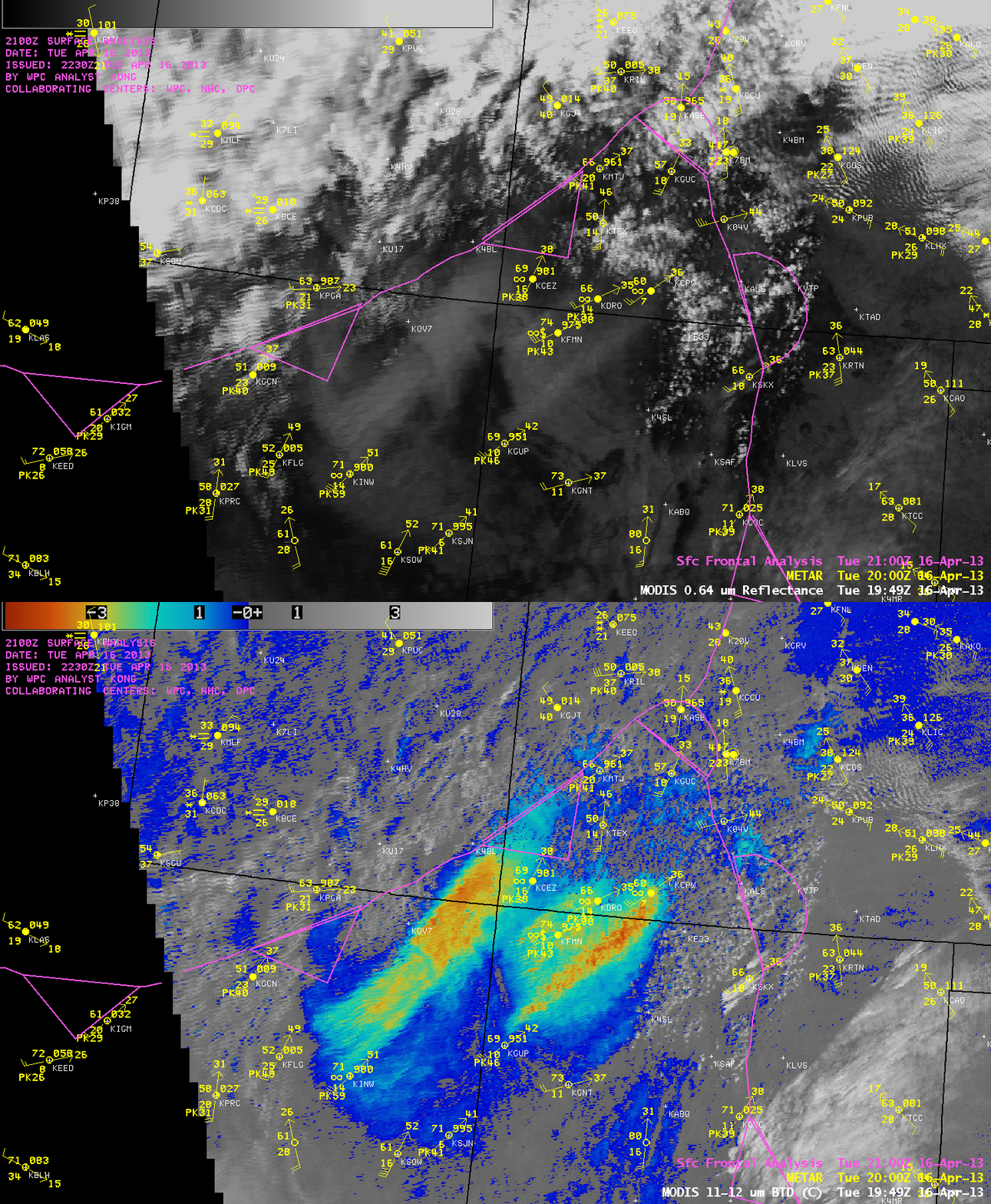
A comparison of AWIPS images of 1-km resolution MODIS 0.65 µm visible channel and 11-12 µm IR brightness temperature difference (BTD) data at 19:49 UTC (below) revealed the hazy signature (on the visible image) and large BTD values of -3 to -5 C (orange to red color enhancement) associated with the most dense plumes of blowing dust that were moving northeastward. In southwestern Colorado, surface visibility was reduced to 1 mile at Cortez (station identifier KCEZ), and winds gusted to 75 mph at Wolf Creek Pass (station identifier KCPW).
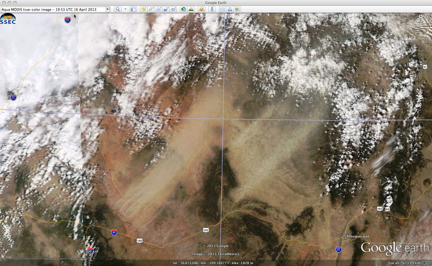
A 250-meter resolution MODIS true-color Red/Green/Blue (RGB) image from the SSEC MODIS Today site (below) showed the lighter tan-colored plumes of blowing dust in great detail.
Later in the day, there were public reports of “dirty rain” at Grand Junction, Colorado, as well as “dirty snow” in the Denver area.
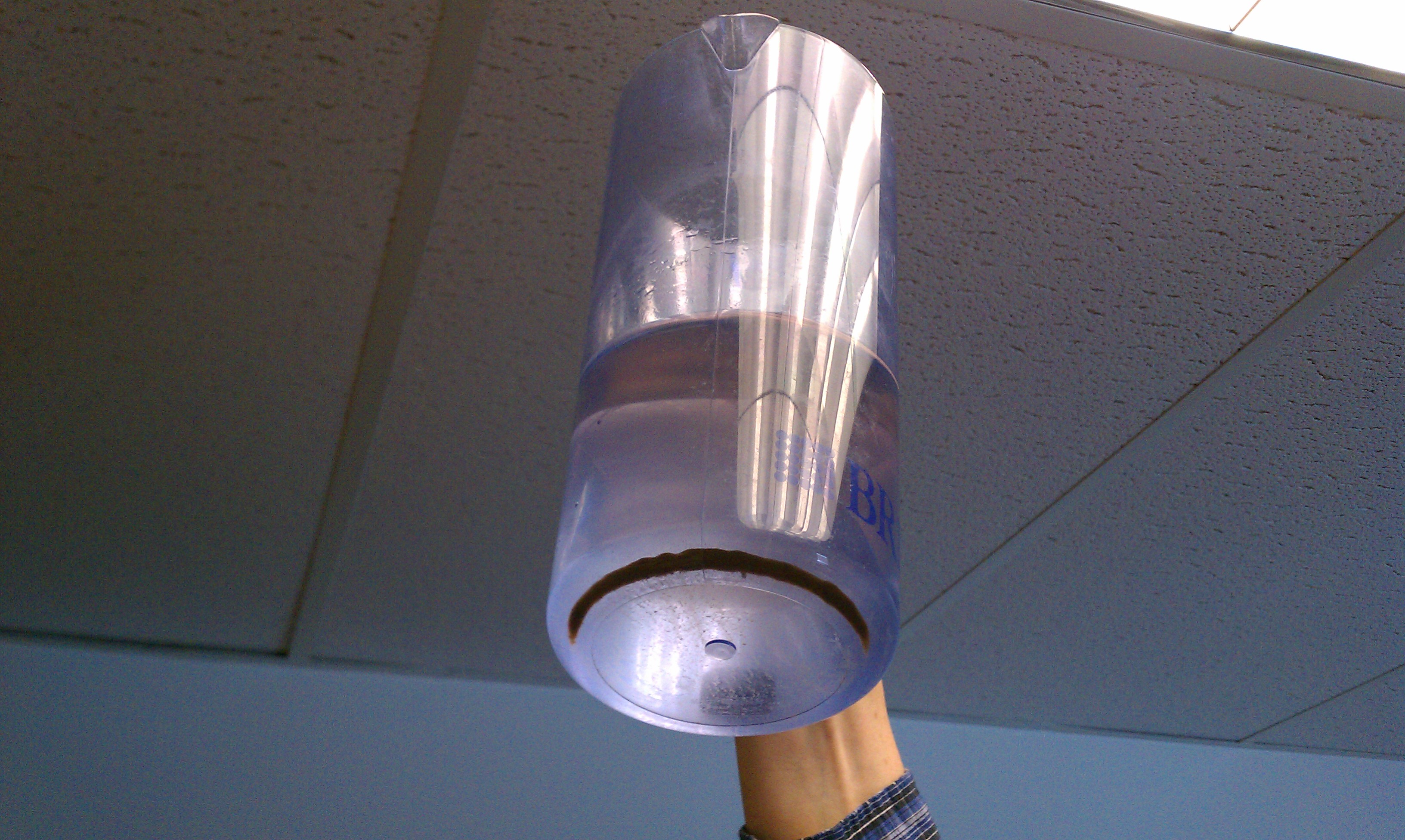
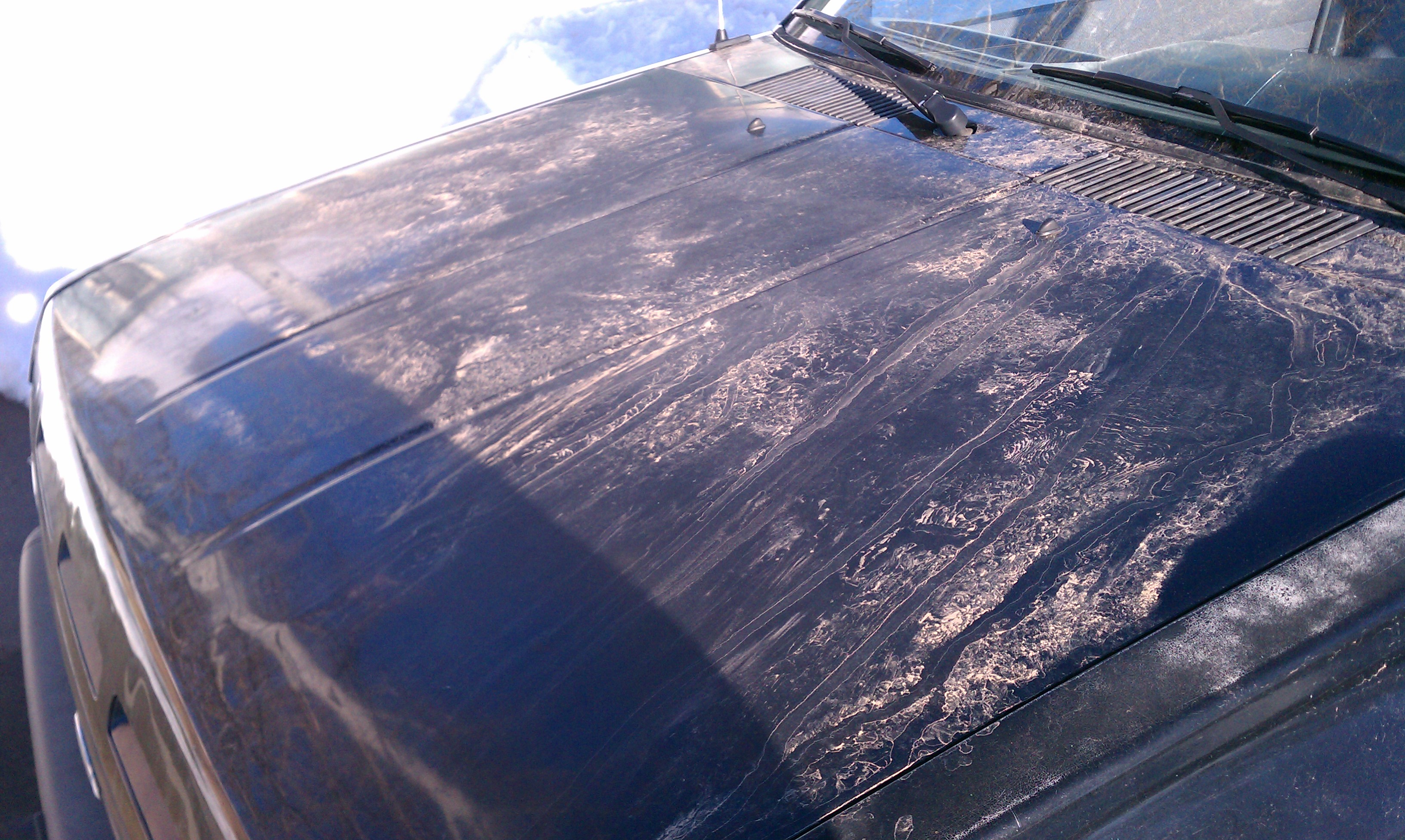
In the Fort Collins, Colorado area, two photos (courtesy of Louis Grasso and Dan Bikos, CIRA)Â showed (1) blowing dust sediment in a container of melted snow water collected on 17 April (above), and (2) dust residue on a vehicle after the snow had melted on 18 April (below).


