Polar low over the western Bering Sea
Suomi NPP VIIRS 0.7 µm Day/Night Band images
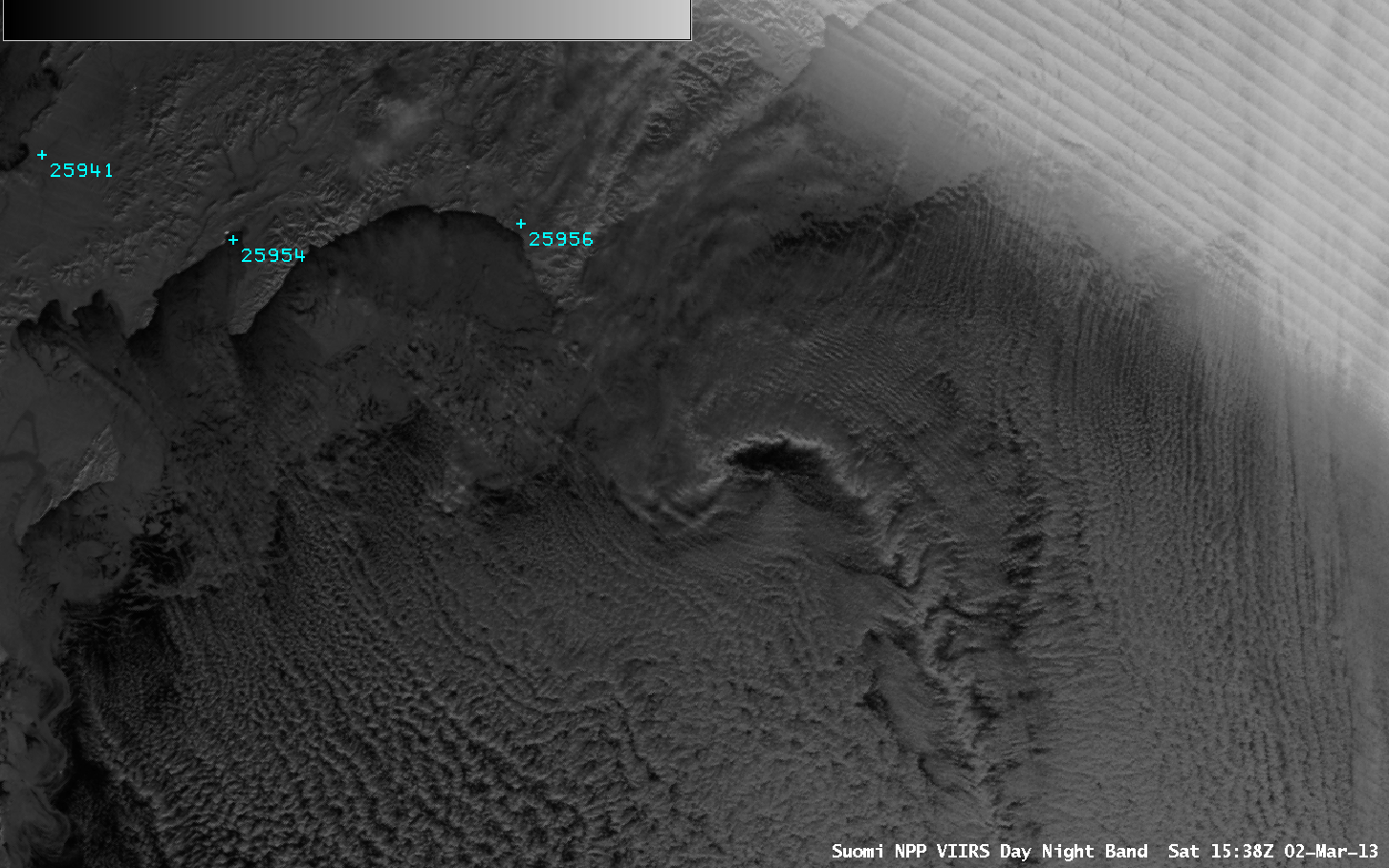
AWIPS images of 1-km resolution Suomi NPP VIIRS 0.7 µm Day/Night Band data (above) showed the development of a small polar low in the far western Bering Sea during the 02 March – 03 March 2013 period. A string of breaking Kelvin-Helmholtz waves could be seen feeding into the circulation of the developing low. Station identifiers 25941, 25954, and 21956 denote the villages of Cemurnaut, Korf, and Apuka (respectively) located on the northern end of the Kamchatka Peninsula of Russia.
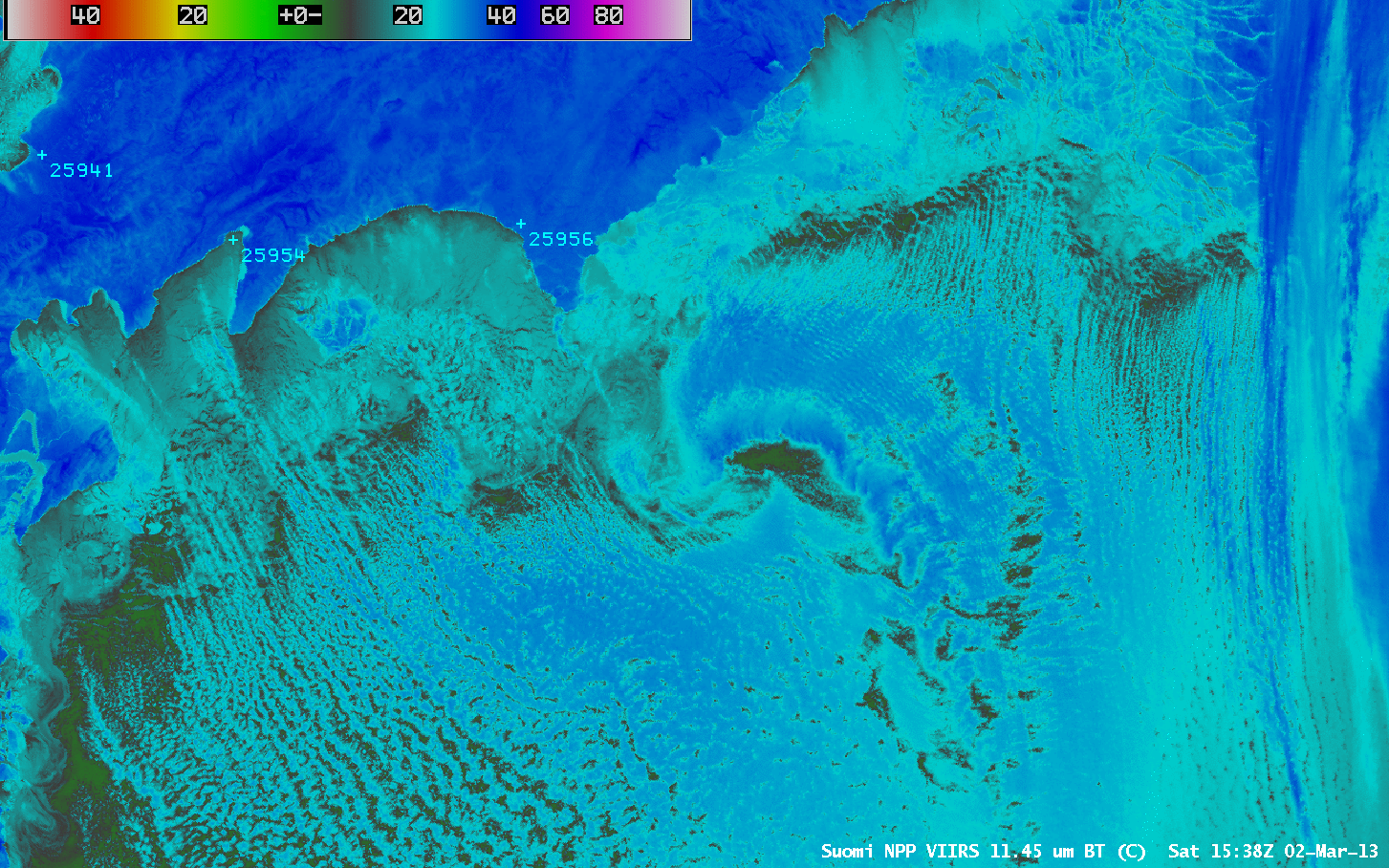
The corresponding Suomi NPP VIIRS 11.45 µm IR channel images (below) indicated that cloud top IR brightness temperatures were colder than -30º C (darker blue color enhancement) near the center of the polar low circulation.
Suomi NPP VIIRS 11.45 µm IR channel images
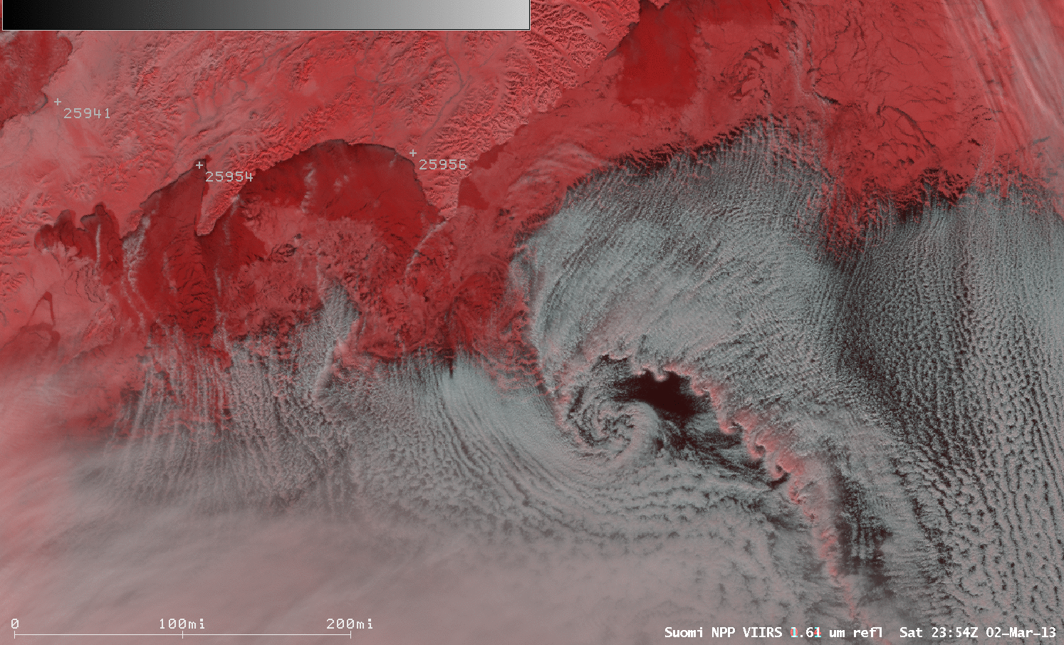
Suomi NPP VIIRS false-color Red/Green/Blue (RGB) images (below) showed that the polar low was developing just south of the sea ice edge (snow and ice appear as darker shades of red). The appearance of red shading also indicated that the cloud tops along the string of Kelvin-Helmholtz waves were beginning to glaciate. Note from the distance scale plotted on the lower left that the diameter of the polar low circulation was less than 100 miles.
Suomi NPP VIIRS false-color Red/Green/Blue (RGB) images
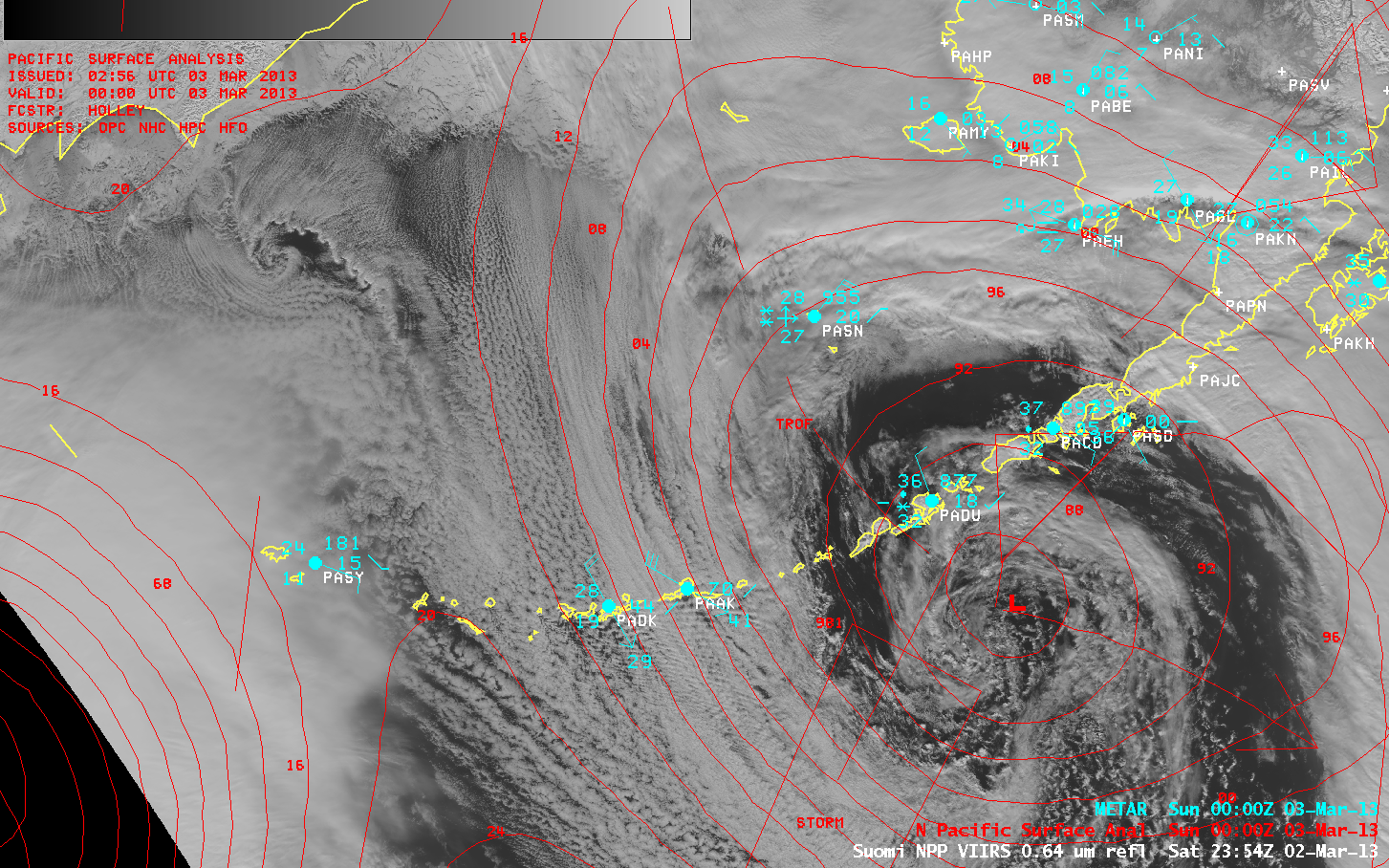
A larger-scale view using a Suomi NPP VIIRS 0.64 µm visible channel image (below) helped to emphasize the small size of the Bering Sea polar low, especially when compared to the much larger storm system that was located just south of the Aleutian Islands at that time. The tightly-packed isobars of another strong storm approaching from the North Pacific Ocean could also be seen.
Suomi NPP VIIRS 0.64 µm visible channel image + Surface reports and surface analysis
McIDAS images of MTSAT-2 0.73 µm visible channel data (below; click image to play animation) indicated that the polar low was initially moving southeastward away from the Kamchatka Peninsula, but then began to reverse direction and move back northwestward due to strong southeasterly flow in advance of the large and intense storm over the North Pacific Ocean.
")
MTSAT-2 0.73 µm visible channel images (click image to play animation)