Historic blizzard affects parts of Texas, Oklahoma, and Kansas
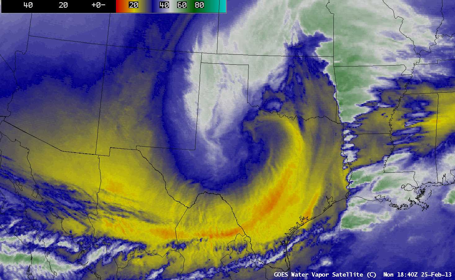
A powerful winter storm brought historic snowfall amounts and widespread blizzard conditions to parts of Texas, Oklahoma, and Kansas during the 25 February – 26 February 2013 period (see additional information from the NWS forecast offices at Amarillo TX, Norman OK, Dodge City KS, Wichita KS, and Topeka KS). AWIPS images of 4-km resolution GOES-13 6.5 µm water vapor channel images (above; click image to play animation) showed the evolution of the storm system on 25 February, which included the development of well-defined dry slot and comma head signatures.
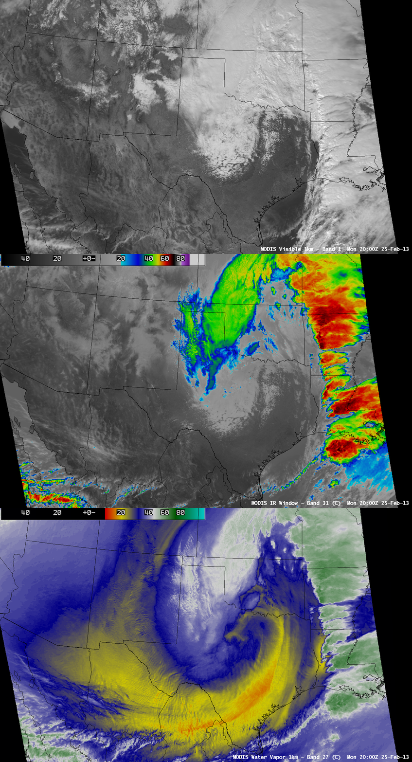
A comparison of 1-km resolution MODIS 0.65 µm visible channel, 11.0 µm IR channel, and 6.7 µm water vapor channel images (below) revealed a snapshot of the storm at 20:00 UTC or 3 PM local time on 25 February. A line of deep convection exhibiting cold cloud top temperatures extended from the Gulf of Mexico northward into Missouri, which produced large hail, damaging winds, and a tornado (SPC storm reports).
Very strong winds were associated with this storm, which created a large area of blowing dust across southwest Texas and southeastern New Mexico on 24 February — and GOES-13 0.63 µm visible channel images (below; click image to play animation) revealed additional areas of blowing dust across drought-stricken areas of southern Texas on 25 February, where winds gusted as high as 56 mph and visibilities were reduced to 1 mile or less in some locations (see NWS Brownsville TX summary).
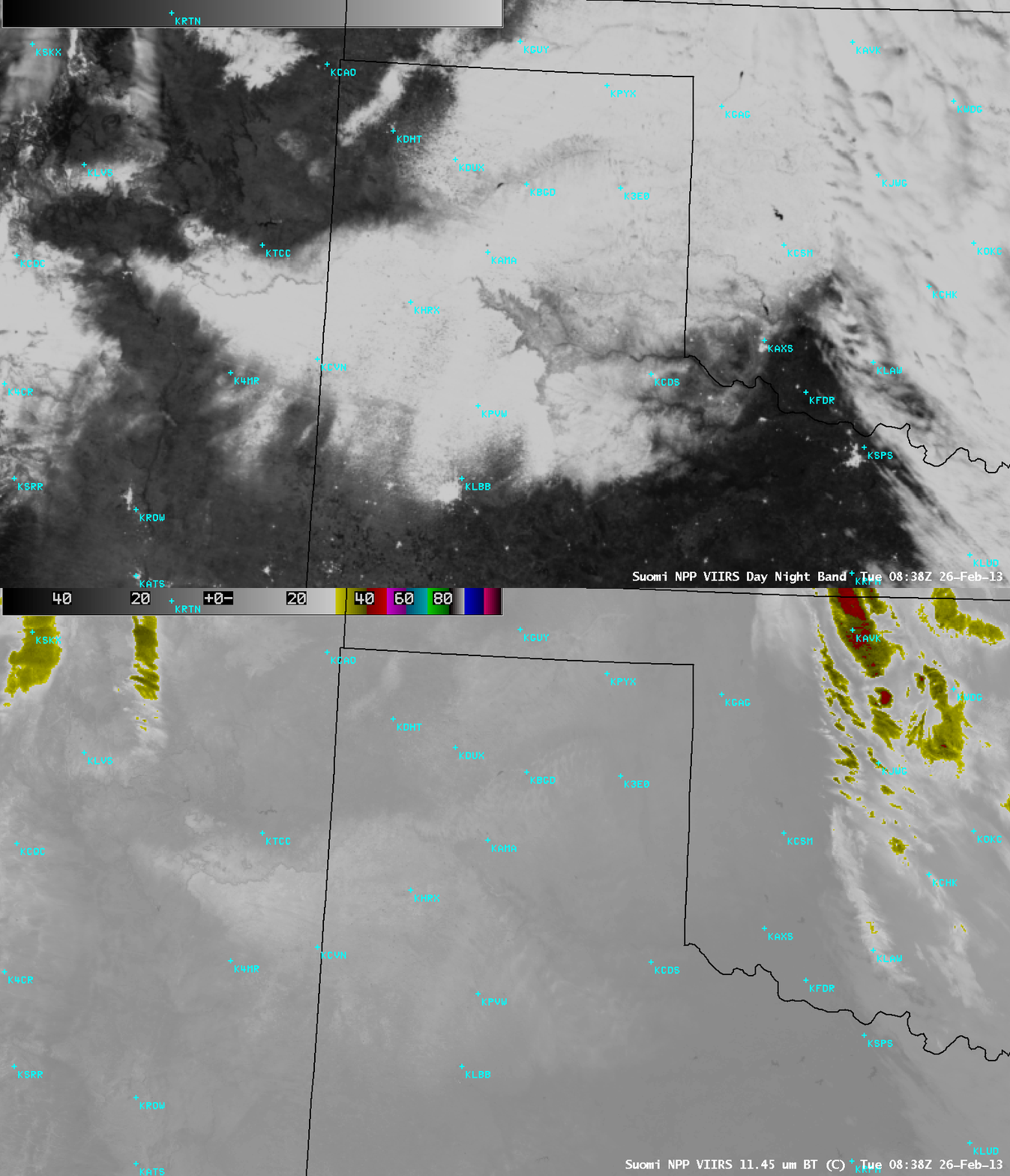
During the following overnight hours the clouds had cleared across the Texas panhandle region, which allowed the Suomi NPP VIIRS 0.7 µm Day/Night Band (below) to provide a “visible image at night” (aided by bright illumination from the “full snow moon”) to display the areal extent of the fresh snow cover at 08:38 UTC or 3:38 AM local time. While the deep snow pack appeared somewhat colder on the corresponding VIIRS 11.45 µm IR image, the exact edges of the snow cover were easier to see on the Day/Night Band image.
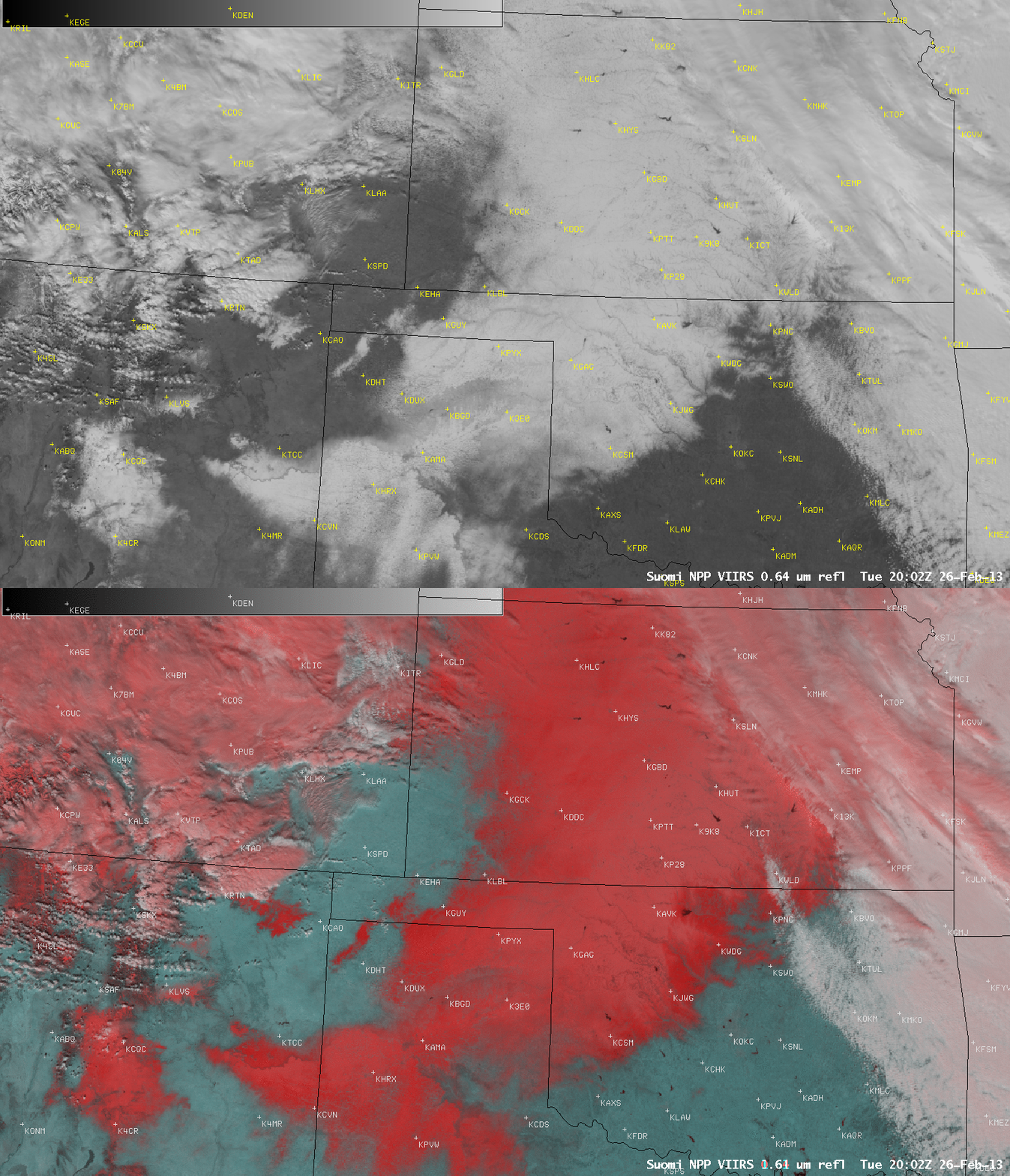
During the afternoon hours on 26 February, a comparison of the Suomi NPP VIIRS 0.64 µm visible channel image with the corresponding false-color Red/Green/Blue (RGB) image at 20:02 UTC or 3:02 PM local time (below) aided in the discrimination between snow cover (varying shades of darker red on the RGB image) and supercooled water droplet cloud features (lighter shades of white). Glaciated (ice crystal) cloud features exhibit a lighter pink appearance in the RGB image.


