Blowing dust over New Mexico and Texas
McIDAS images of GOES-13 0.63 µm visible channel data (above; click image to play animation) showed the development of widespread plumes of blowing dust over parts of New Mexico and Texas on 09 February 2013. Surface wind gusts across the region were as high as 79 mph in New Mexico and 71 MPH in Texas. Most of the blowing dust appeared to have originated from dry lake beds in northern Mexico, but early in the animation a narrow dust plume can be seen whose source region was White Sands, New Mexico. Due to an increasingly favorable forward scattering angle, the dust became more apparent on the visible imagery during the afternoon hours.
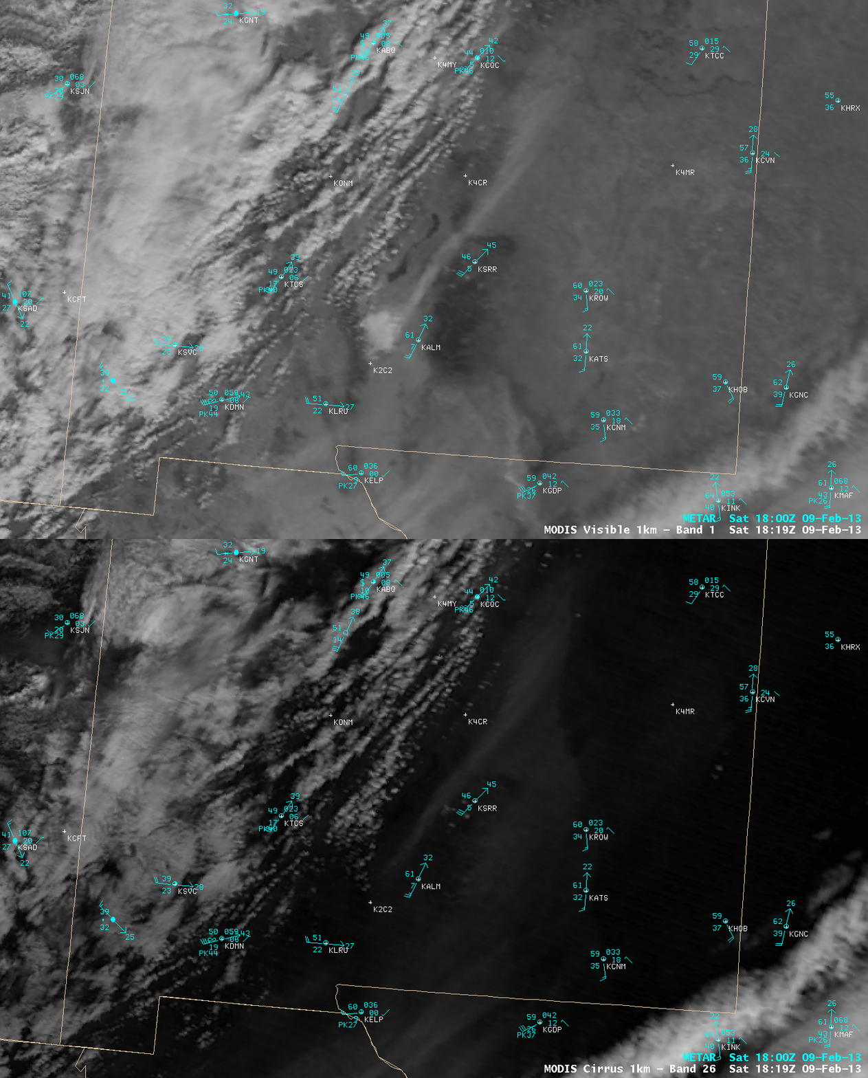
A comparison of AWIPS images of 1-km resolution MODIS 0.65 µm visible channel and 1.61 µm near-IR “cirrus detection channel” data (below) demonstrated how the MODIS cirrus channel can be used to more accurately identify the leading edge of the airborne dust over eastern New Mexico — the 1.61 µm channel can detect the presence of partcles that are efficient scatterers of light (such as cirrus cloud ice crystals, volcanic ash, smoke, dust).
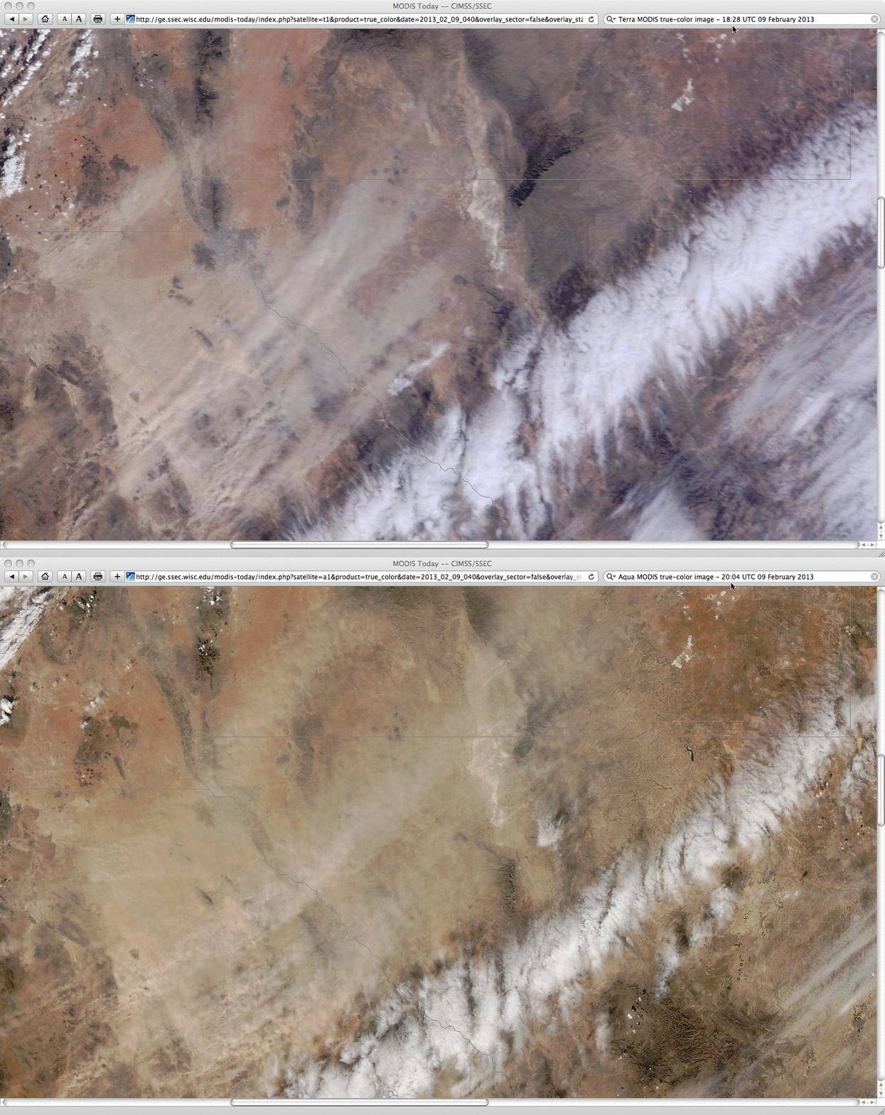
A closer view using 250-meter resolution Terra (18:28 UTC) and Aqua (20:04 UTC) MODIS true-color Red/Green/Blue (RGB) images from the SSEC MODIS Today site (below) helped to identify a few of the blowing dust source regions in far northern Mexico.


