Ice motion in the Bering Sea off the coast of Alaska
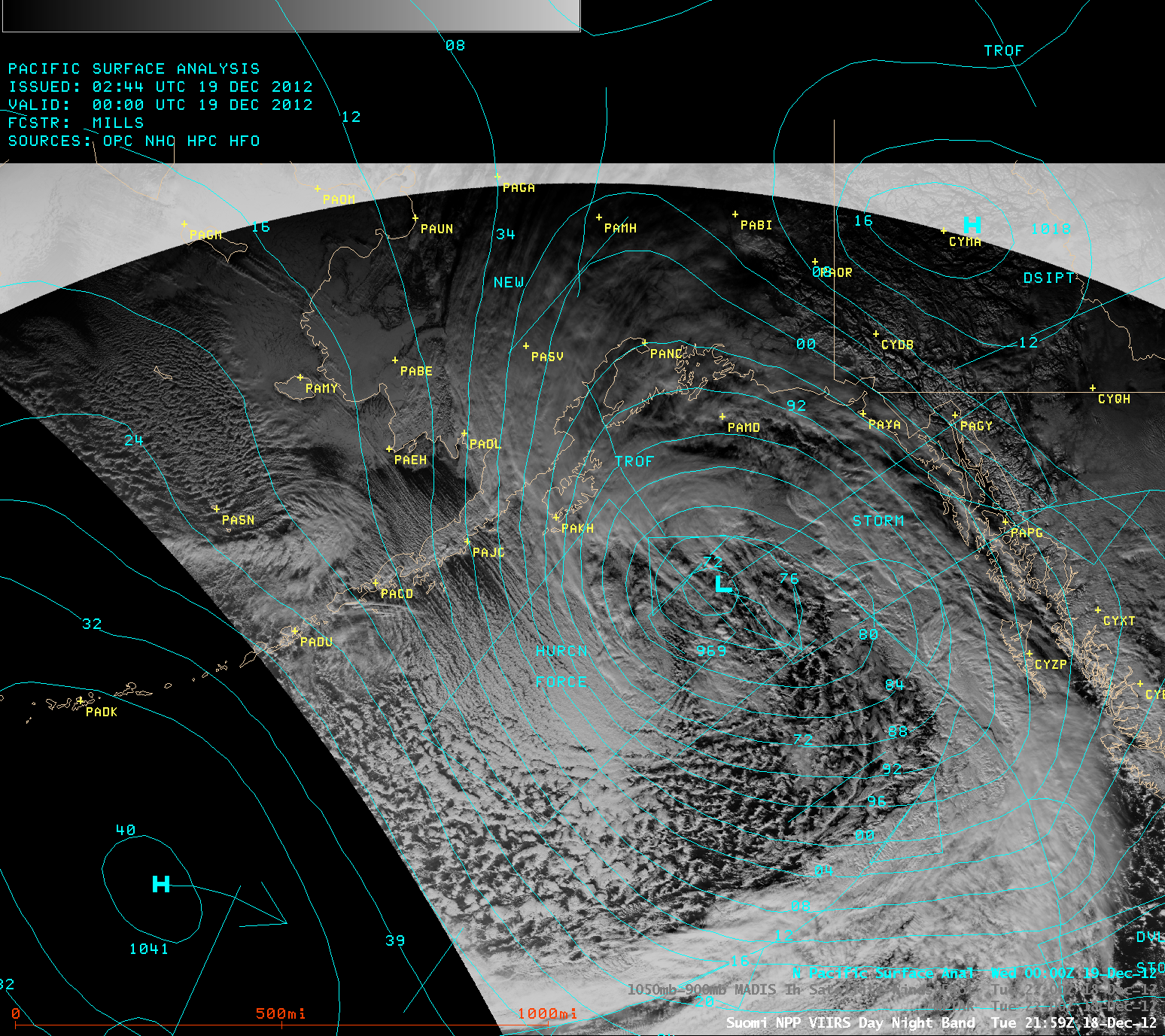
Suomi NPP VIIRS 0.7 µm Day/Night Band image with overlay of surface analysis
A large and intense area of low pressure was located in the Gulf of Alaska on 18 December 2012 (above), which was forecast to produce areas of hurricane-force winds west and southwest of the storm center.
A comparison of AWIPS images of Suomi NPP VIIRS 0.7 µm Day/Night Band images (below) revealed a large amount of Bering Sea ice motion just off the southwest coast of Alaska in the 101 minutes between the two images (21:59 UTC and 23:40 UTC), due to the strong northwesterly winds of 30-40 knots that had existed over that region.
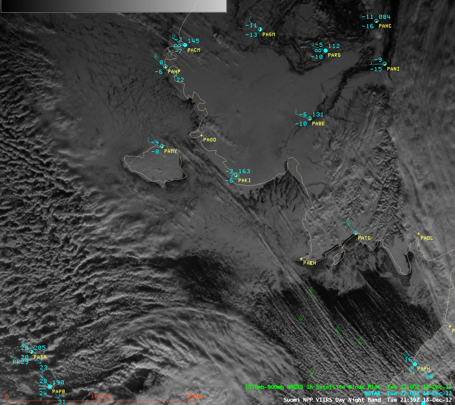
Suomi NPP VIIRS 0.7 µm Day/Night Band images with surface observations and GOES cloud-tracked atmospheric motion vectors
The image comparison below shows false-color Red/Green/Blue (RGB) composites created using the 0.64 µm VIIRS visible channel (Red) and the 1.61 µm “snow/ice channel” (Green and Blue) which allowed an easier discrimination between the ice (which appeared as darker shades of red) and supercooled water droplet clouds (which appeared as shades of white).
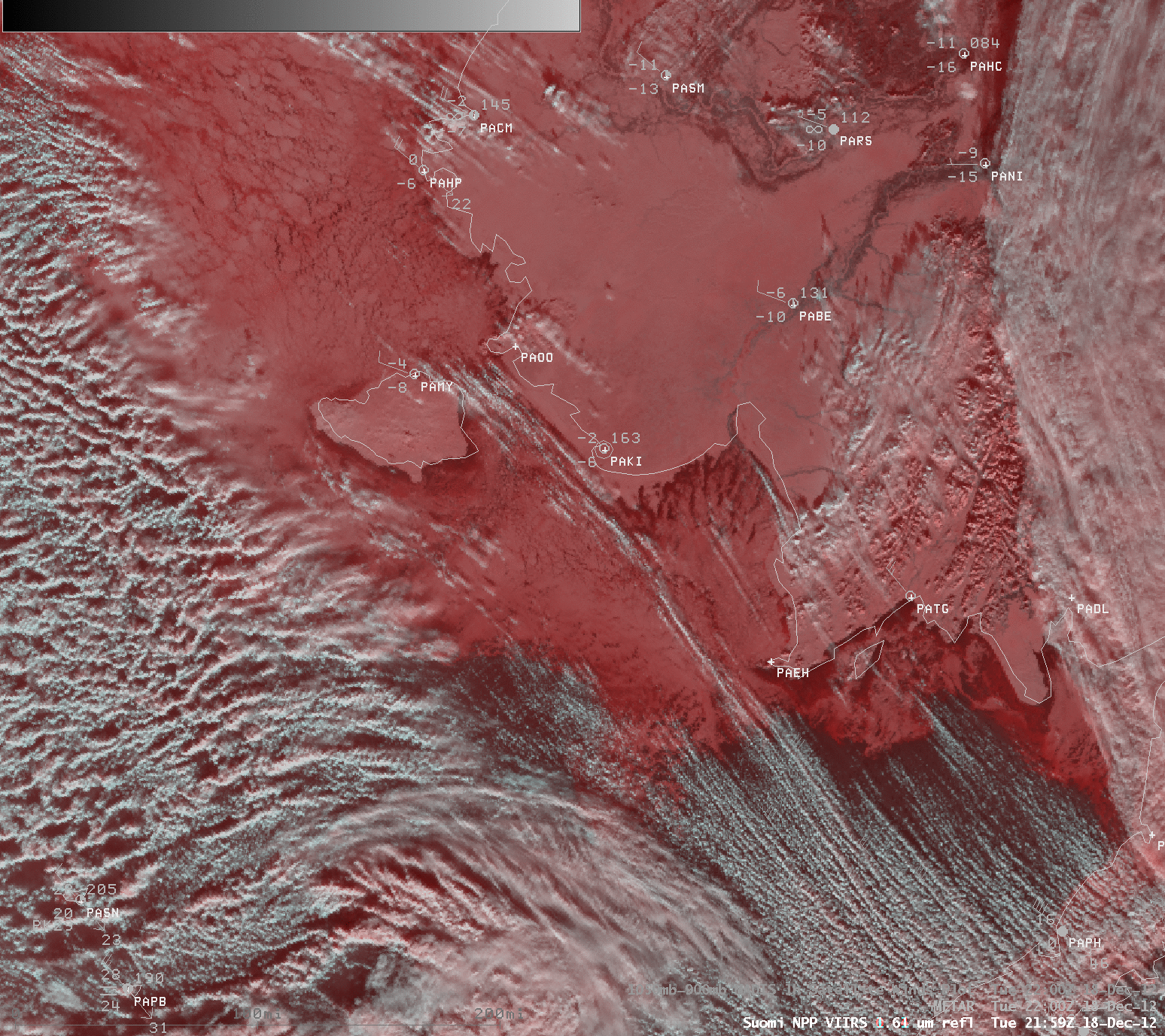
Suomi NPP VIIRS false-color Red/Green/Blue (RGB) images