Contrail detection using shortwave IR imagery
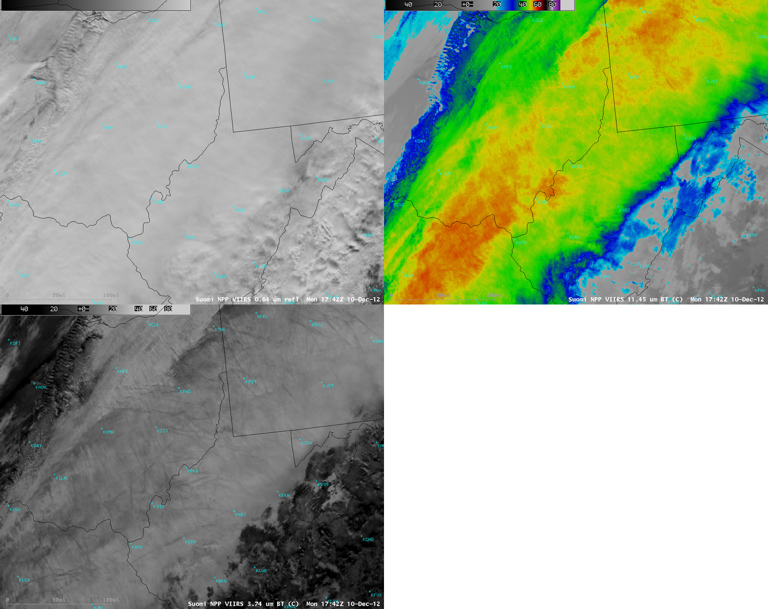
A wide band of multi-layered clouds was oriented southwest-to-northeast along a cold frontal boundary moving through the Ohio River Valley region on 10 December 2012. On a 1-km resolution Suomi NPP VIIRS 11.45 µm IR image at 17:42 UTC (above), much of this cloud band was topped with cirrus clouds exhibiting IR brightness temperatures in the -50 to -60 C range (orange to red color enhancement), indicating a cloud top height in the 30,000-40,000 foot range (KILM rawinsonde data | KPIT rawinsonde data)– the general cruising altitudes of most aircraft.
It is interesting to note that the Suomi NPP VIIRS 3.74 µm shortwave IR image revealed a large number of contrails across that cloud band — the contrails appeared darker than the background cirrus clouds, due to reflection of solar radiation by smaller ice crystals or by supercooled water droplets. Either the contrails themselves were located above the cirrus cloud deck, or the aircraft were flying through the top portion of the cirrus clouds and altering the microphysics of the cloud ice crystals to make them smaller.
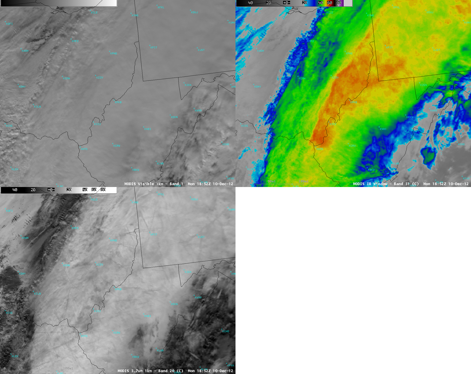
Similar contrails were seen about an hour later on a 1-km resolution MODIS 3.7 µm shortwave IR image (below).


