Significant winter storm across the Northern Plains and Upper Midwest regions
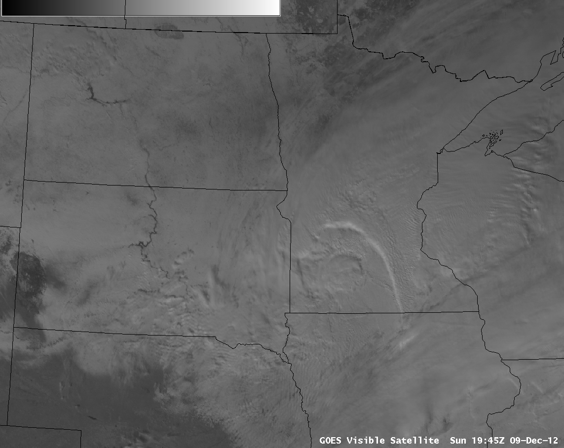
A strong winter storm moved across the Northern Plains and Upper Midwest regions of the US on 09 December 2012, producing widespread heavy snowfall (HPC storm summary) and creating blizzard conditions that closed a number of roads (including portions of Interstates 90 and 29 in eastern South Dakota). AWIPS images of GOES-13 0.63 µm visible channel data (above; click image to play animation) showed the development of a tightly-curved deformation band across Minnesota during the day — much of the heavier snowfall totals occurred beneath the pivot point of this deformation feature.
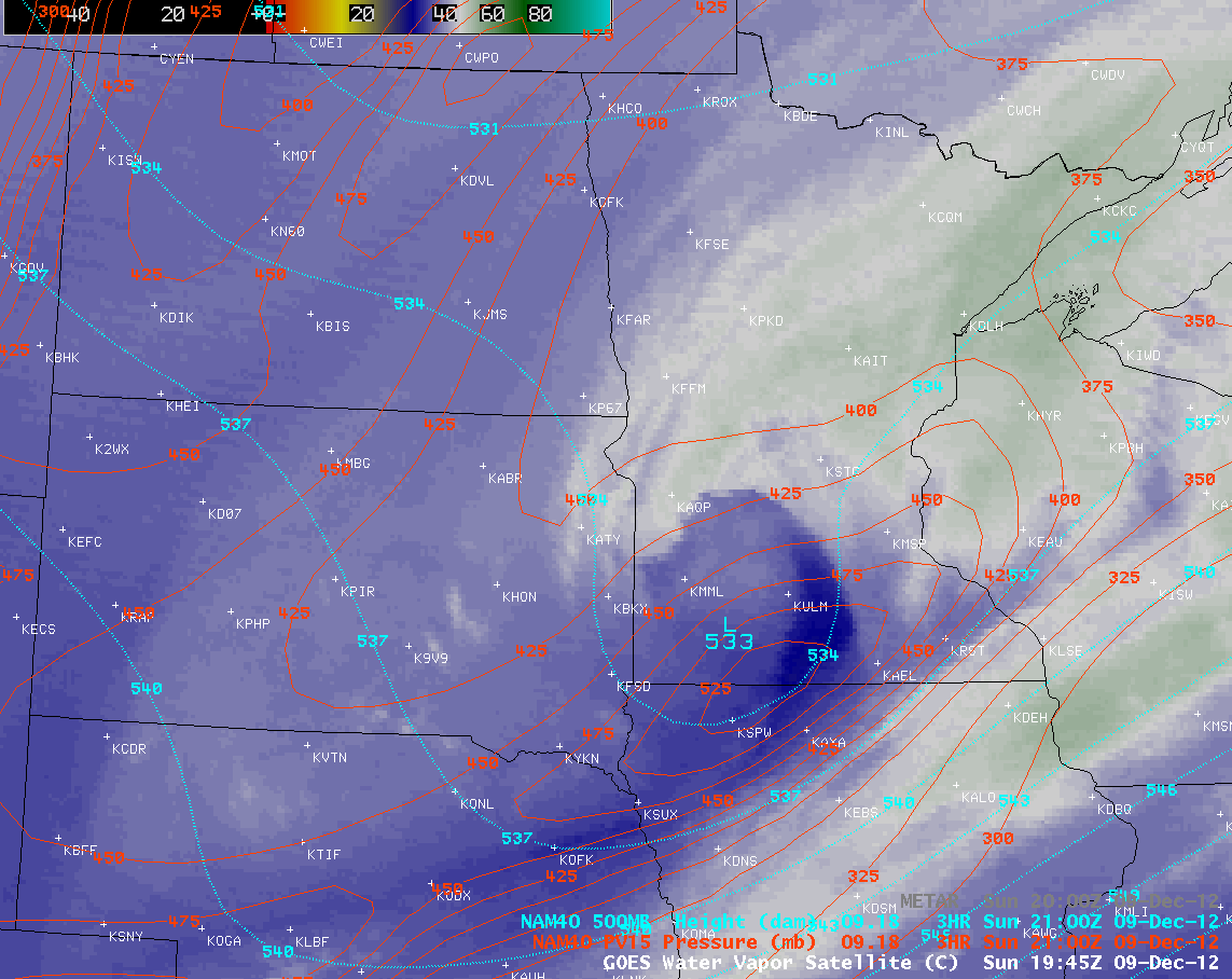
GOES-13 6.5 µm water vapor channel images (below; click image to play animation) showed the development of a dry slot along the leading edge of the core of a potential vorticity (PV) anomaly (red contours) that was moving northeastward over southern Minnesota. The approach of this PV anomaly was helping to enhance upward vertical velocities, thereby increasing snowfall rates.
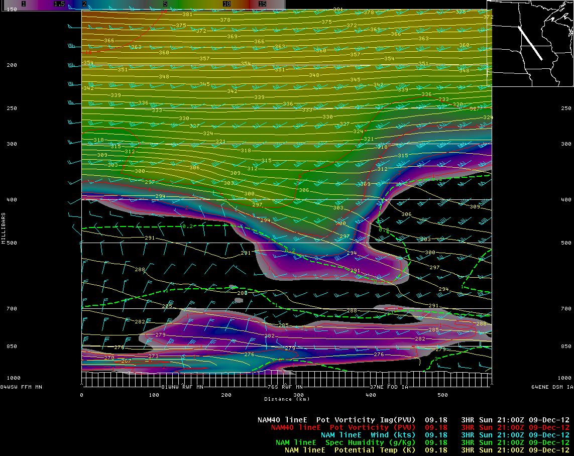
A northwest-to-southeast oriented vertical cross section using NAM40 model fields at 21 UTC (below) showed that the PV anomaly was lowering the height of the dynamic tropopause (taken to be the pressure of the PV1.5 surface) down to the 525 millibar level over southern Minnesota.
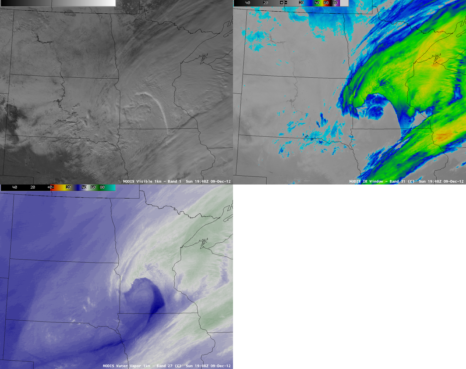
A comparison of 1-km resolution images of MODIS 0.65 µm visible channel, 11.0 µm IR channel, and 6.7 µm water vapor channel data at 19:48 UTC (below) revealed hints of some subtle banding structure over parts of Minnesota and Wisconsin, which was likely helping to enhance snowfall rates over those areas.
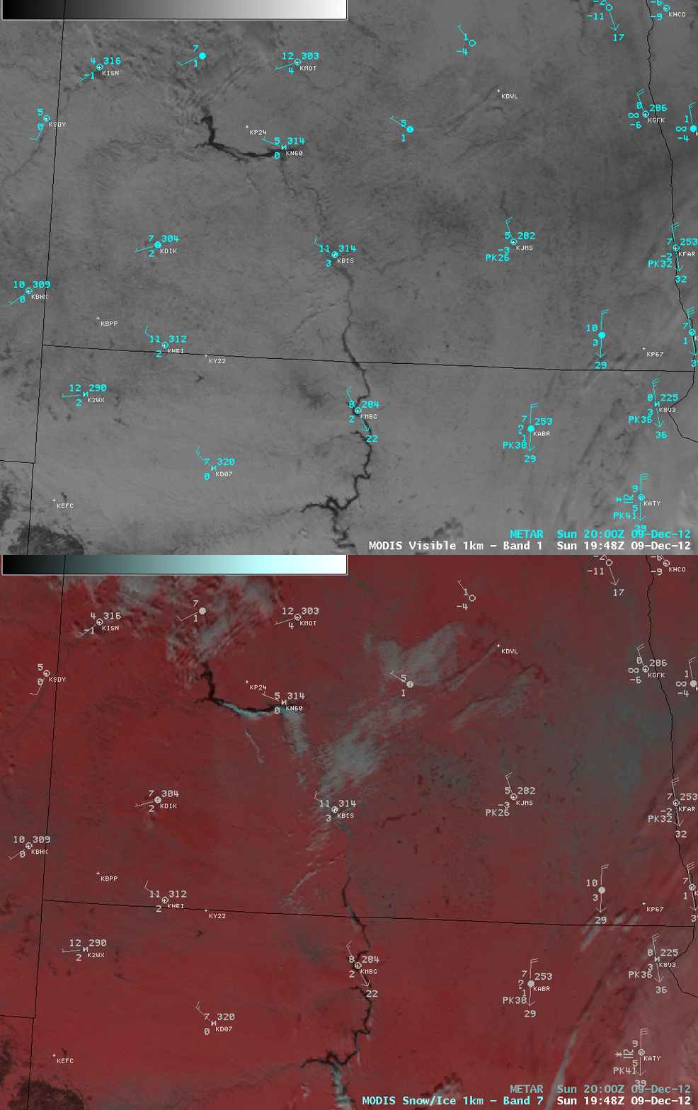
On the back side of the storm, cold arctic air was being drawn southward across wesern North Dakota and South Dakota — and a comparison of a MODIS 0.65 µm visible image with the corresponding false-color Red/Green/Blue (RGB) image using the 2.1 µm “snow/ice channel” (below) revealed small “river-effect cloud bands” forming (most notably over Lake Sakakawea in North Dakota) as this cold air moved over the still-unfrozen waters of the larger reservoirs of the Missouri River. Deeper snow cover appeared as darker shades of red, in contrast to supercooled cloud features which were brighter shades of white.


