Record October snowstorm across Wyoming and Montana
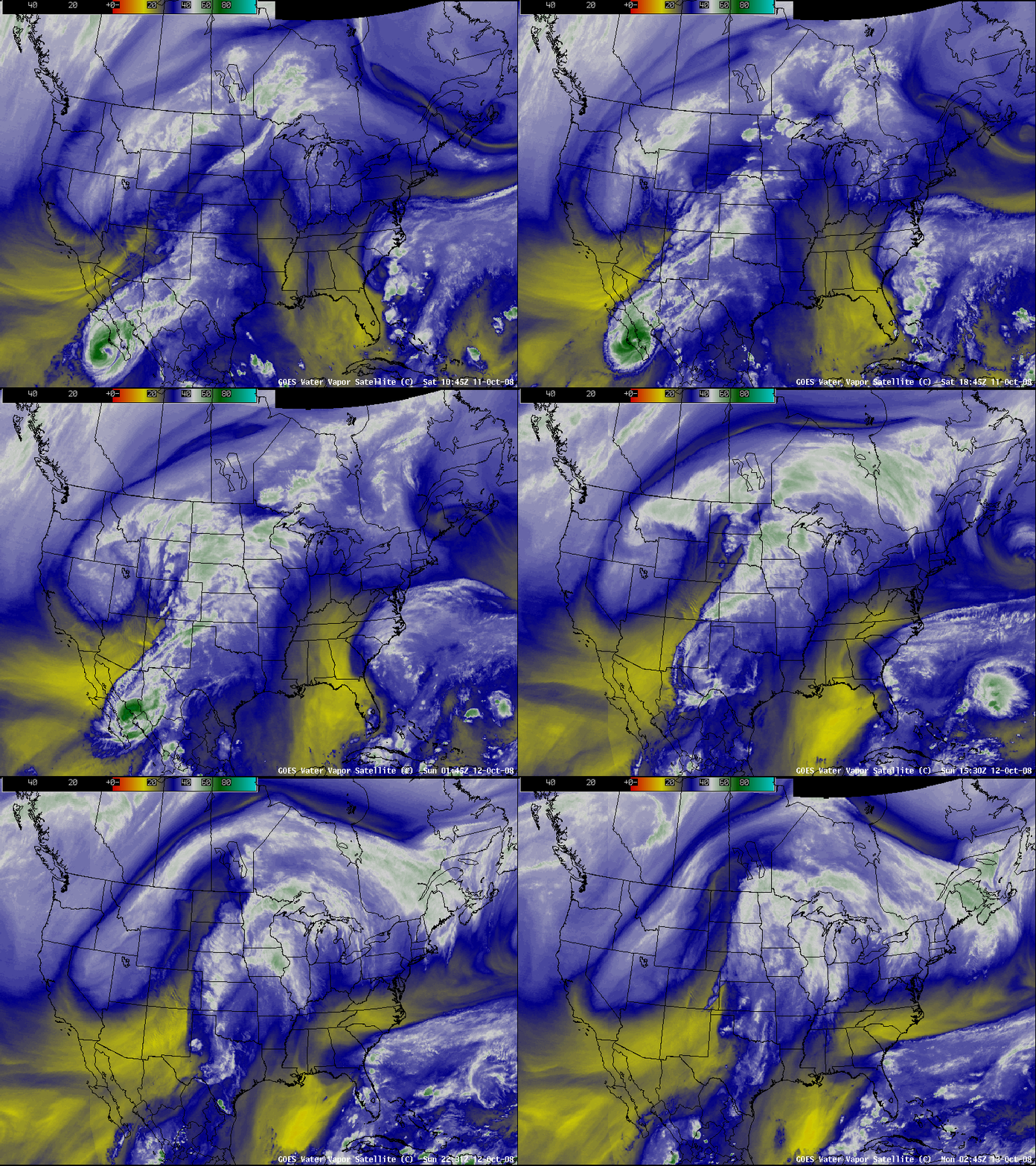
AWIPS images of the GOES-11 + GOES-12 water vapor channels (above) showed the large size of a major snowstorm that impacted much of the western US during the 10 October – 12 October 2008 time frame. This storm dropped as much as 48.8 inches of snow at Cole Creek, Montana and 29.7 inches at Lander, Wyoming (their greatest October snowfall on record), and Glasgow, Montana received 12.8 inches of snow on 12 October (their heaviest snowfall for any calendar day during the month of October). At Billings, Montana the snow depth of 9 inches on 13 October was the earliest date on record for a 9-inch snow depth.
AWIPS images of the MODIS visible channel and the 1.6 µm near-IR “snow/ice” channel (below) displayed the areal coverage of snow on the ground across much of Wyoming, eastern Montana, far northwestern South Dakota (including the higher elevations of the Black Hills) and western North Dakota, stretching northeastward into portions of Saskatchewan and Manitoba on 13 October. Snow cover exhibits a darker signal on snow/ice channel imagery (in contrast to supercooled water droplet clouds, which appear as lighter shades of gray).
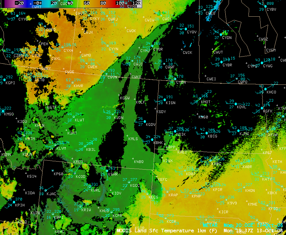
An AWIPS image of the MODIS Land Surface Temperature (LST) product (below) showed the effect of the deep snow cover on surface temperatures across much of Wyoming and Montana on 13 October — LST values within the snow swath were only in the upper 20s to low 30s F (green colors), compared to the 60s and 70s F (orange colors) north of the deep snow cover. The daily maximum temperature on 13 October at Glasgow, Montana was only 37º F (which tied the record for coldest maximum temperature for that date), while the daily high temperature of 28º F at Wisdom, Montana was the earliest date for such a cold maximum temperature.
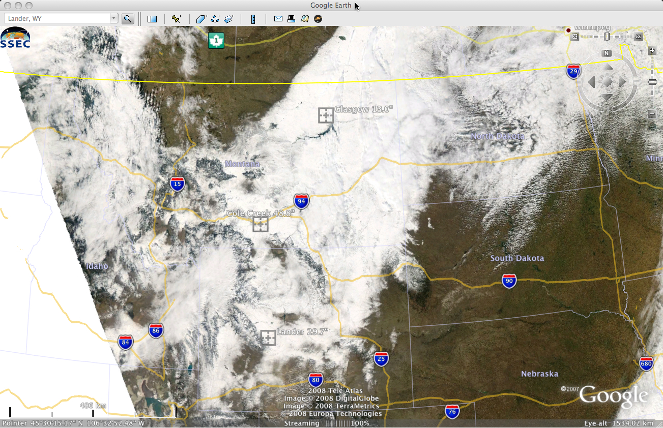
A 250-meter resolution MODIS true color image (below, viewed using Google Earth) displayed the extent of the snow cover across parts of Wyoming and Montana. Note that there were a few snow-free patches located within the broad swath of snow cover (a result of the complex terrain across the region).


