Of large eyes and midget tropical cyclones
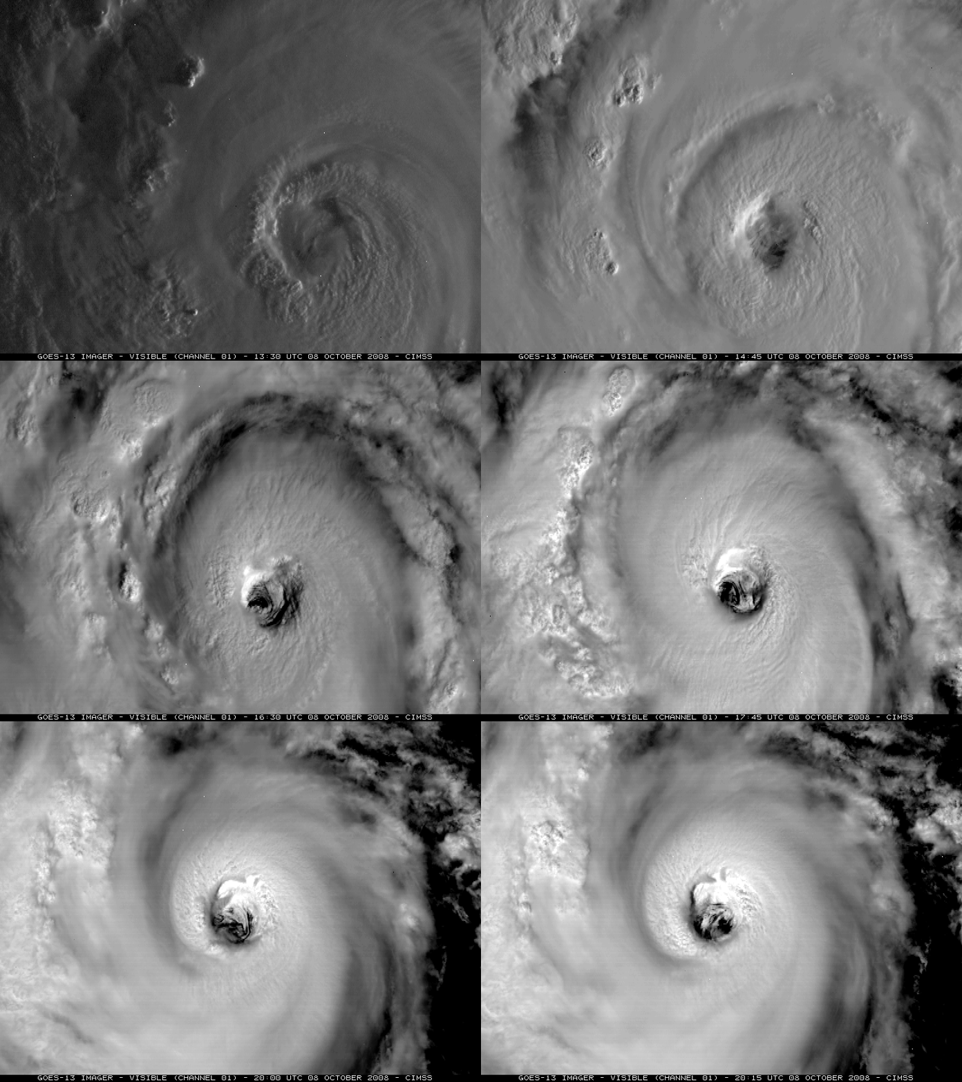
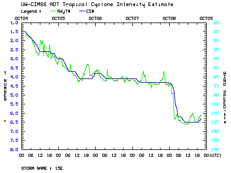
GOES-13 visible imagery (above) revealed the rather large eye of Hurricane Norbert on 08 October 2008 — Norbert was a Category 4 storm at that time, and the eye appeared to be about 30-35 nautical miles in diameter. Hurricane Norbert underwent a period of rapid intensification during the pre-dawn hours on 08 October, which was clearly seen on a plot of the Advanced Dvorak Technique intensity estimate (below) from the CIMSS Tropical Cyclones site.
To illustrate the diversity of tropical cyclone spatial scales, it is interesting to compare the large eye of Hurricane Norbert (in the eastern Pacific Ocean) with the small cluster of deep convection around the core of Tropical Storm Marco (2 days earlier in the Gulf of Mexico) — Marco is not much larger than the eye of Norbert! The visible and IR images shown below are from the same satellite (GOES-13) at the same time of day (20:00 UTC), displayed with the same magnification (zoomed in to an effective 0.5 km resolution). According to the National Hurricane Center discussions, Tropical Storm Marco may have been one of the smallest tropical cyclones on record, with tropical storm force winds only extending about 10 nautical miles away from the center.


