Ice floes in Hudson Bay
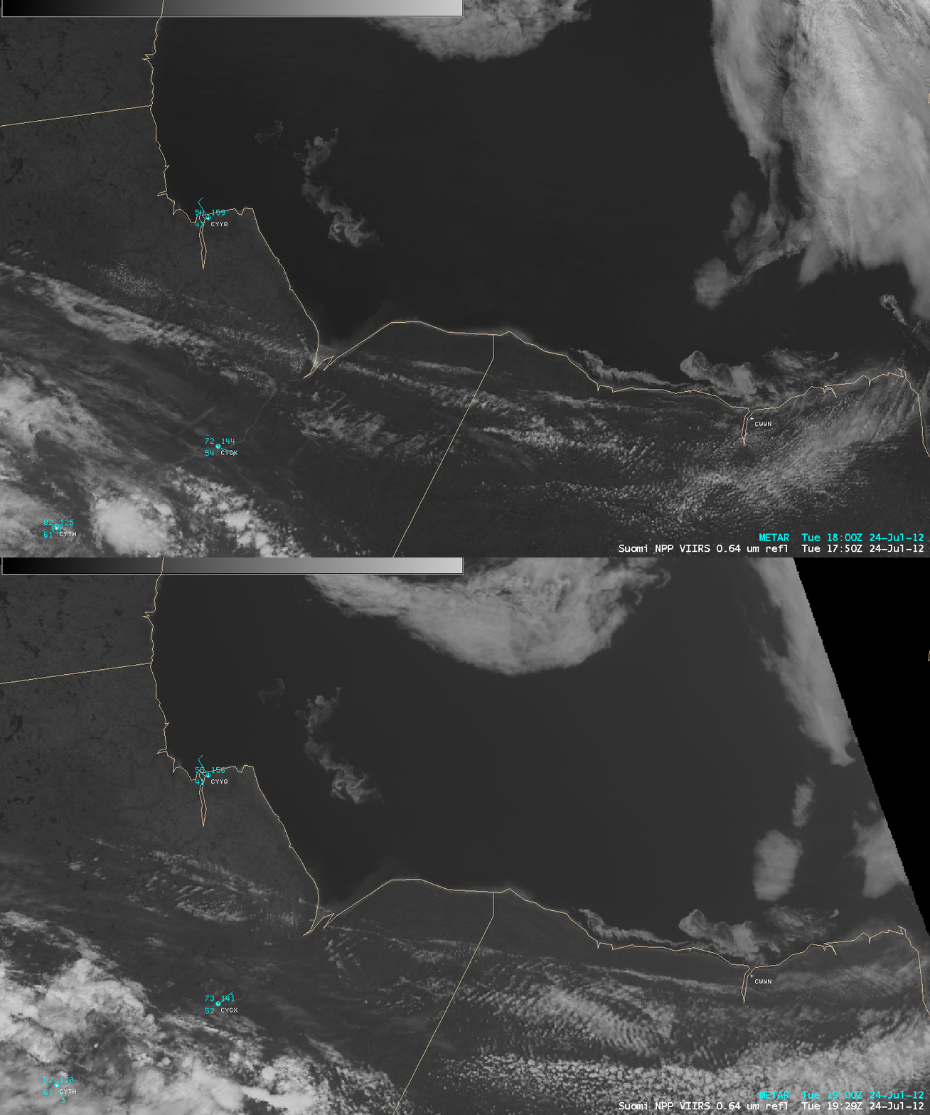
Even though most of Hudson Bay in Canada was essentially ice-free on 24 July 2012, there were still some ice floes consisting of thick first year ice that remained in the far southwestern part of the Bay. AWIPS images of Suomi NPP VIIRS 0.64 µm visible channel data (above) showed the motion of these ice floes (along with the other cloud features in the region) between 17:50 and 19:29 UTC.
A comparison of a VIIRS 0.64 µm visible channel image with the corresponding 3-channel Red/Green/Blue (RGB) image created by using 0.64 µm, 1.61 µm, and 11.45 µm data (below) demonstrated the utility of using RGB imagery to help discriminate between ice features (darker purple color enhancemnt) and clouds (varying shades of white).
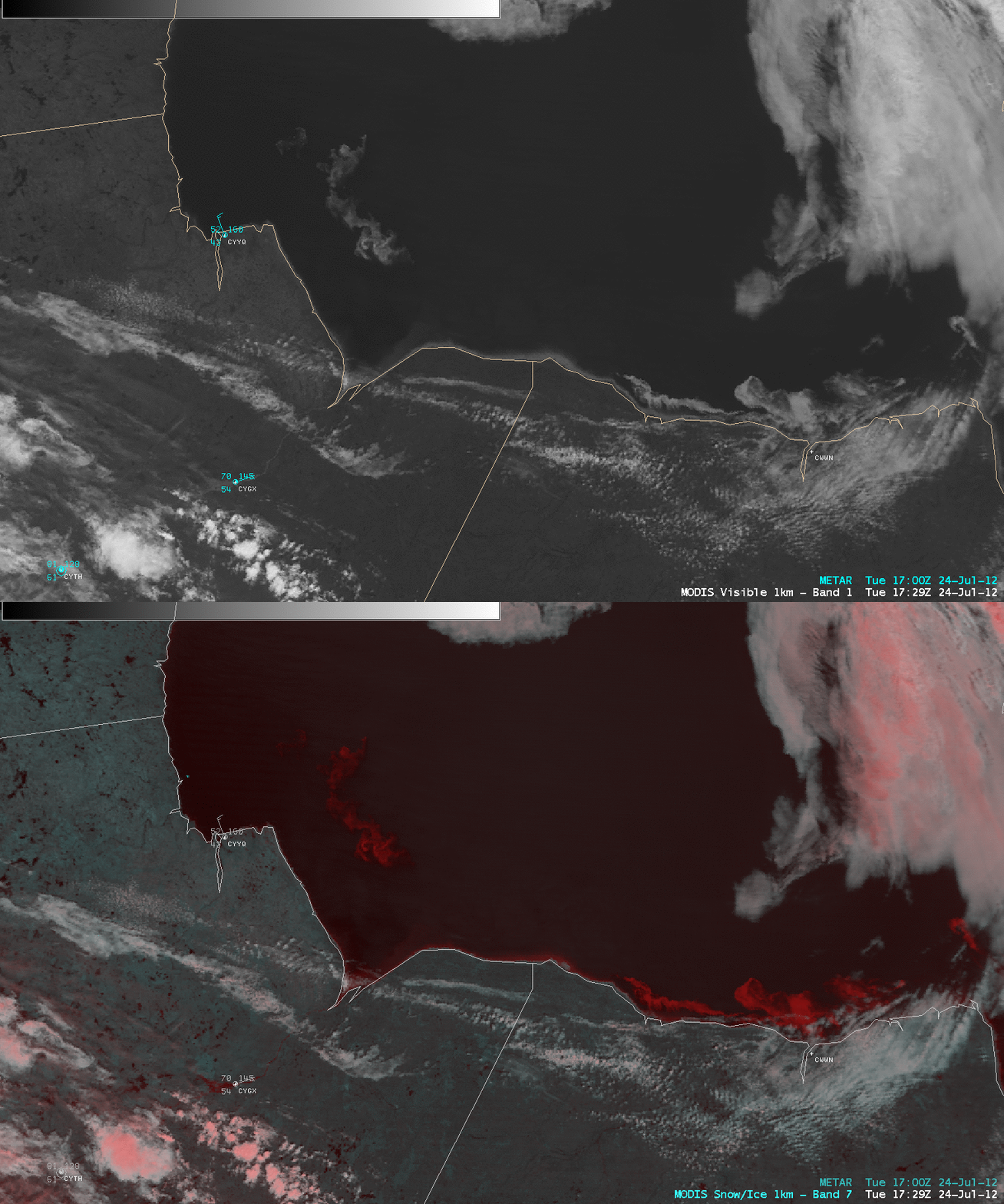
Similarly, a comparison of a MODIS 0.65 µm visible channel image with the corresponding RGB image created using 0.64 µm and 2.1 µm data (below) showed the ice features as darker red, compared to supercooled water droplet clouds (lighter shades of white) and glaciated clouds (lighter pink color enhancement).
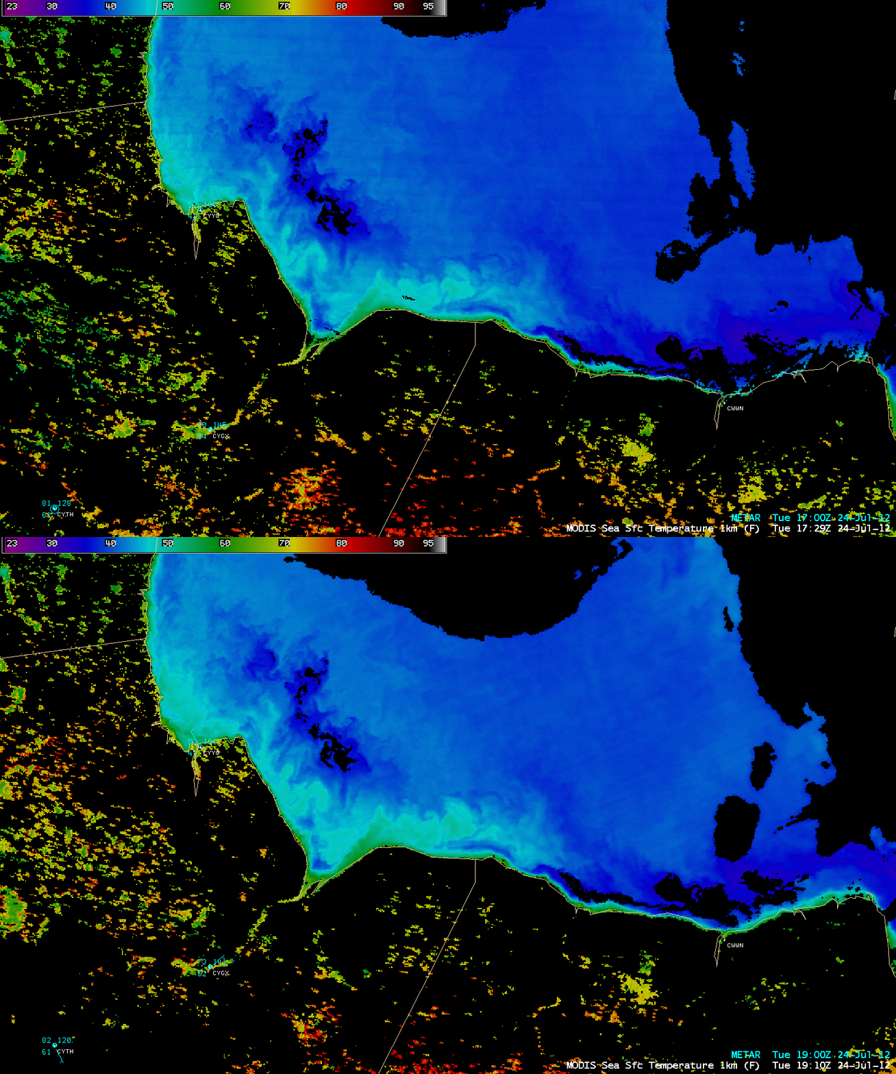
The MODIS Sea Surface Temperature (SST) product (below) showed SST values in the middle 30s F (darker blue color enhancement) over the ice floe features, compared to SST values in the low-middle 40s F over the adjacent open waters of Hudson Bay.


