Precipitation variability across the Upper Midwest region
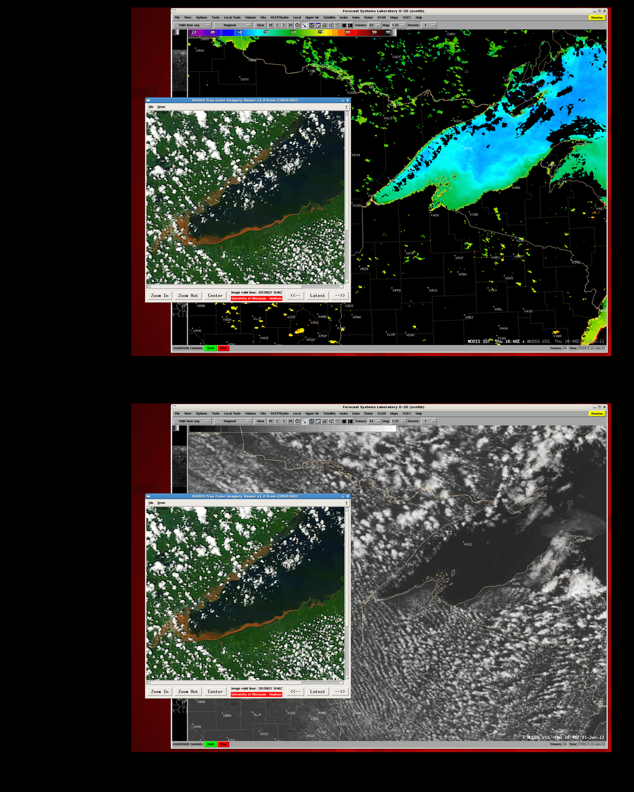
AWIPS comparisons of a 250-meter resolution MODIS true-color Red/Green/Blue (RGB) image at 16:46 UTC on 21 June 2012 with the corresponding 1-km resolution MODIS Sea Surface Temperature product and 0.65 µm visible channel image (above) revealed the vivid signature of iron and/or copper rich runoff sediment in the near-shore waters of western Lake Superior following the historic heavy rainfall event of 19 June – 20 June 2012 (for more details on this event, see the Duluth National Weather Service).
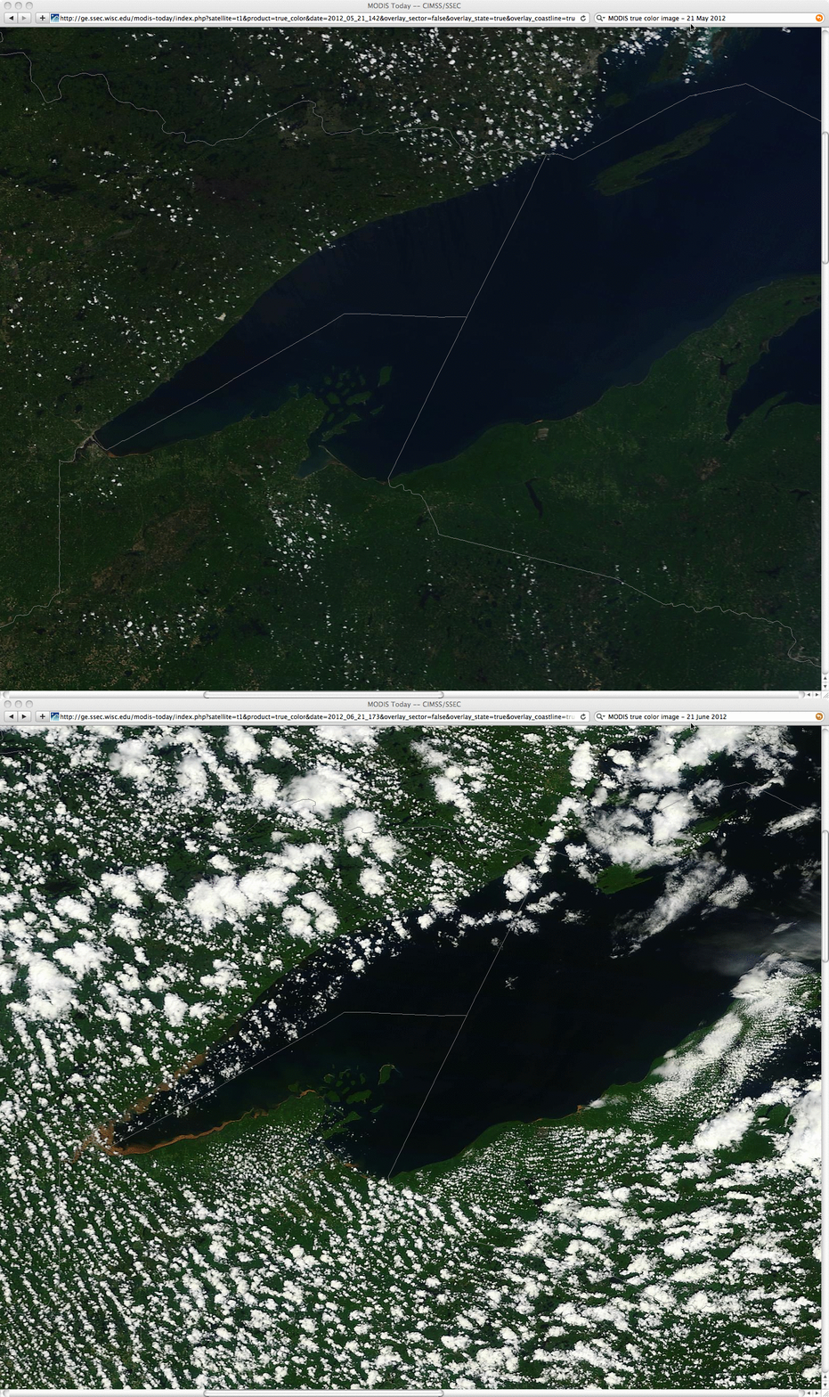
A “before” (21 May 2012) and “after” (21 June 2012) true color image from the SSEC MODIS Today site (below) showed the dramatic change in appearance of the western Lake Superior near-shore waters.
================================================
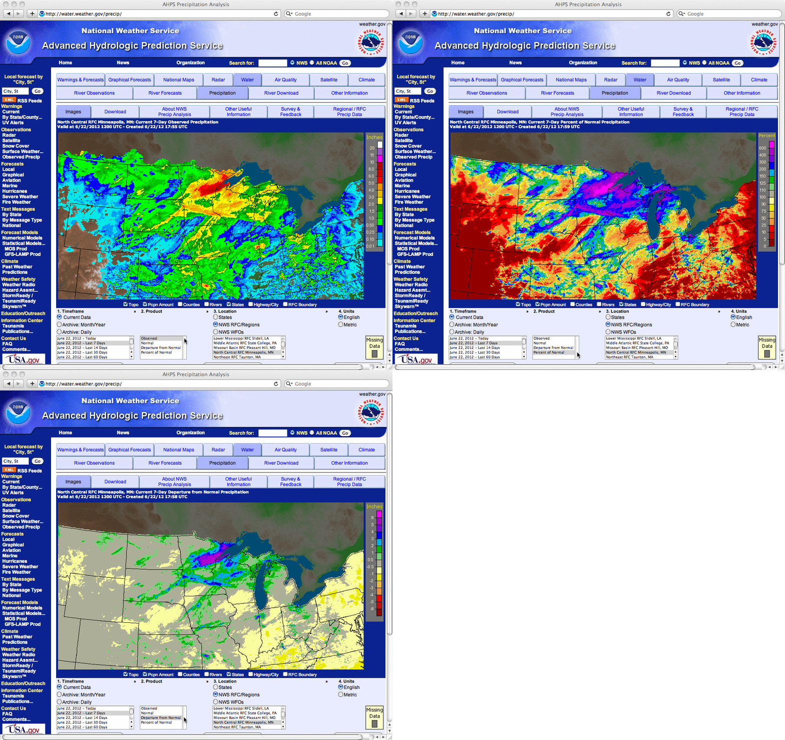
Maps of the total 7-day precipitation, percent of normal precipitation, and precipitation departure from normal (above) highlighted the extreme nature of the event in the Duluth region, but also showed the large amount of variability in precipitation across other portions of the Upper Midwest states during this period.
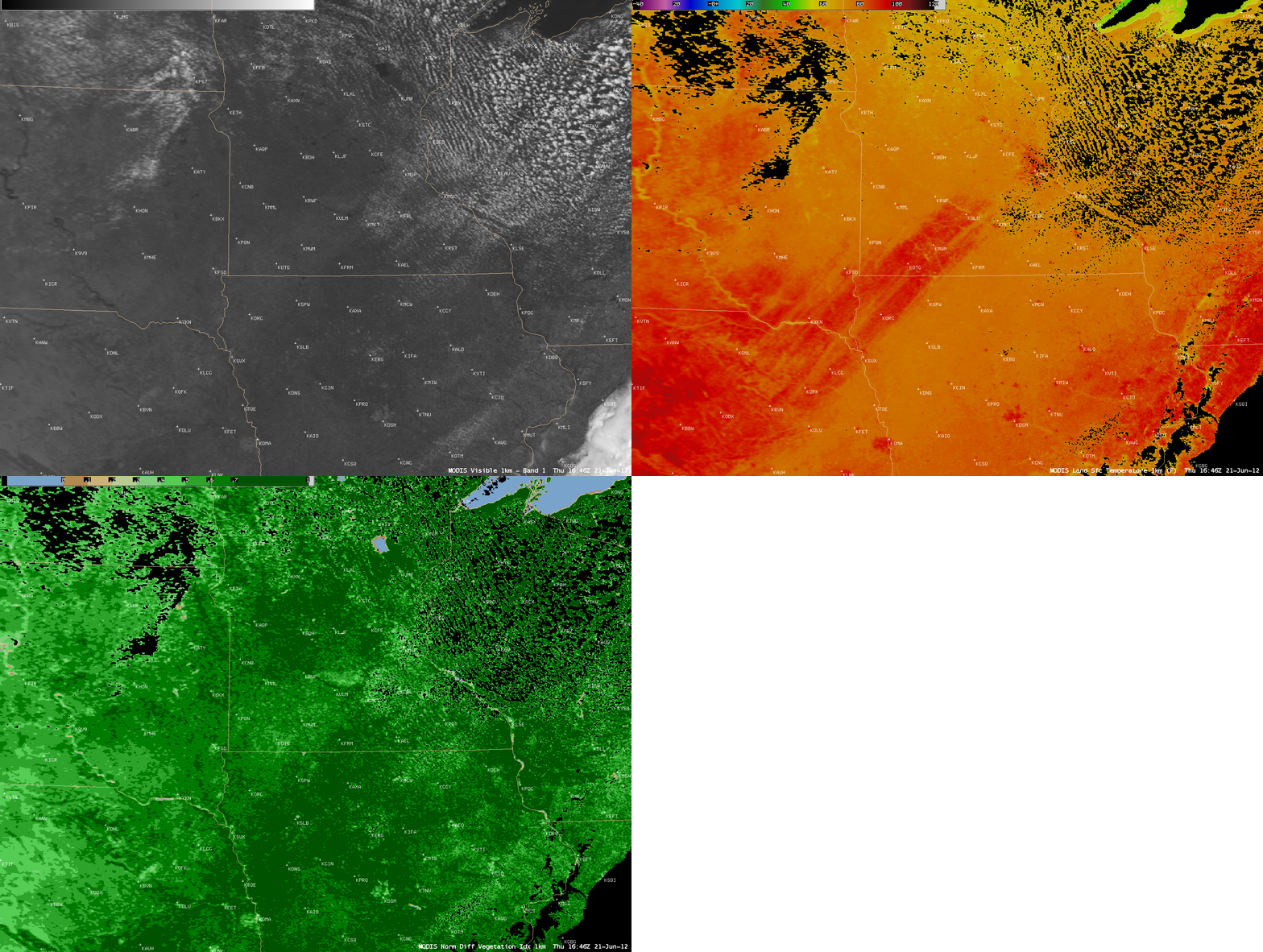
In particular, note the large southwest-to-northeast oriented swath across northeastern Nebraska, northwestern Iowa, southeastern South Dakota, and southwestern Minnesota (below): in this highly agricultural area, the stress on the crops within this rain-free swath was apparent on MODIS 0.65 µm visible imagery (lighter gray where the vegetation was less healthy), the MODIS Land Surface Temperature (LST) product (LST values in the upper 80s to mid 90s F, surrounded by LST values in the 70s F), and the Normalized Difference Vegetation Index (NDVI values as low as 0.43 in southwestern Minnesota, surrounded by NDVI values of 0.7 to 0.8 to the north and to the south where ample rainfall had been occurring).


