Large wildfire in Labrador, Canada
McIDAS images of GOES-13 0.63 µm visible channel data (above; click image to play animation) revealed the development of a very broad and dense smoke plume emanating from a large wildfire that was burning just northwest of Goose Bay, Labrador (station identifier CYYR) in far eastern Canada on 13 June 2012. Note the appearance of a number of bright “pyro-cumulus” clouds near the fire source region, as the very hot fires produced intense updrafts to form large towering cumulus clouds. As an aside, it is interesting to note that there were still a number of large ice floes (slow-moving brighter white features) not far off the Labrador coast, which were drifting slowly northward during the day.
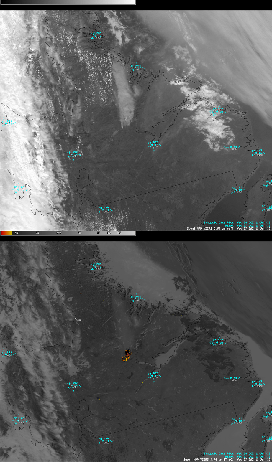
McIDAS images of 375-meter resolution (projected onto a 1-km AWIPS grid) Suomi NPP VIIRS 0.64 µm visible channel data and 3.74 µm shortwave IR channel data (below) showed the large size of the fire “hot spot” (yellow to red to black pixels), in addition to the thick smoke plume.
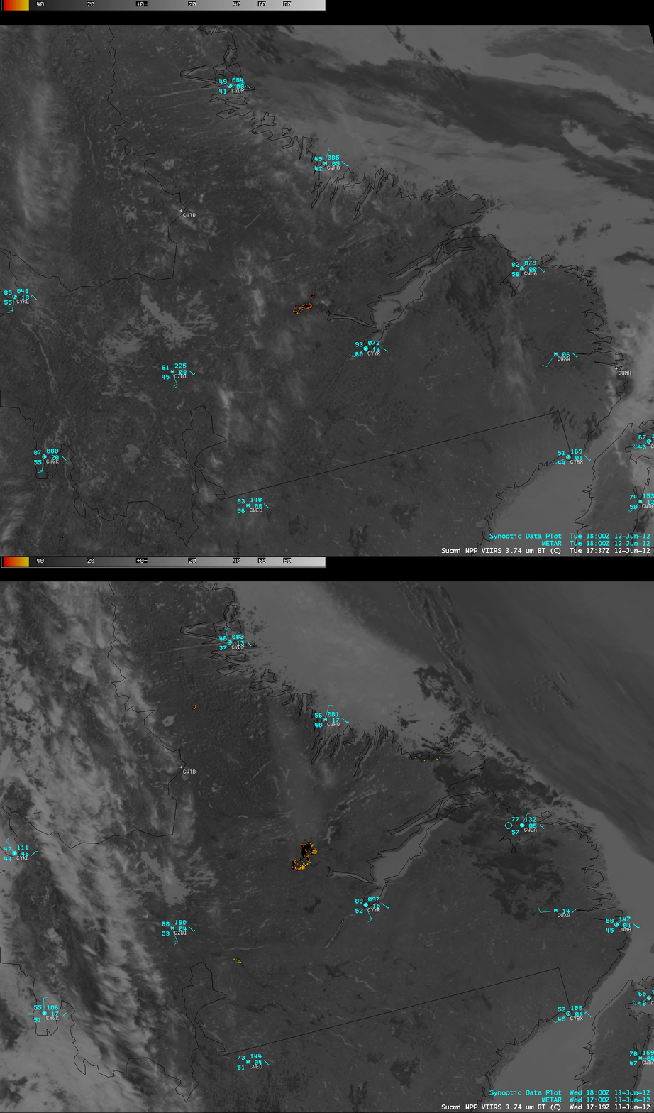
A comparison of Suomi NPP VIIRS 3.74 µm shortwave IR images from 12 June and 13 June (below) show how large the fire hot spot had grown in a day. Note that the surface air temperature at Goose Bay plotted on the 12 June image was 93 F (33.9 C) — the high temperature at Goose Bay on that day was actually 95 F (35 C), only 2.2 F (1.2 C) shy of their all-time record high temperature for the month of June.


