Mesoscale Convective Vortex (MCV) over Mississippi
McIDAS images of GOES-13 0.63 µm visible channel data (above; click image to play animation) revealed the cyclonic circulation of a Mesoscale Convective Vortex (MCV) that was moving northeastward across Mississippi on 30 March 2012. This MCV appeared to play a role in helping to initiate new convective cells ahead of it as the atmosphere destabilized during the late morning and early afternoon hours.
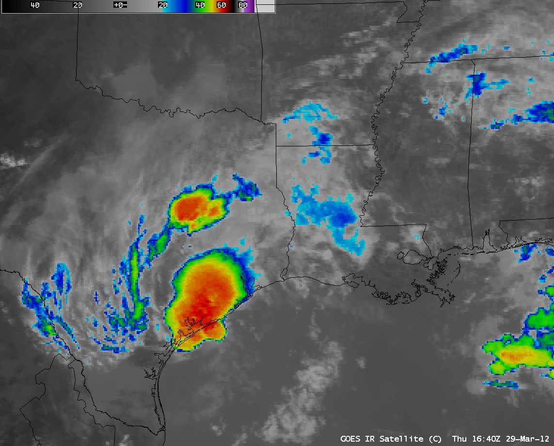
AWIPS images of GOES-13 10.7 µm IR channel images (below; click image to play animation) helped to identify the apparent origin of the MCV — a large mesoscale convective system that developed along the Texas coast after about 15 UTC on the previous day (29 March).
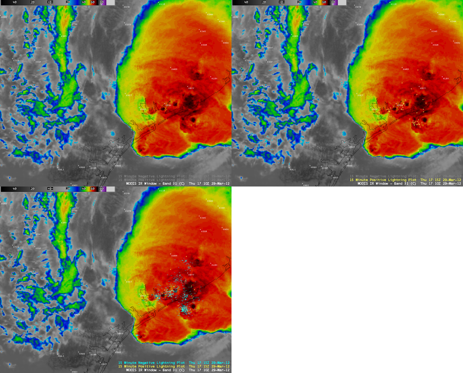
A closer look at the parent mesoscale convective system using a 1-km resolution MODIS 11.0 µm IR image with overlays of cloud-to-ground lightning strikes (below) showed that the storm was producing a large number of lightning strikes. The coldest MODIS cloud top IR brightness temperatures were -70 C (darker black color enhancement).


