Hurricane Ike: GOES-11 Super Rapid Scan images
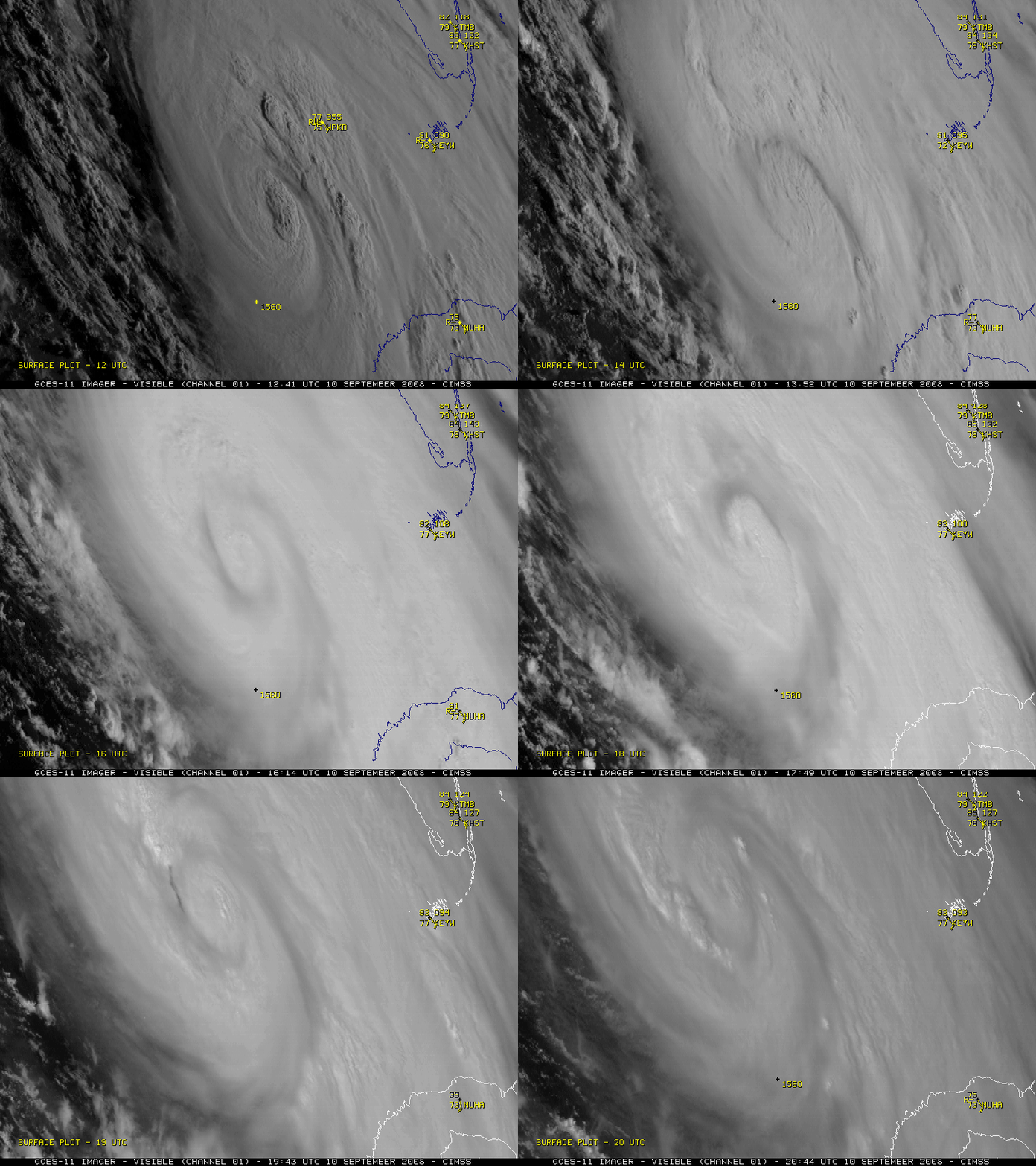
The GOES-11 (GOES-West) satellite was placed into Super Rapid Scan Operations (SRSO) mode on 10 September 2008, allowing imagery at 1-minute intervals to monitor Hurricane Ike in the Gulf of Mexico. Using the visible channel imagery (above; QuickTime animation), the large satellite viewing angle from GOES-West positioned over the Pacific Ocean (the satellite zenith angle is approximately 66 degrees for features over the Gulf of Mexico) allowed for an interesting “oblique view” of convective bursts developing around the core of Hurricane Ike.
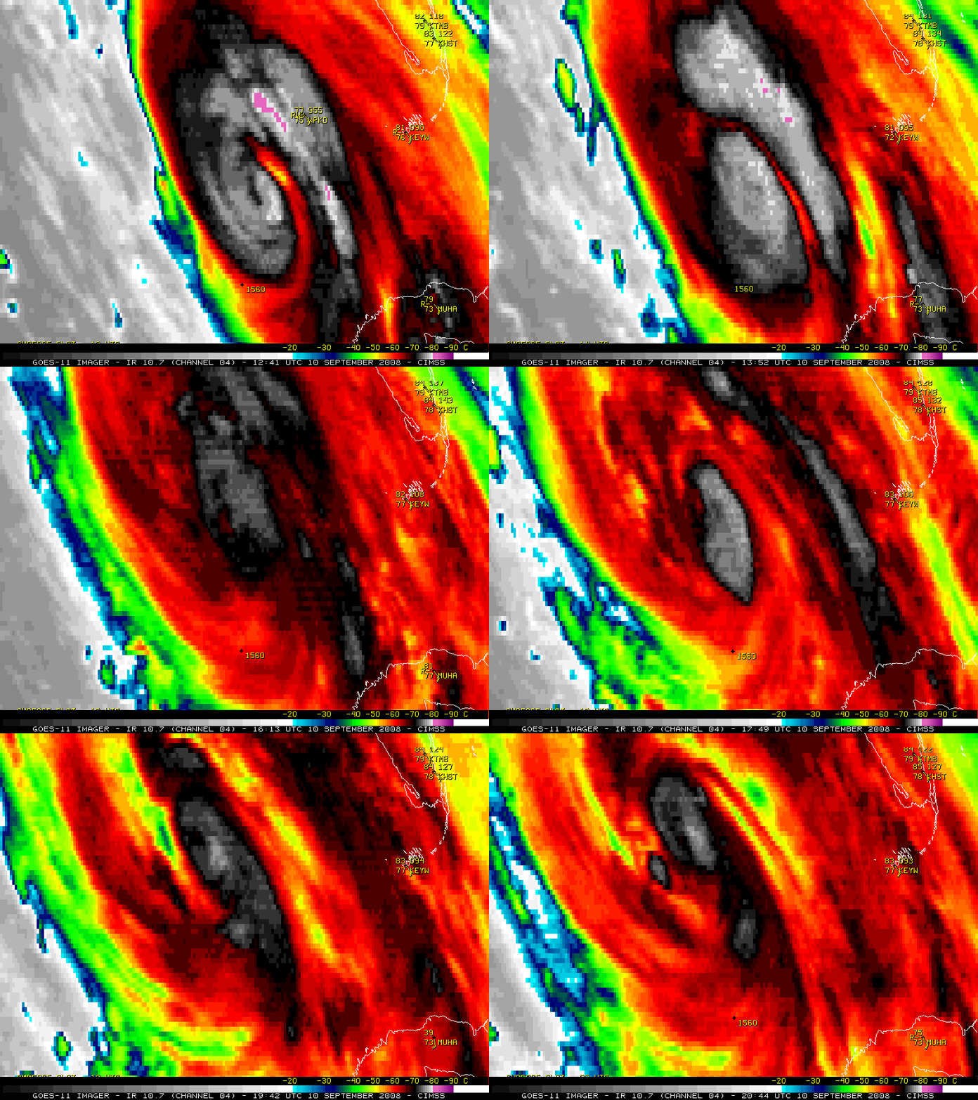
GOES-11 10.7 µm IR imagery (below; QuickTime animation) revealed a band of very cold cloud top temperatures — colder than -80º C (purple colors) — in the northeastern quadrant of Hurricane Ike early in the day. The minimum cloud top brightness temperature value of -83º C was seen at 12:49 and 13:19 UTC. During the course of the day, Hurricane Ike re-intensified into a Category 2 storm as it moved over a high Ocean Heat Content area in the eastern Gulf of Mexico.
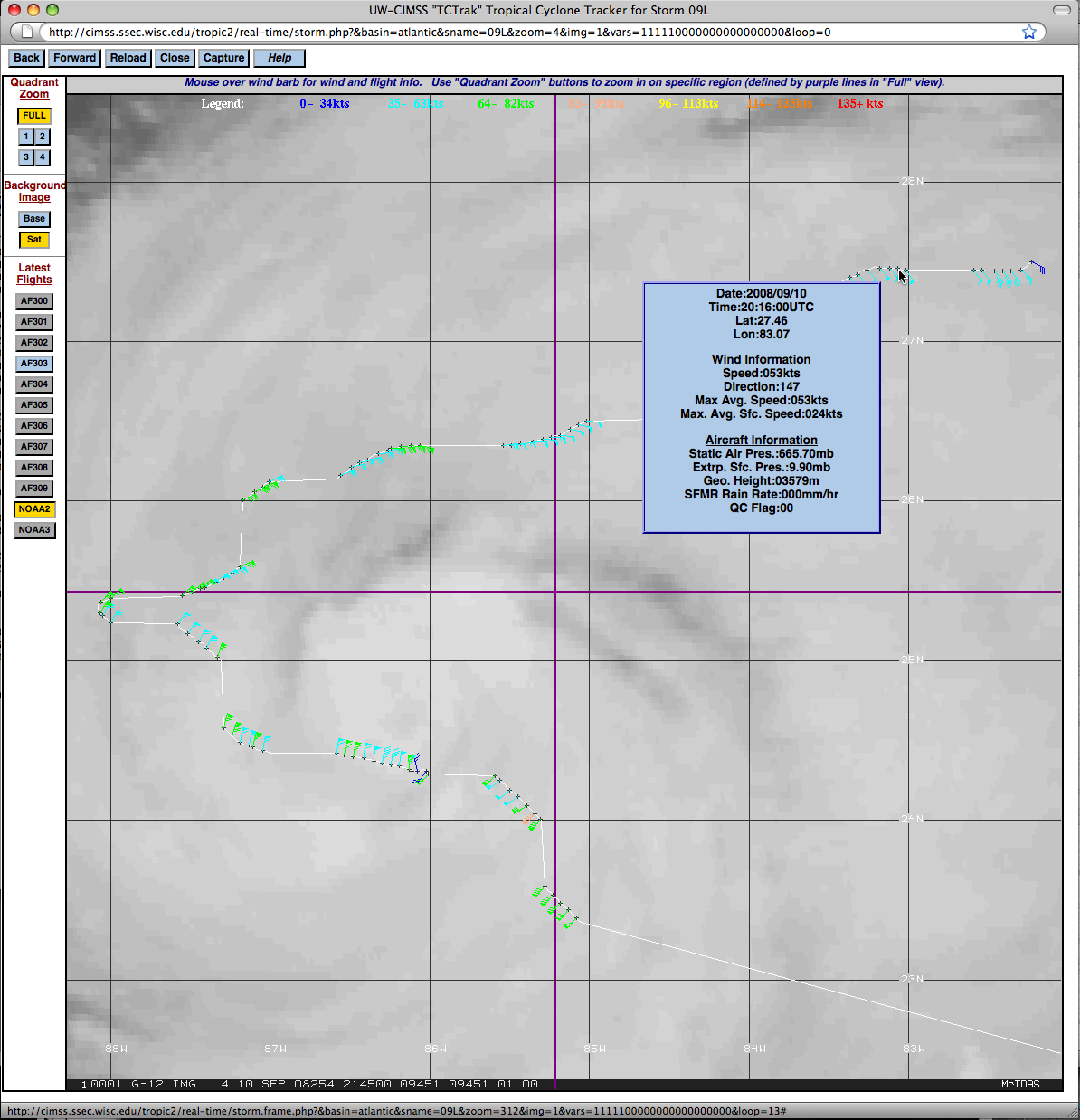
A plot of NOAA aircraft reconnaissance data from the CIMSS Tropical Cyclones site (below) showed that Ike was a rather large hurricane, with tropical storm force winds extending a significant distance away from the eye. TRMM/TMI (Tropical Rainfall Measuring Mission Microwave Imager) data indicated that Ike possessed a double eyewall structure, with a small inner eye within a very large outer eyewall.
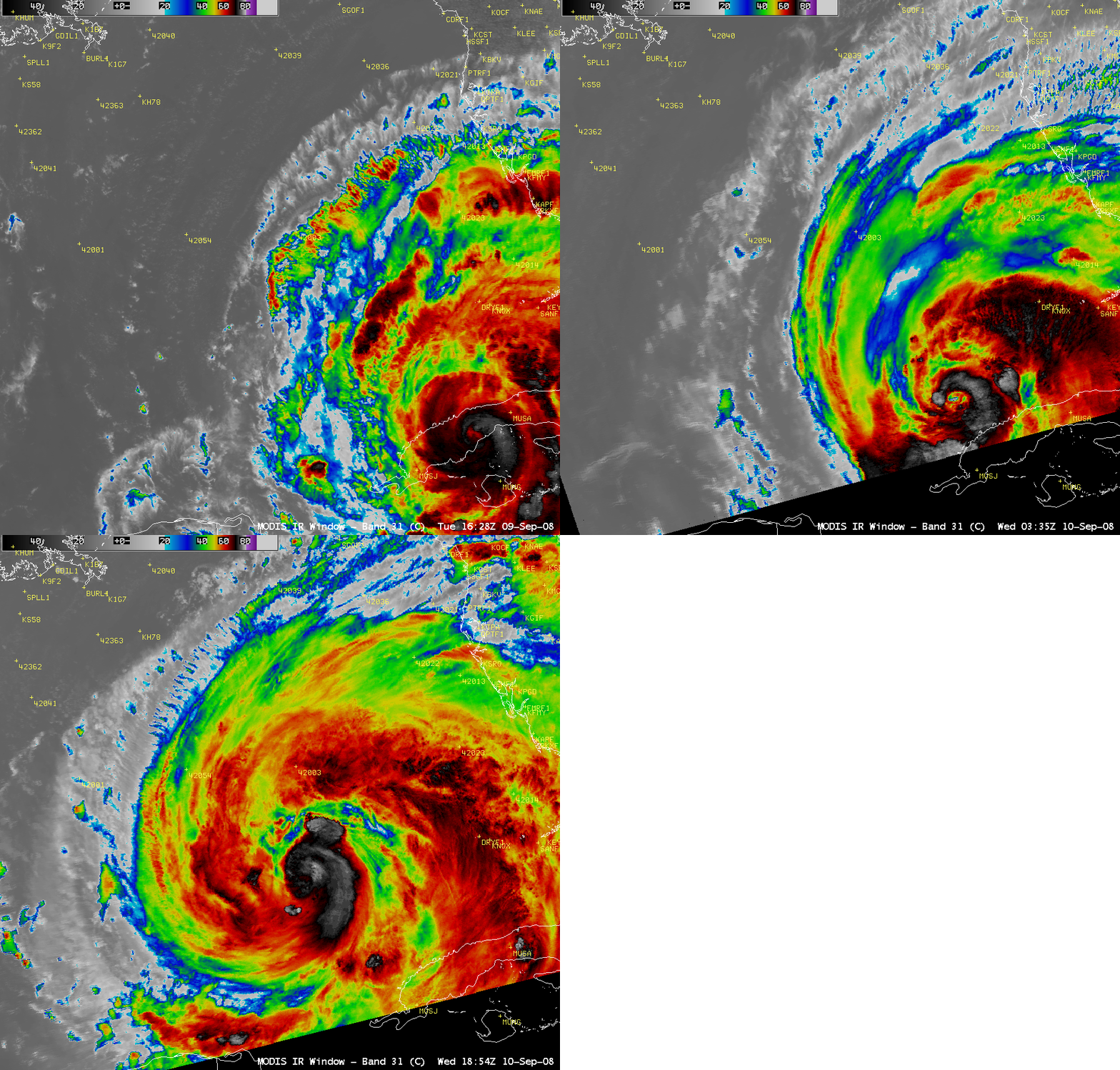
A sequence of AWIPS images of the 1-km resolution MODIS 11.0 µm IR channel data (below) showed that Hurricane Ike remained very well organized even after its encounter with the island of Cuba.


