River valley fog over southwestern Wisconsin
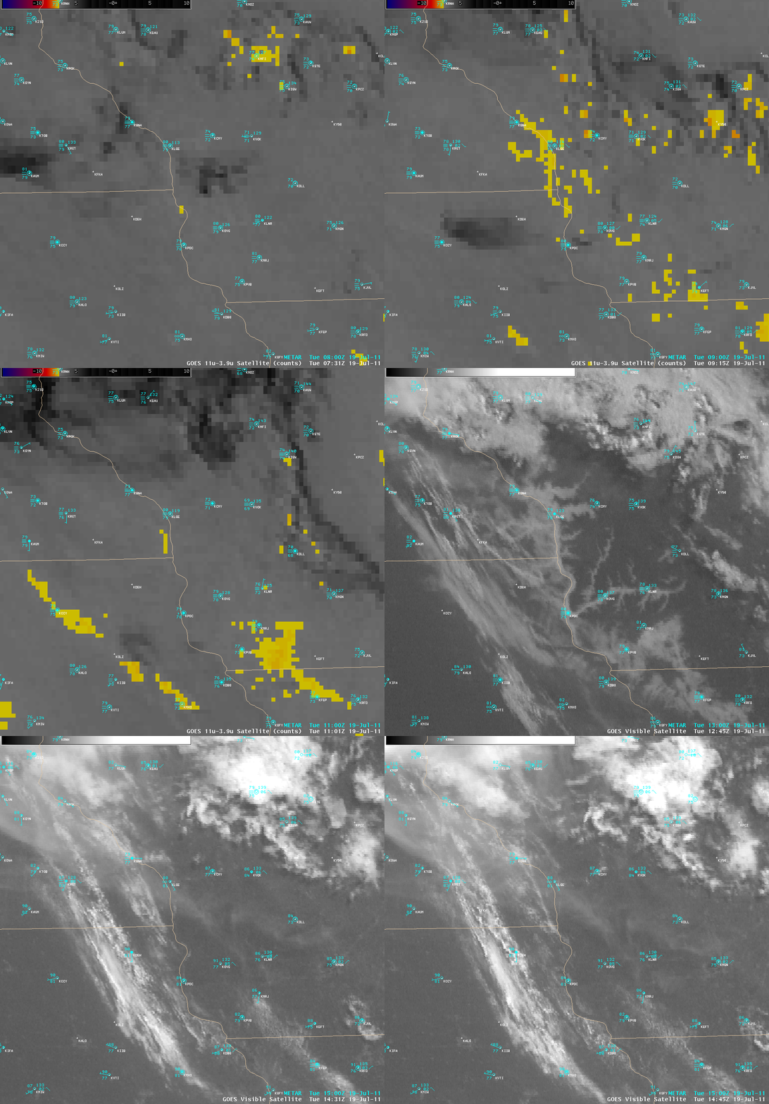
AWIPS images of the 4-km resolution GOES-13 “fog/stratus product” at night followed by 1-km resolution GOES-13 0.63 µm visible channel data (above) showed that there was a great deal of river valley fog along the portion of the Mississippi River where Wisconsin borders Minnesota and Iowa, as well as some of the tributaries across southwestern Wisconsin on the morning of 19 July 2011. Not surprisingly, much more detail in the fog structure was evident in the higher spatial resolution visible images after sunrise, compared to that seen using the night-time 2-channel IR brightness temperature difference employed to create the standard operational fog-stratus product.
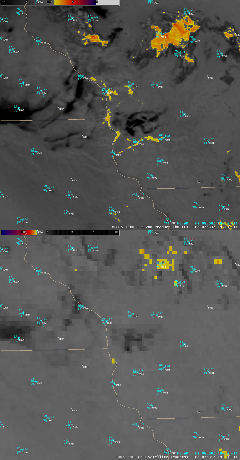
Another example showing how improved spatial resolution aids in river valley fog detection could be seen below with a comparison of the 1-km resolution MODIS fog/stratus product with the 4-km resolution GOES-13 fog/stratus product images around 07:30 UTC (2:30 am local time). Along the Wisconsin River Valley at that particular time, Lone Rock (station identifier KLNR) and Boscobel (station identifier KOVS) were both reporting surface visibilities restricted to 0.25 mile with fog.
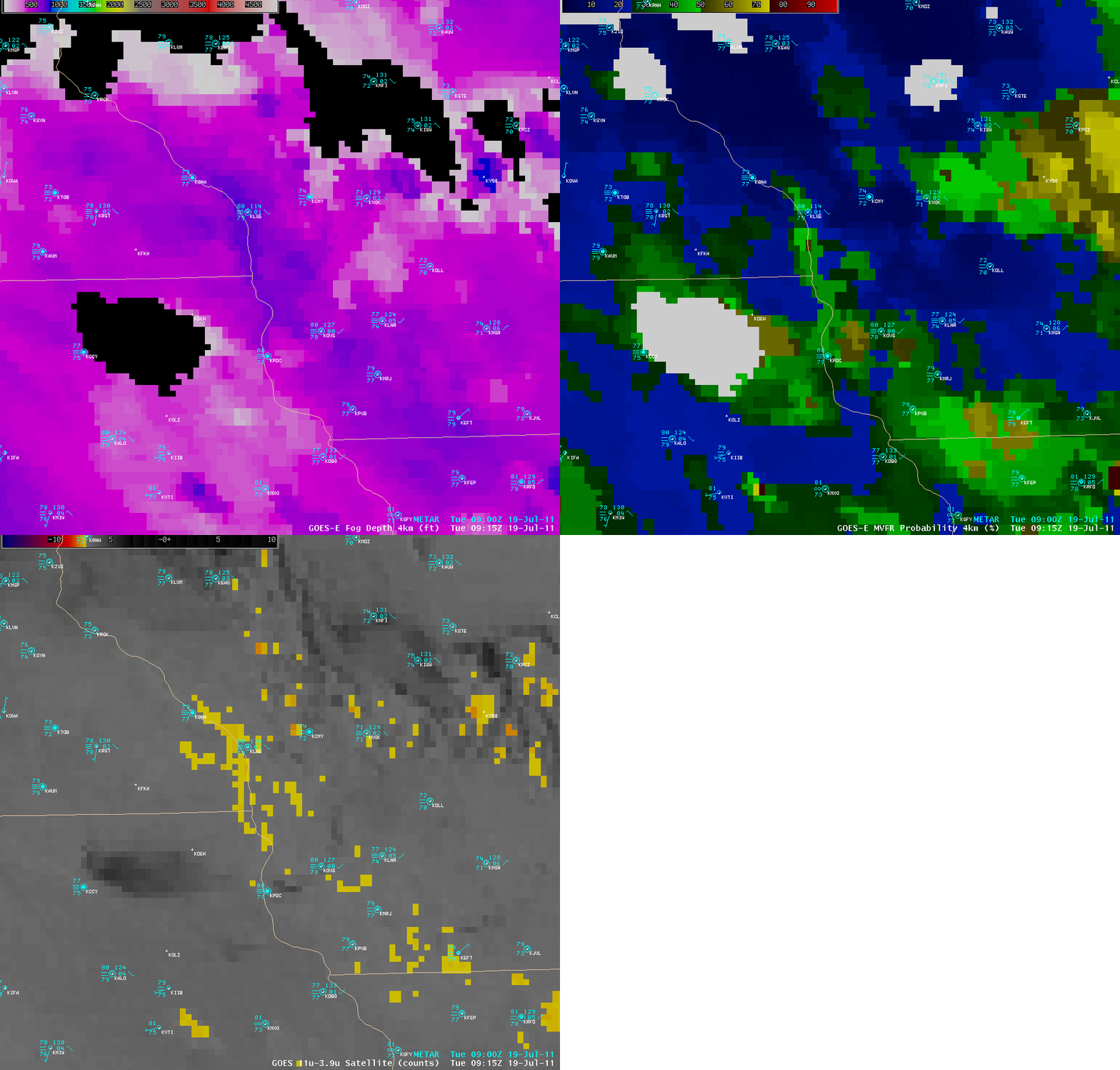
More quantitative information about the fog features is available using products such as the Fog Depth and Marginal Visual Flight Rules (MVFR) Probability products (below), which blend model fields with satellite imagery. Fog depth values along the Mississippi River were greater than 700 feet (blue color enhancement), and MVFR Probability was near 50% (lighter green color enhancement) at 09:15 UTC (4:15 am local time). CIMSS participation in the GOES-R Proving Ground includes the distribution of these types of products to select NWS forecast offices for testing and evaluation.
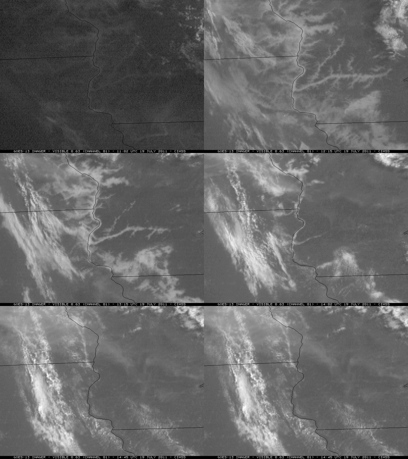
McIDAS images of GOES-13 0.63 µm visible channel data (below) offered a slightly clearer view of the river valley fog dissipation during the morning hours.
Farther to the east, there was extensive fog/stratus over southern Lake Michigan, which was discussed on the GOES-R Proving Ground Hazardous Weather Testbed blog.


