Flooding continues along the Mississippi River
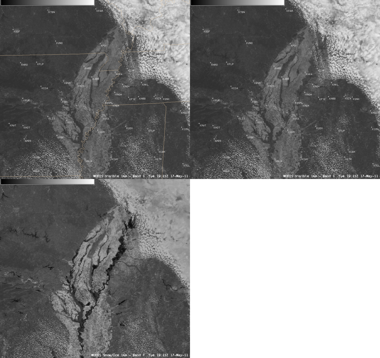
AWIPS images of MODIS 0.65 µm visible channel data and MODIS 2.1 µm near-IR “snow/ice channel” data (above) demonstrated the utility of the snow/ice channel imagery for highlighting the areal extent of flooding along parts of the lower Mississippi River on 17 May 2011. Water is a strong absorber at the 2.1 µm wavelength, so it appears very dark on the MODIS snow/ice channel image.
CIMSS participation in GOES-R Proving Ground activities includes making MODIS imagery available for National Weather Service forecasters to add to their AWIPS workstations. The VISIT training lesson “MODIS Products in AWIPS†is also available to help users understand the products and their applications to weather analysis and forecasting.
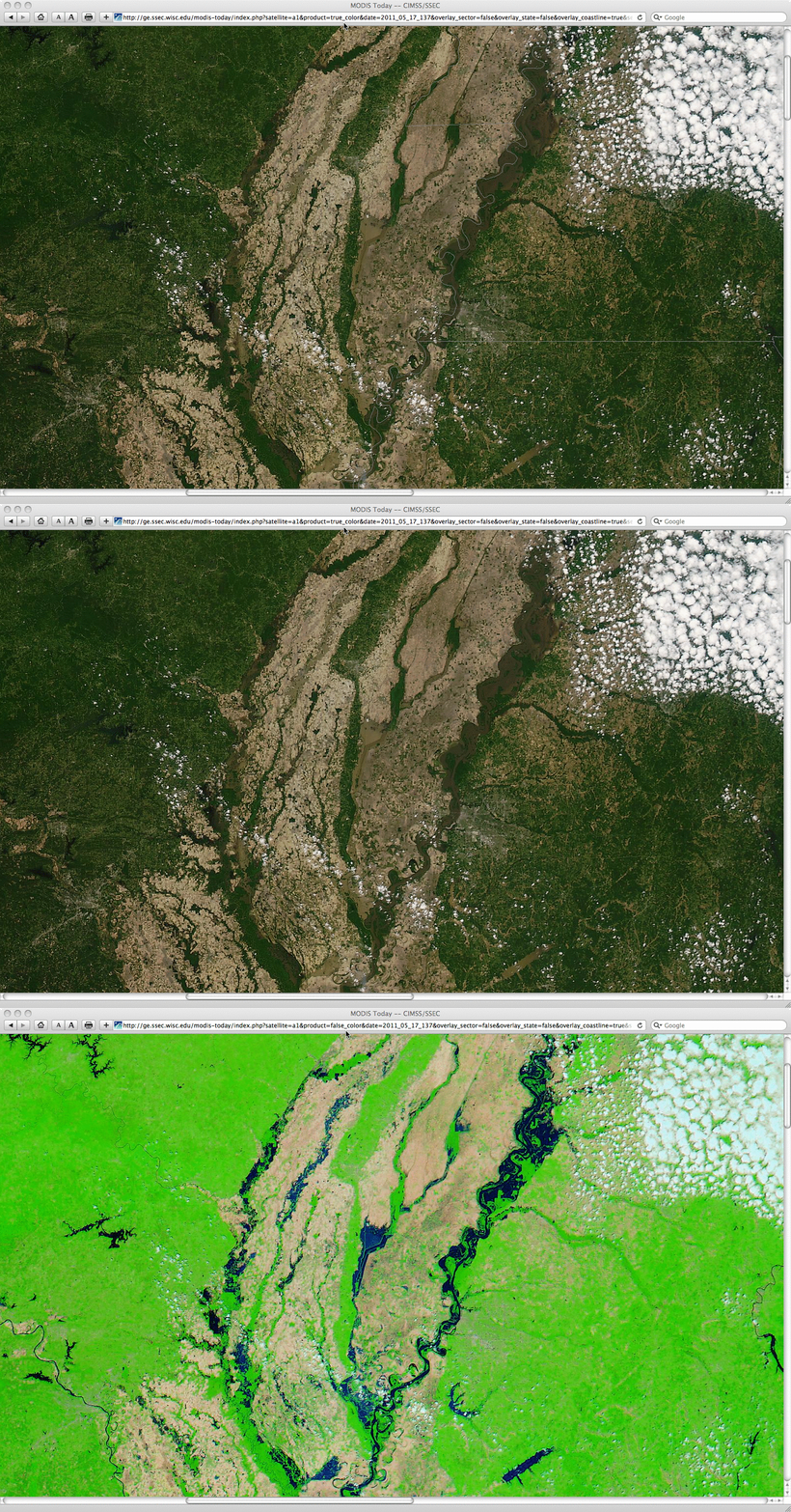
A closer view using 250-meter resolution MODIS true color (using channels 1/4/3) and false color (using channels 7/2/1) MODIS Red/Green/Blue (RGB) images from the SSEC MODIS Today site (below) revealed the darker brown “muddy” appearance of much of the flooded areas adjacent to the Mississippi River, due to high sediment loading of the water. Water exhibited a very dark blue appearance on the MODIS false color image.


