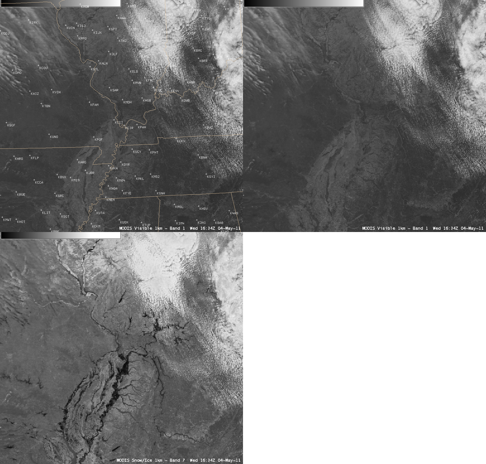
Flooding at the confluence of the Mississippi and Ohio Rivers
A comparison of AWIPS images of the 1-km resolution MODIS 0.65 µm visible channel (first shown with a map overlay and location of METAR sites) and the corresponding 1-km resolution MODIS 2.1 µm near-IR “snow/ice channel” (above) shows the areal coverage of flood waters across the region of the confluence of the Mississippi River and the Ohio River on 04 May 2011. Since water happens to be a strong absorber at the 2.1 µm wavelength, it shows up as a very dark feature on the MODIS “snow/ice channel” image — making it more useful for locating areas of flooding than just a simple visible channel image.
A similar near-IR channel will be on the ABI instrument of the future GOES-R satellite. CIMSS participation in GOES-R Proving Ground activities includes making a variety of MODIS images and products available for National Weather Service offices to add to their local AWIPS workstations.
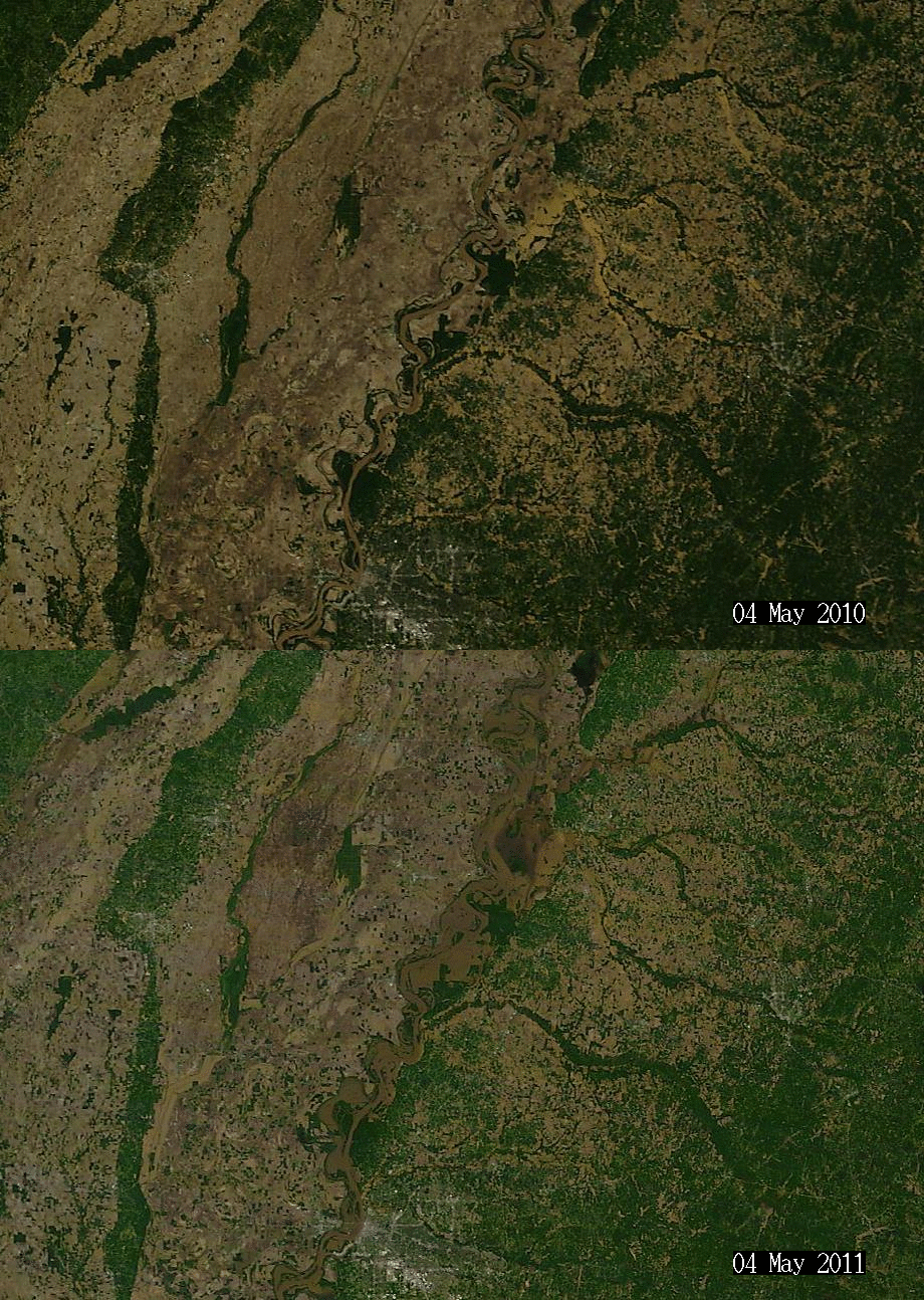
MODIS True-color imagery from the SSEC MODIS Today website can be used to compare data from this year and last year, shown below. In the linked-to-images, the Mississippi River north of Memphis (located at the bottom edge of each image) meanders through the center part of the images. There are several former meanders of the river in Arkansas and Tennessee that are filled with water this year, but not last.


