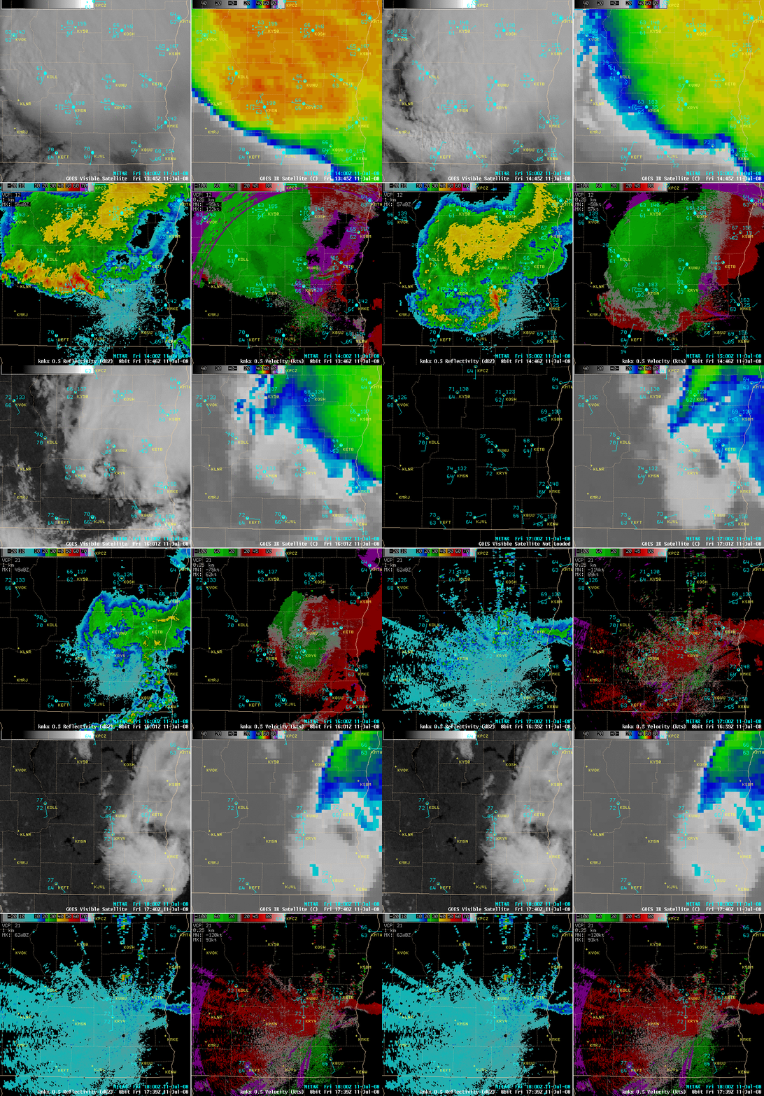
Mesoscale Convective Vortex (MCV) over southeastern Wisconsin
A mesoscale convective system (MCS) moved southward across southern Wisconsin during the morning of 11 July 2008, producing a well-defined bowing segment along the southern flank. As the MCS continued to decay into the late morning hours, the signature of a weak Mesoscale Convective Vortex or MCV (see Interesting Clouds on Satellite: “Mesoscale Convective Vortex” from the NWS Milwaukee) became apparent on AWIPS images of the GOES-12 visible and IR channels (above, upper 2 image panels; see also a GOES-12 visible animation from Dave Santek, SSEC). While the presentation of the MCV was fairly impressive on the GOES-12 satellite imagery, this feature was much less obvious on the Milwaukee/Sullivan radar base reflectivity and base velocity data (above, lower 2 image panels).
Northerly winds gusted to 37 mph at the Madison airport KMSN (41 mph on top of the SSEC building in downtown Madison) as the bowing segment convection moved through; however, it is interesting to note that Juneau KUNU later reported a southeasterly wind gust of 43 mph at 17 UTC (Noon local time) as the MCV passed over that area; apparently a boundary layer “wake low” was responsible for producing this brief period of gusty southeasterly winds (which also included gusts to 20 mph at West Bend KETB and 17 mph at Watertown KRYV).
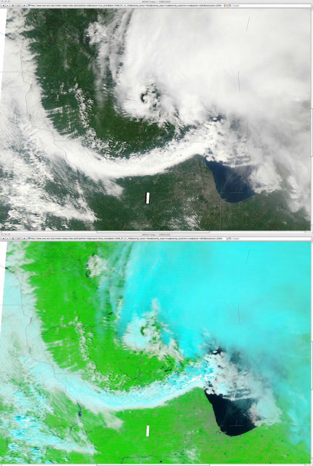
A comparison of MODIS true color and false color images from the SSEC MODIS Today site (below) showed finer detail in the cloud structures of both the leading edge of the convective outflow (the aforementioned bowing segment) and the MCV. The MCV signature was comprised primarily of lower to middle level clouds, and became more obvious as the canopy of high-level cirrus clouds (cyan colors on the MODIS false color image) began to dissipate as the MCS decayed.


