Was there a waterspout/tornado in western Puerto Rico?
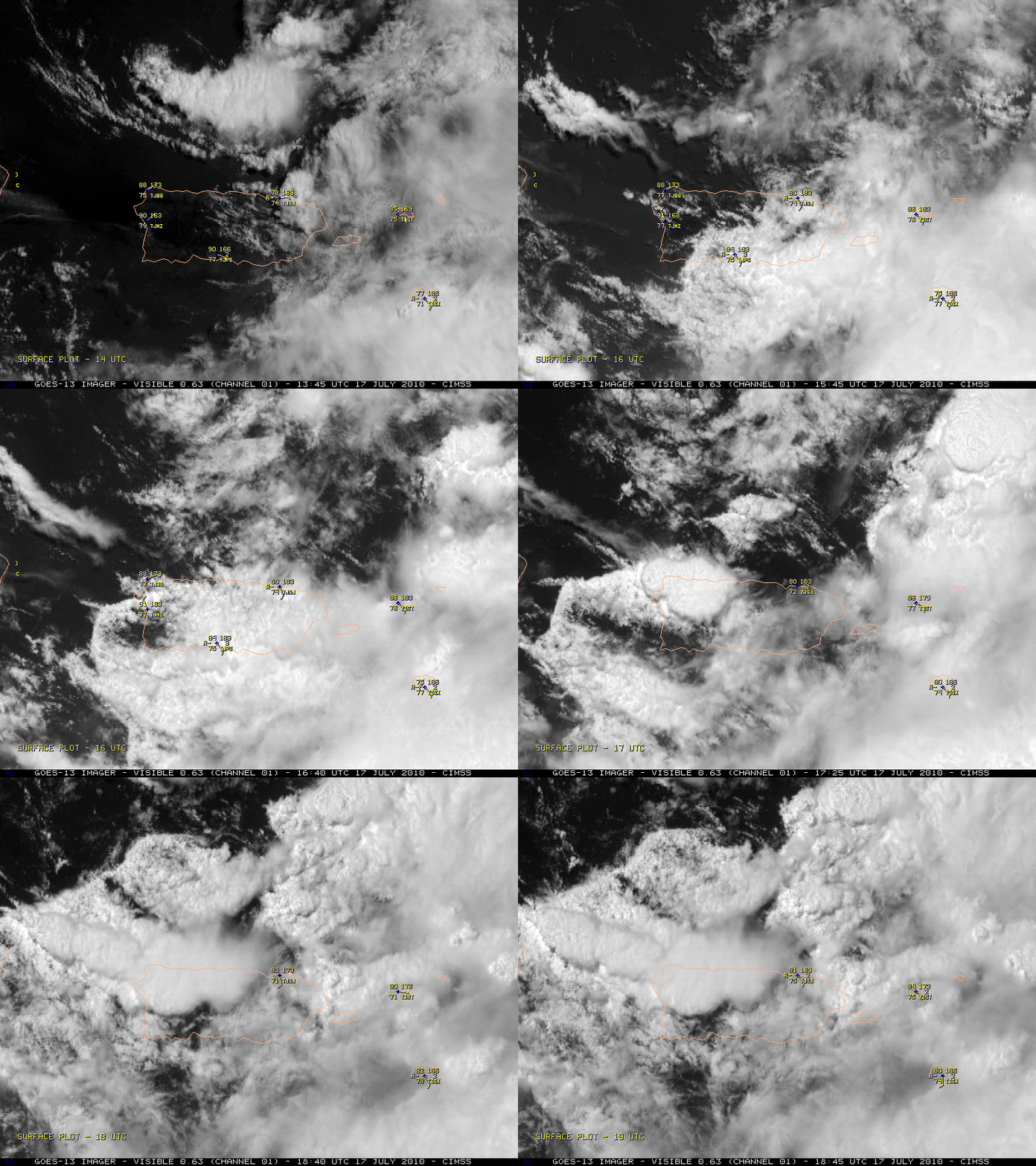
There were numerous media reports of a waterspout/tornado that moved inland near Mayaguez (station identifier TJMZ) in far western Puerto Rico around 16:45 UTC (12:45 pm local time) on 17 July 2010, causing tree and structural damage along with multiple injuries. However, due to a lack of visual confirmation, the NWS is not classifying this as a waterspout or a tornado event. McIDAS images of 1-km resolution GOES-13 0.63 µm visible channel data (above) did show a fast-moving outflow boundary / gust front moving from east to west across the island, causing wind gusts in excess of 50 mph at a number of locations. A strong thunderstorm then developed along this fast-moving boundary as it reached the far western end of the Puerto Rico.
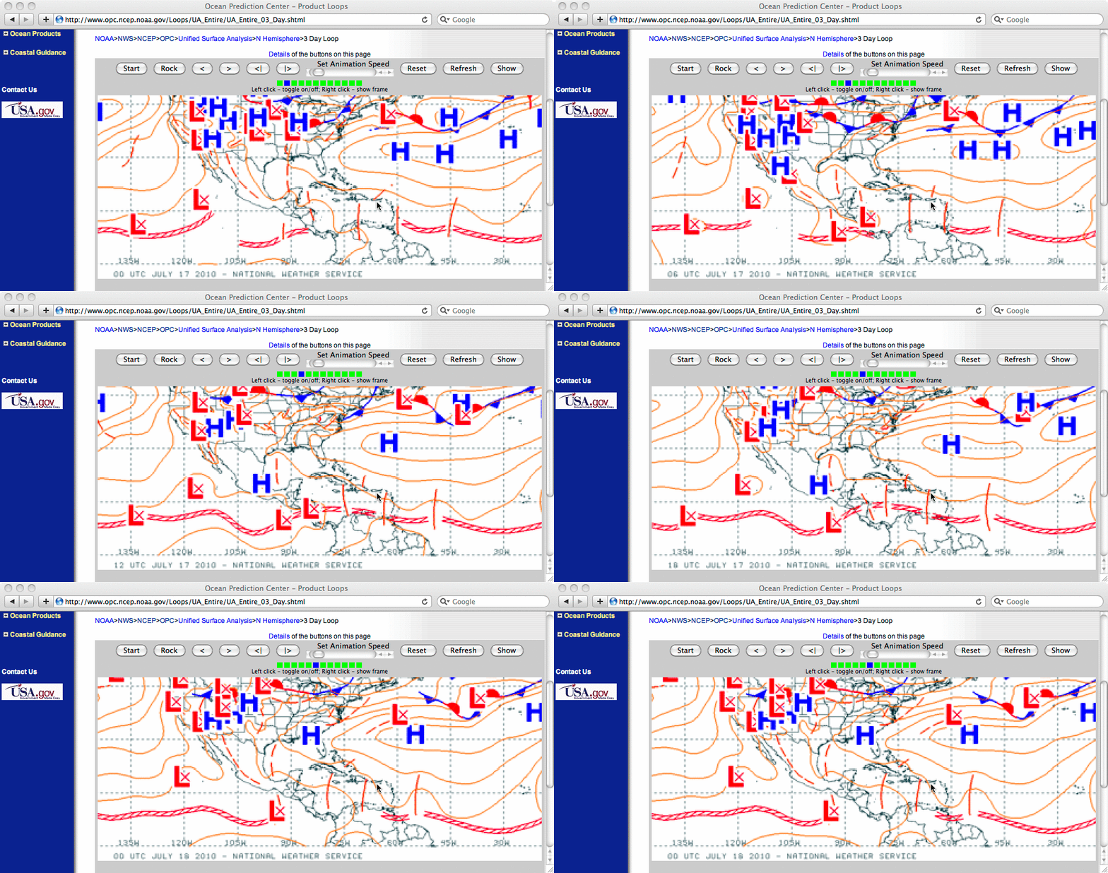
Surface analyses from the NWS Ocean Prediction Center (below) depicted a westward-moving tropical wave along the InterTropical Convergence Zone (ITCZ) that may have played a role in providing forcing for the convection that produced the initial outflow boundary / gust front that raced westward across Puerto Rico.
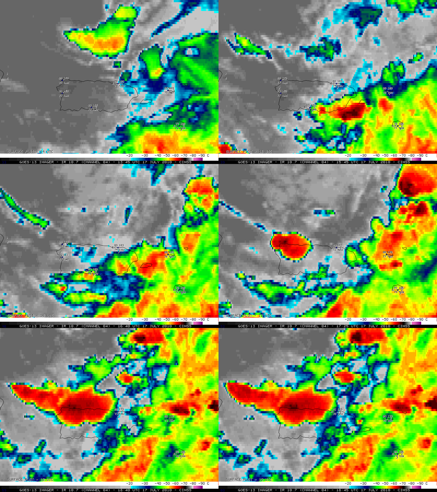
The corresponding 4-km resolution GOES-13 10.7 µm IR images (below) revealed that cloud top IR brightness temperatures were as cold as -68º C (black color enhancement) at 17:45 UTC as the thunderstorm continued to grow and intensify.
A closer look using 1-km resolution Aqua MODIS 11.0 µm IR imagery at 17:44 UTC (below) showed what appeared to be a subtle “enhanced-v” storm top signature associated with this thunderstorm. The color enhancement is slightly different than that shown with the GOES-13 IR imagery, but the coldest/warmest IR brightnes temperatures within the enhanced-v signature were -75º C / -67º C respectively, making for a delta-T of 8º C. Enhanced-v storm top signatures over the continental US can exhibit delta-T values as large as 20-30º C, but to see an enhanced-v signature (even a subtle one) over Puerto Rico is rather unusual.
Related information:


