Light snow moves across central Alaska
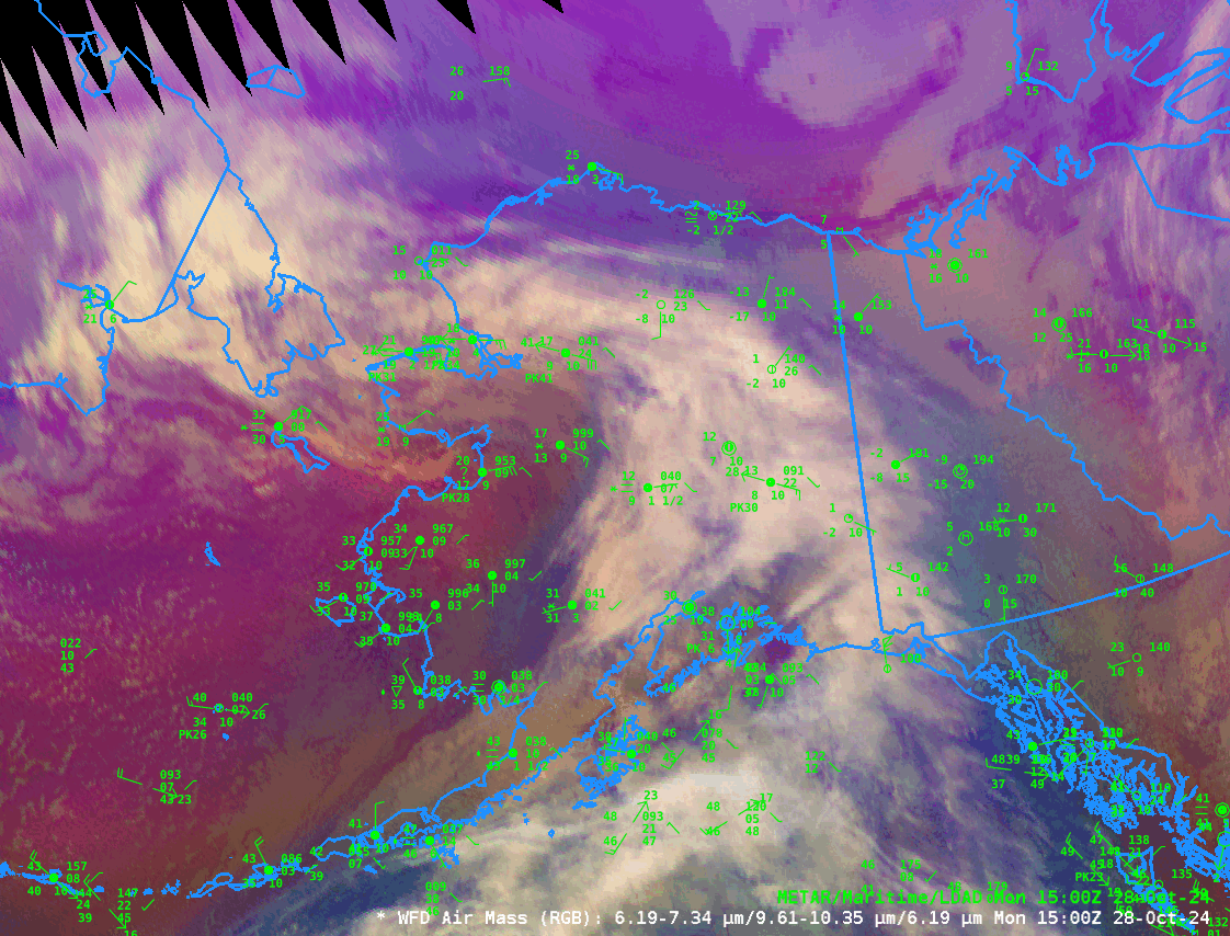
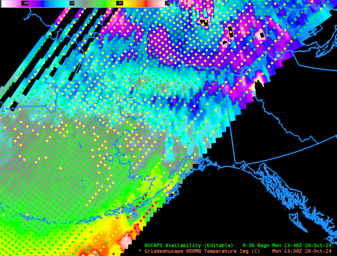
GOES-18 Airmass RGB imagery, above, from 1500-1820 UTC on 28 October, show light snow over much of central Alaska as a storm system moves into the state. Temperatures at 500 mb, below, derived from NUCAPS profiles (as shown in the toggle), show a tongue of warmer air positioned with the cloud feature (shown as white) in the RGB above. Temperatures in that warm(ish) tongue of air (bluish in the enhancement) are around -25 to -27oC versus the Bering Sea (magenta in the enhancement) where they are around -35oC. Temperatures at 850 mb over the Bering Sea (shown here with a color enhancement that ranges from -25oC to +10oC) are around -6oC.

Snowfall Rates, estimated from ATMS on Suomi-NPP (from this site) show snow moving slowly north between 1324 and 1504 UTC over western Alaska.
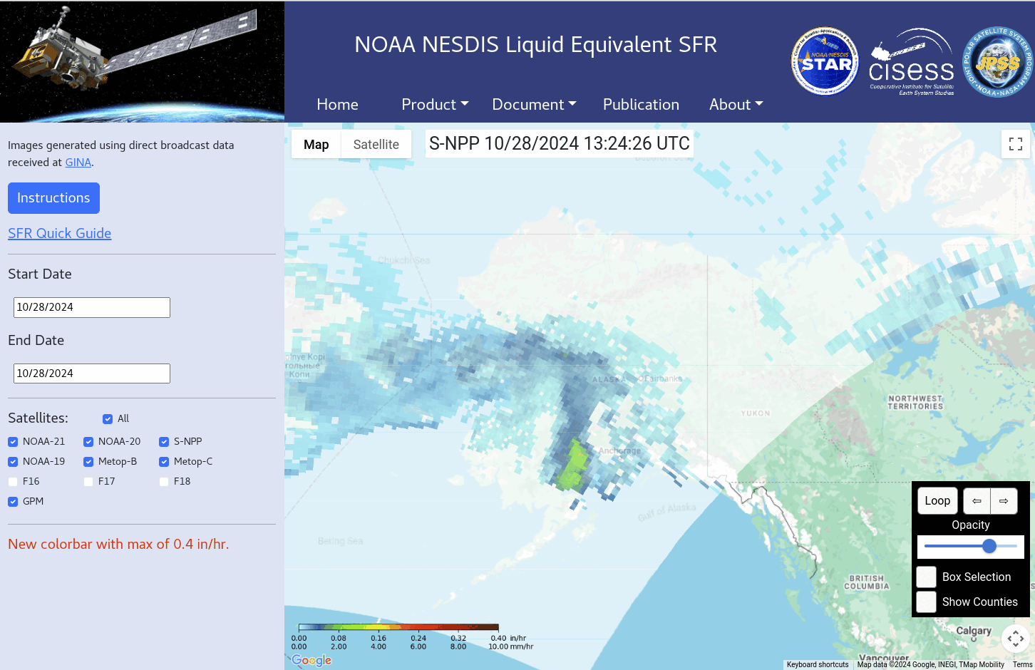
Did your eye jump on the heavier Snowfall rates over southern Alaska? The region around Anchorage is in a Winter Storm Warning; 6-12″ is expected, more than the lighter values expected across the central part of the state.