The ample eye of Ampil

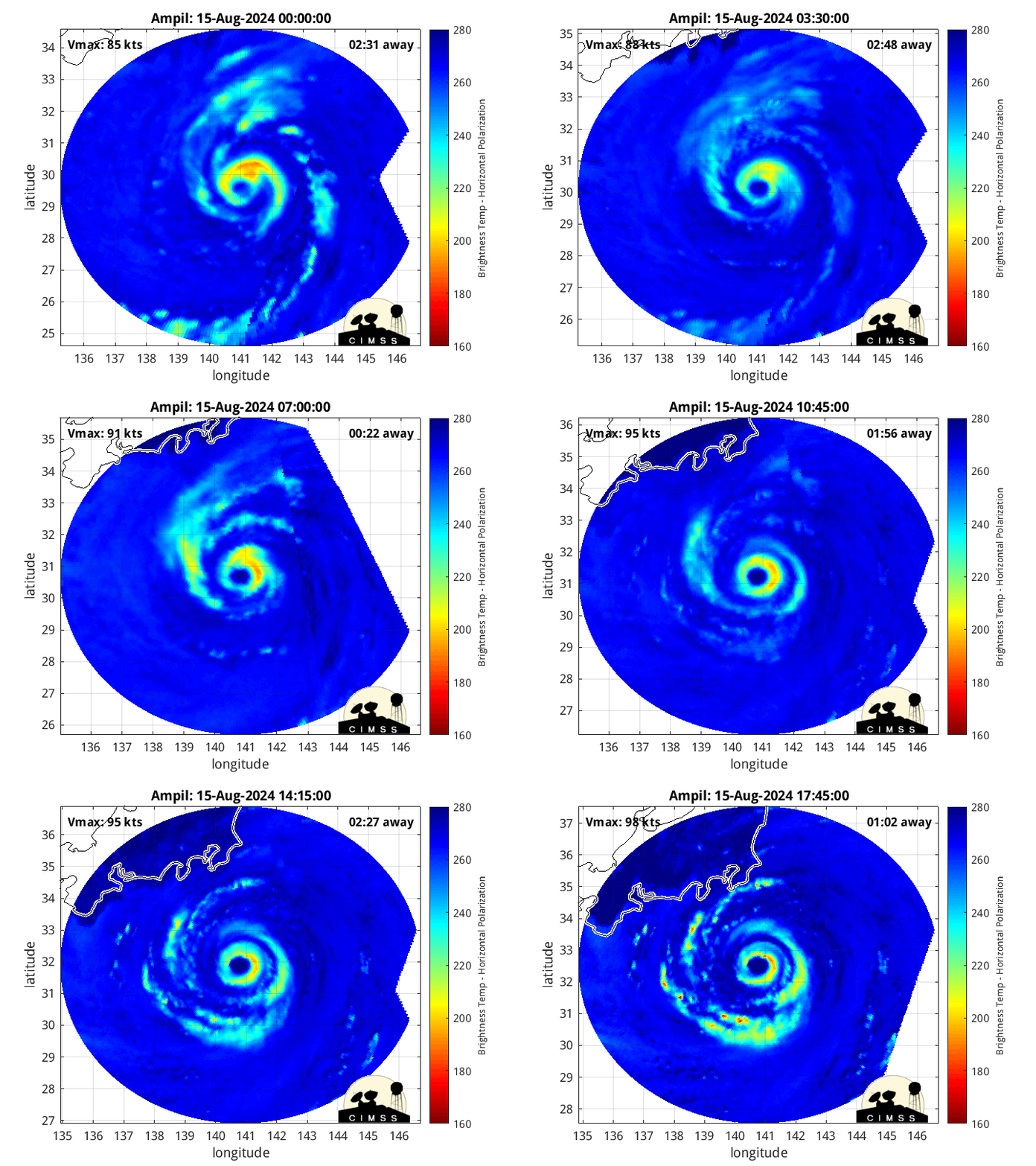
Typhoon Ampil was at the northern edge of the view of the Direct Broadcast antenna at the forecast office on Guam, and CSPP software processed the above images (courtesy Douglas Schumacher) showing the ample eye of the Typhoon. Microwave imagery suggests an eyewall that is not quite complete, especially on the western side. MIMIC imagery below (from here) suggests an incomplete eyewall as well.

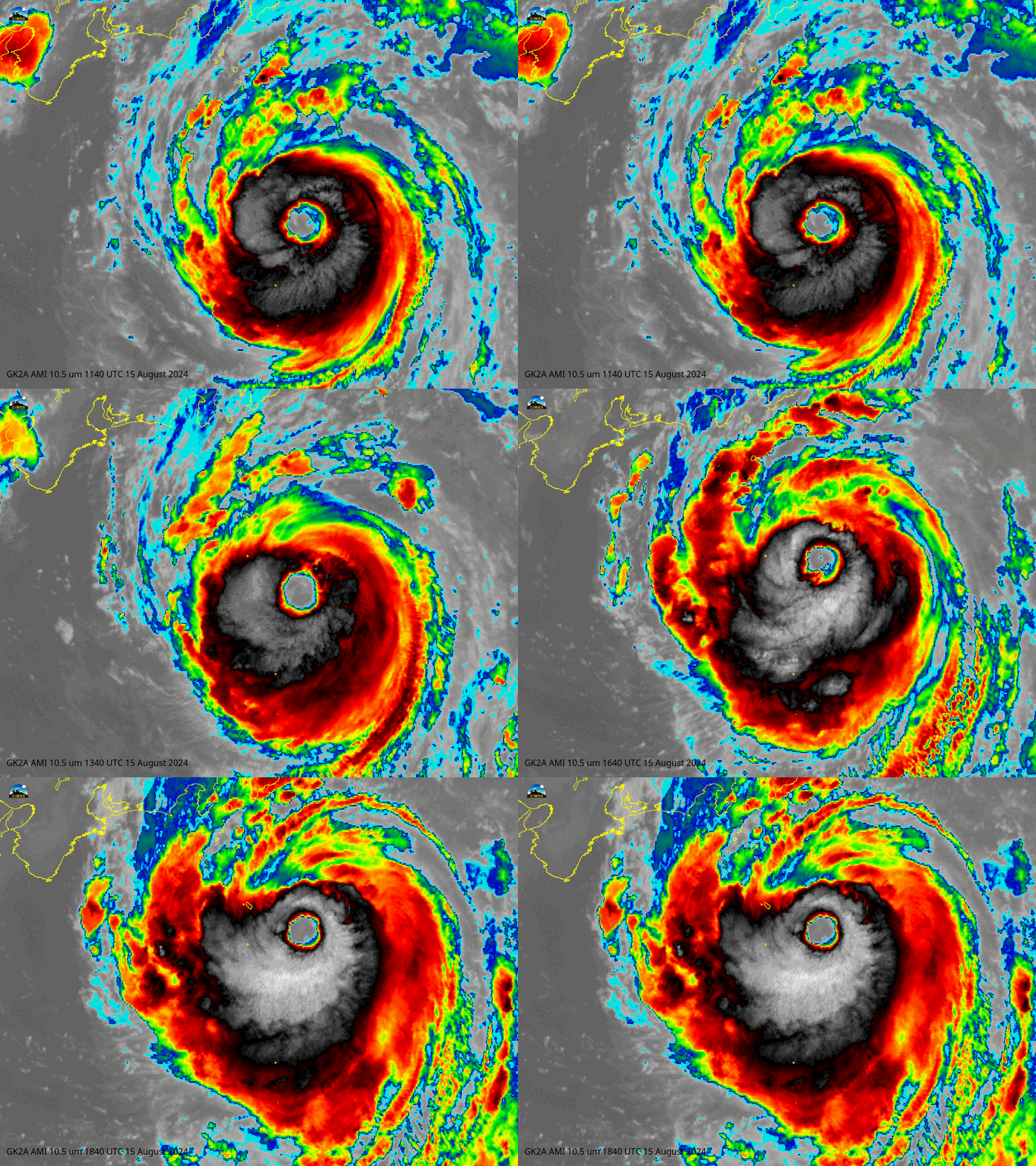
Hourly imagery from 1140 (just after the NOAA-19 overpass shown above) through 1840 UTC show cold cloud tops not quite continuously encircling Ampil’s eye. The GK2A imagery below was created using geo2grid imagery and level-1b GK2A data from KMA.

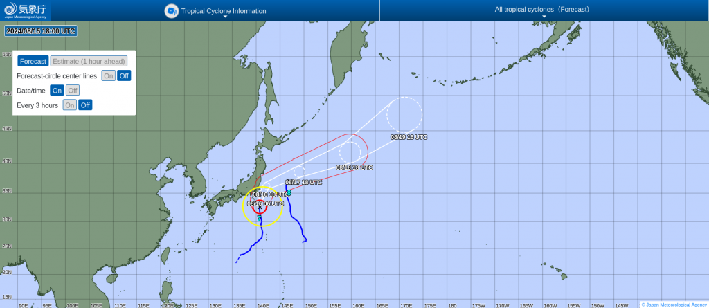
See the Tokyo Regional Specialized Meteorological Center (RSMC) or the USA’s Joint Typhoon Warning Center for the latest on Ampil. The storm is forecast to make a very close approach to Japan before turning eastward out to sea.


