Plumes of blowing dust (and smoke) in Washington State
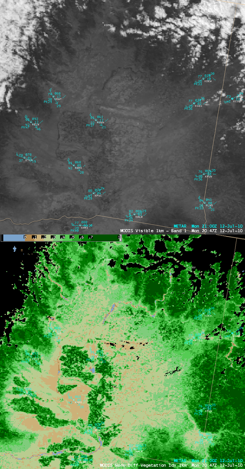
Strong northwesterly winds behind a cold front gusted as high as 55 mph at Magee Peak in Washington State on 12 July 2010, causing some traffic accidents and road closures due to low visibility from blowing dust — and the blowing dust ended up restricting surface visibility to 2 miles as far to the east as Spokane (station identifier KGEG). A write-up of the event by the NWS forecast office at Spokane showed some web camera views of the dust. An AWIPS image of the 1-km resolution 0.65 µm visible channel data (above) did reveal two distinct aerosol plumes: one originating to the northwest of Wenatchee (station identifier KEAT), and another originating to the north and northeast of Moses Lake (station identifier KMWH). These aerosol plumes appeared to be originating from areas with a low Normalized Difference Vegetation Index (NDVI) value, suggesting dry land void of crops, trees, or other vegetation.
A comparison of MODIS 0.65 µm visible and MODIS 6.7 µm water vapor channel images (below) indicated that there was a mountain wave (to the lee of the Cascade Range) present over the region with the plumes, which may have acted as a mechanism to help transfer some of the strong momentum aloft downward toward the surface.
Note how this mountain wave signature as seen with MODIS was not evident at all on the corresponding 8-km resolution GOES-11 6.7 µm water vapor channel image (below).
A closer look using 250-meter resolution MODIS true color and false color Red/Green/Blue (RGB) images from the SSEC MODIS Today site (below) was helpful in determining that the westernmost plume was actually smoke from a wildfire (the fire hot spots and burn scar showed up as red to pink on the false color image, and the smoke plume itself was brighter on the true color image). In contrast, the blowing dust plume farther to the east had more of a light brown to tan appearance on the true color image.
===================================
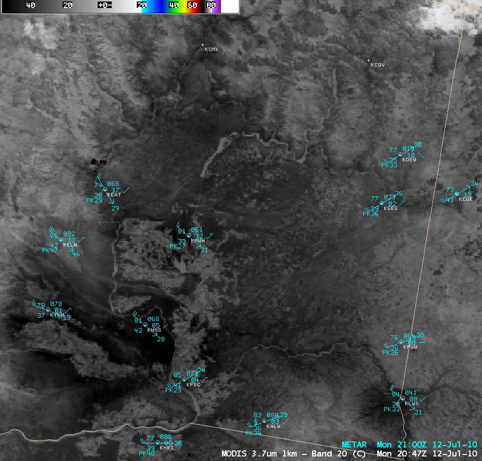
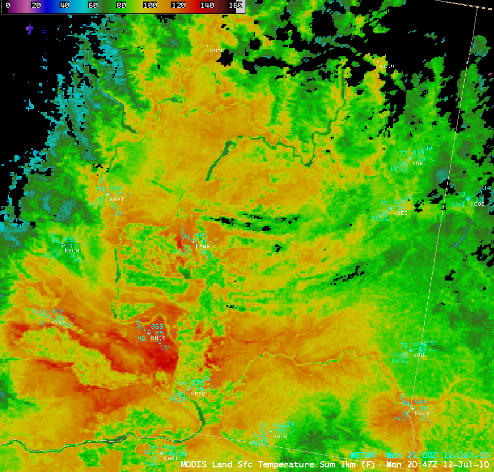
The presence of an actively-burning fire was confirmed by a large cluster of hot pixels (dark black color enhancement) to the northwest of Wenatchee (station identifier KEAT) on MODIS 3.7 µm shortwave IR imagery (above). Farther to the south and southeast, the larger dark black area seen on the shortwave IR image corresponded to the sparsely-vegetated region around Hanford (station identifier KHMS), which was exhibiting MODIS Land Surface Temperature values in the 120-130º F range (below).


