Sheared Tropical System approaching the coast of Georgia
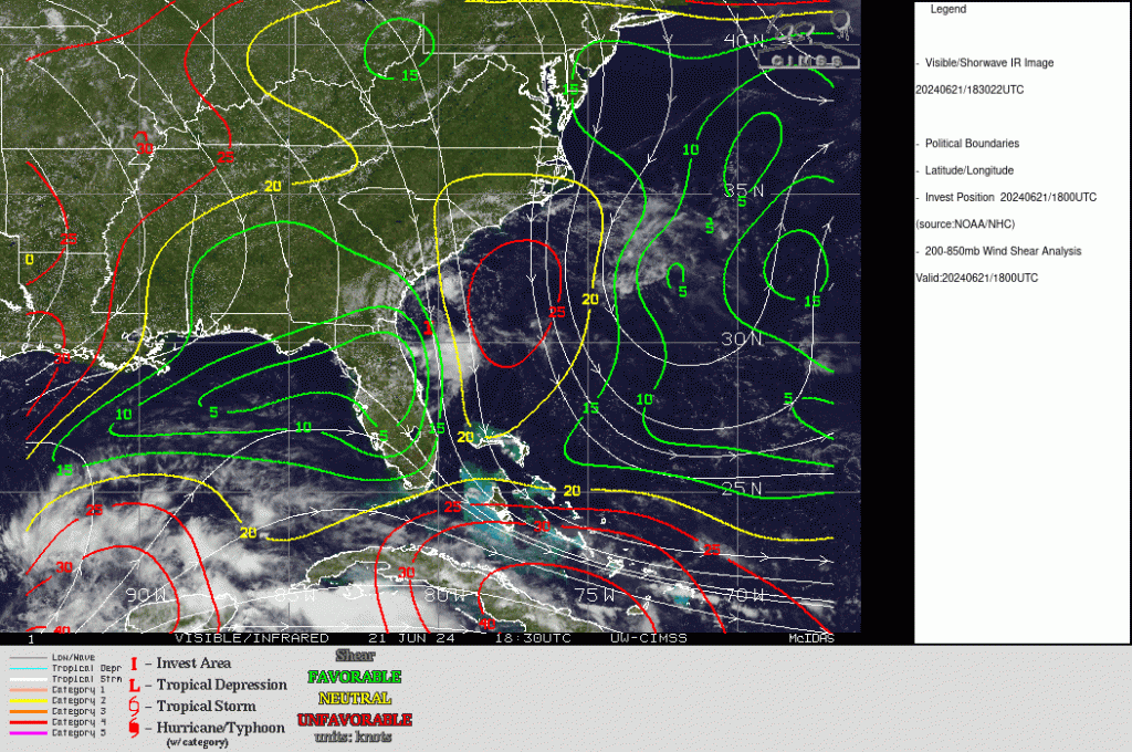
Geosphere true-color imagery over the Atlantic Ocean to the east of Florida and Georgia, above, shows a low-level cyclonic circulation with strong convection to its south. The appearance of the system suggests strong shear; an analysis of shear from the SSEC Tropical Weather website, below, shows the northerly shear over the storm that displaces the convection.

__________

1-minute GOES-16 “Red” Visible (0.64 µm) images, from 1400 UTC on 21 June to 0000 UTC on 22 June (courtesy Scott Bachmeier, CIMSS) [click to play animated GIF | MP4]
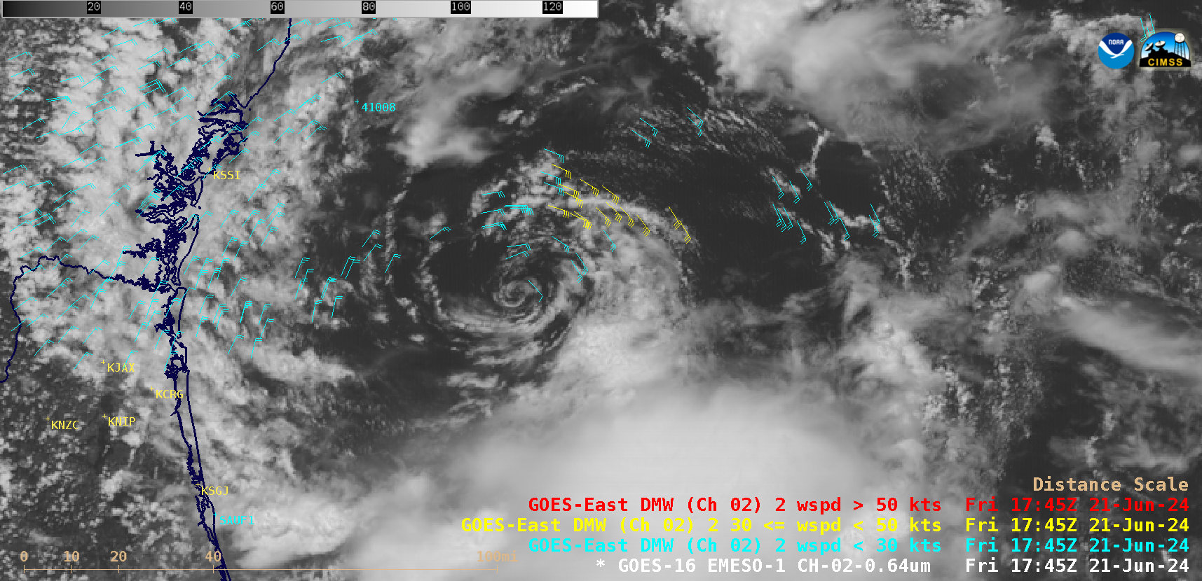
1-minute Mesoscale Domain Sector GOES-16 (GOES-East) “Red” Visible (0.64 µm) images (above) showed a closer view of the exposed low level circulation center (LLCC) of Invest 92L. A slight amount of trochoidal motion (wobble) was seen as the LLCC moved toward the coast.
1-minute GOES-16 Visible images with plots of 5-minute Derived Motion Winds (below) depicted slightly higher wind speeds (30-35 knots, yellow wind barbs) within the northeast quadrant of 92L — but satellite-derived wind speeds with the circulation of 92L were generally in the 10-25 knot range. Invest 92L passed between Buoy 41008 to the north and Buoy SAUF1 to the south; on 21 June the highest wind speeds/gusts at those two buoys were in the 22-29 knot range. 92L eventually moved inland several hours after sunset, near the Georgia/Florida border — between Brunswick GA (KSSI) and Jacksonville FL (KCRG). Wind speeds/gusts remained below 30 knots at those two sites as well.

1-minute GOES-16 “Red” Visible (0.64 µm) images with plots of Derived Motion Winds, from 1500-2330 UTC on 21 June (courtesy Scott Bachmeier, CIMSS) [click to play animated GIF | MP4]
__________
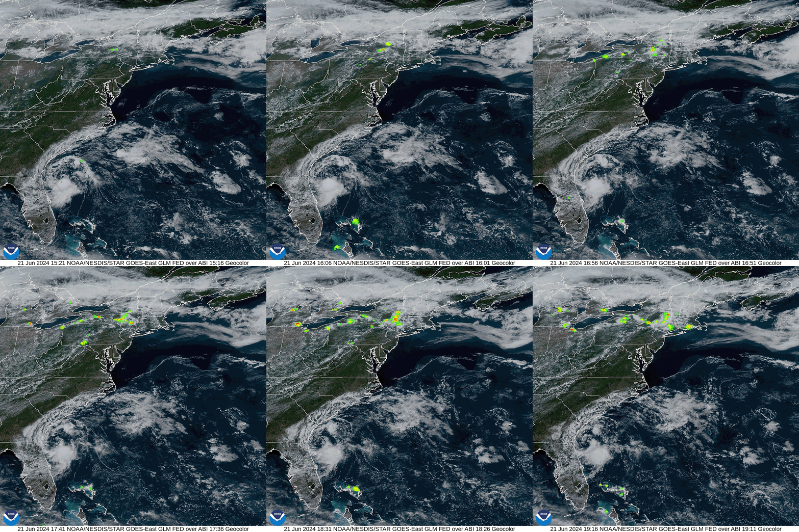
GOES-16 Geocolor imagery, overlain with GLM Flash Extent Density fields, below, (from this source), show meager lightning within the convection to the south of the low-level cyclonic circulation.

More information on this system is available at the National Hurricane Center, and from the NWS Forecast Offices in Jacksonville FL and in Charleston SC.

