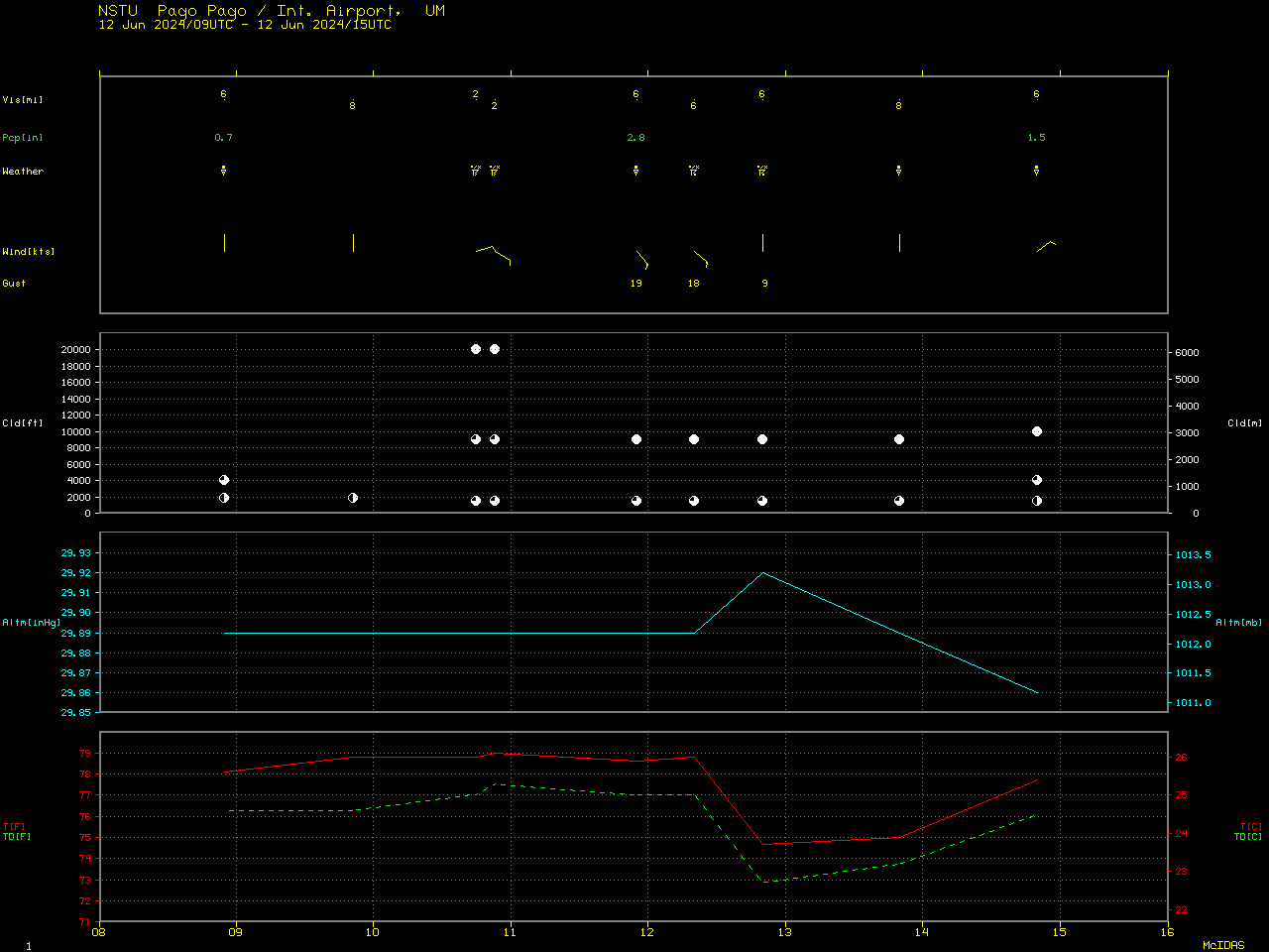
Heavy rainfall across American Samoa

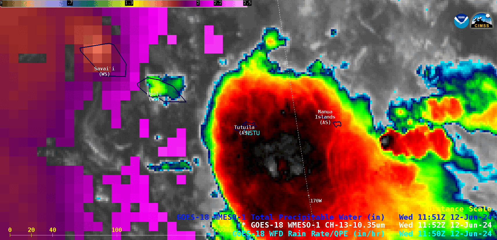
1-minute GOES-18 “Clean” Infrared Window (10.3 µm) images combined with the 1-minute Total Precipitable Water derived product (in cloud-free regions), from 0900-1400 UTC on 12 June; NSTU denotes the location of Pago Pago, American Samoa [click to play animated GIF | MP4]
The 1-minute GOES-18 Total Precipitable Water (TPW) derived product (in cloud-free regions) showed a N-to-S oriented corridor of TPW values in the 2.0 to 2.2 inch range (lighter shades of violet) across the islands of Western Samoa — however, the presence of extensive cloudiness across the islands of American Samoa prevented the retrieval of TPW there. The TPW value derived from NSTU rawinsonde data at 0000 UTC on 12 June was 2.48 inches (below).
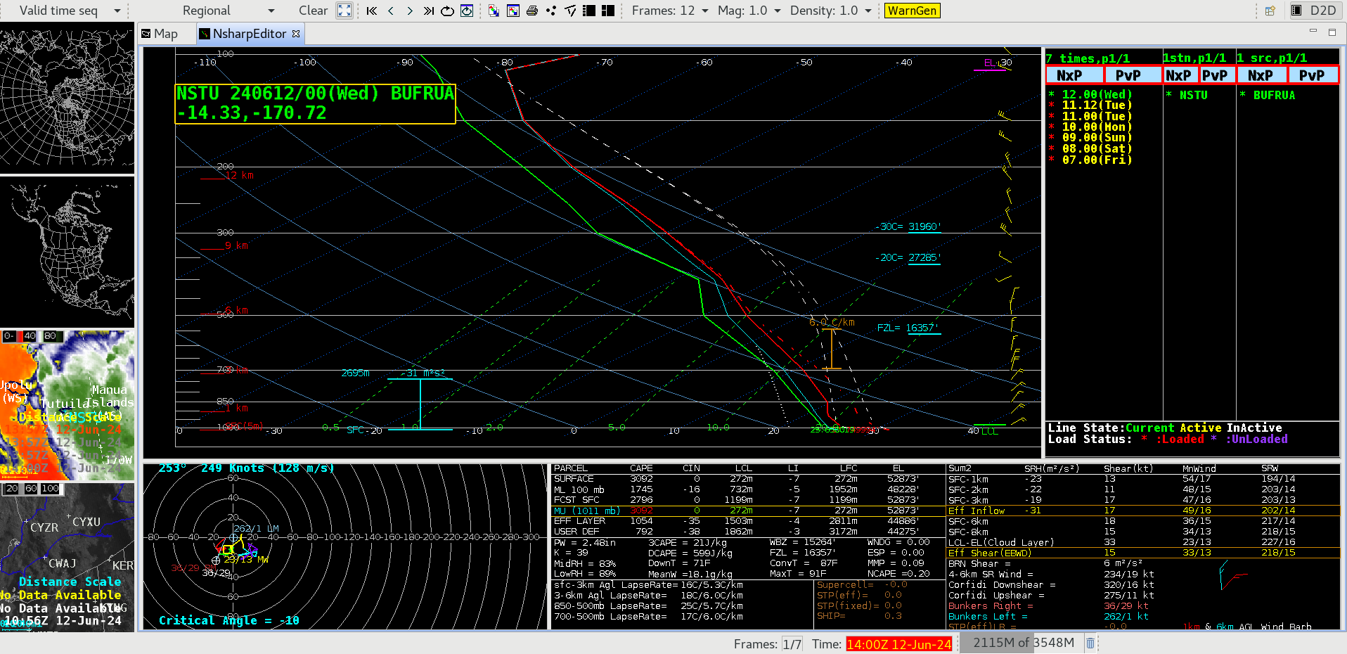
Plot of rawinsonde data from Pago Pago, American Samoa at 0000 UTC on 12 June [click to enlarge]
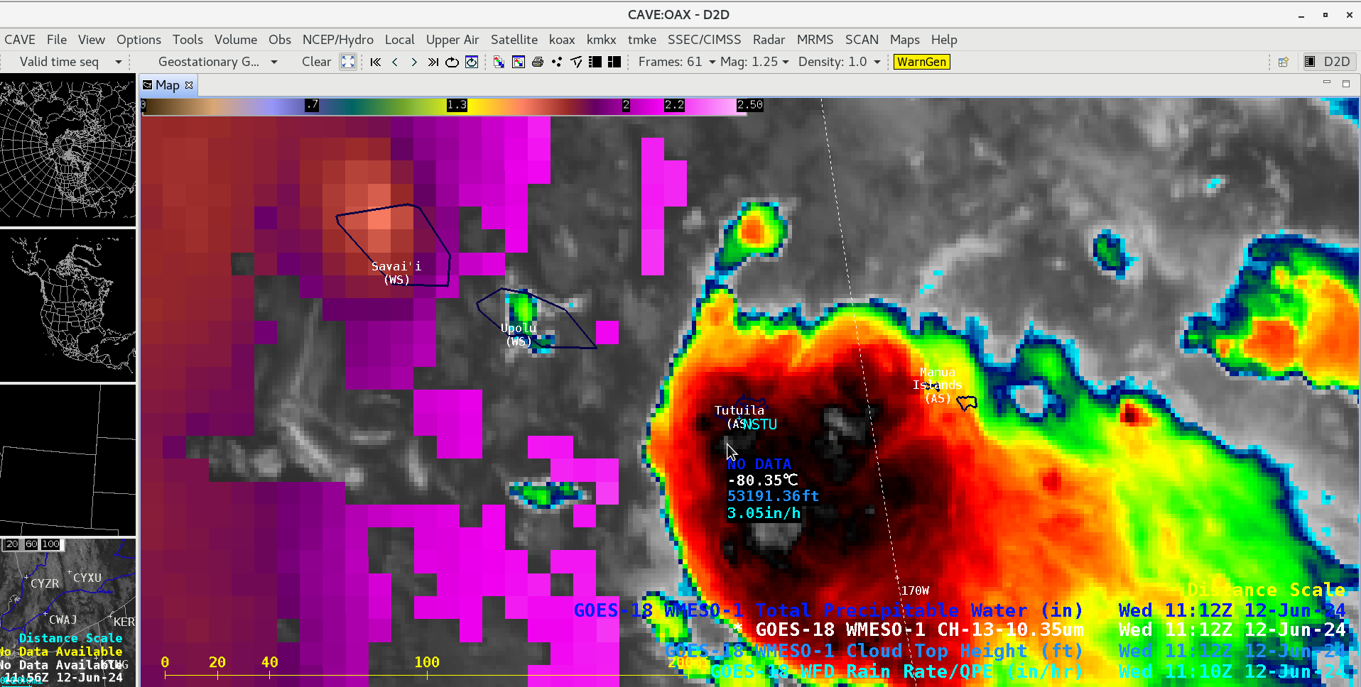
GOES-18 “Clean” Infrared Window (10.3 µm) image showing a cold thunderstorm overshooting top just southwest of the American Samoa island of Tutuila at 1112 UTC on 12 June, which included a cursor sample of the associated GOES-18 Cloud Top Height (light blue) and Rain Rate (cyan) derived products [click to enlarge]
GOES-18 “Clean” Infrared Window (10.3 µm) and Mid-level Water Vapor (6.9 µm) images at 1152 UTC on 12 June [click to enlarge]