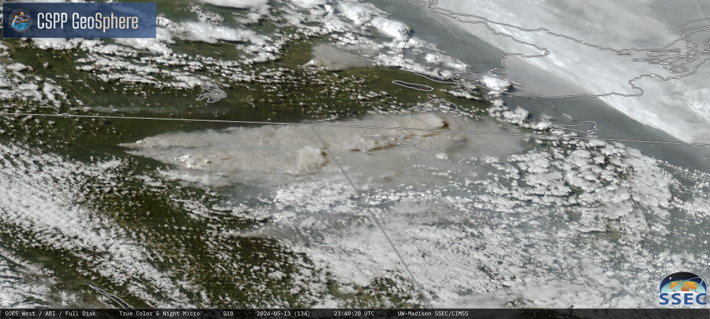
Wildfires in British Columbia produce pyrocumulonimbus clouds

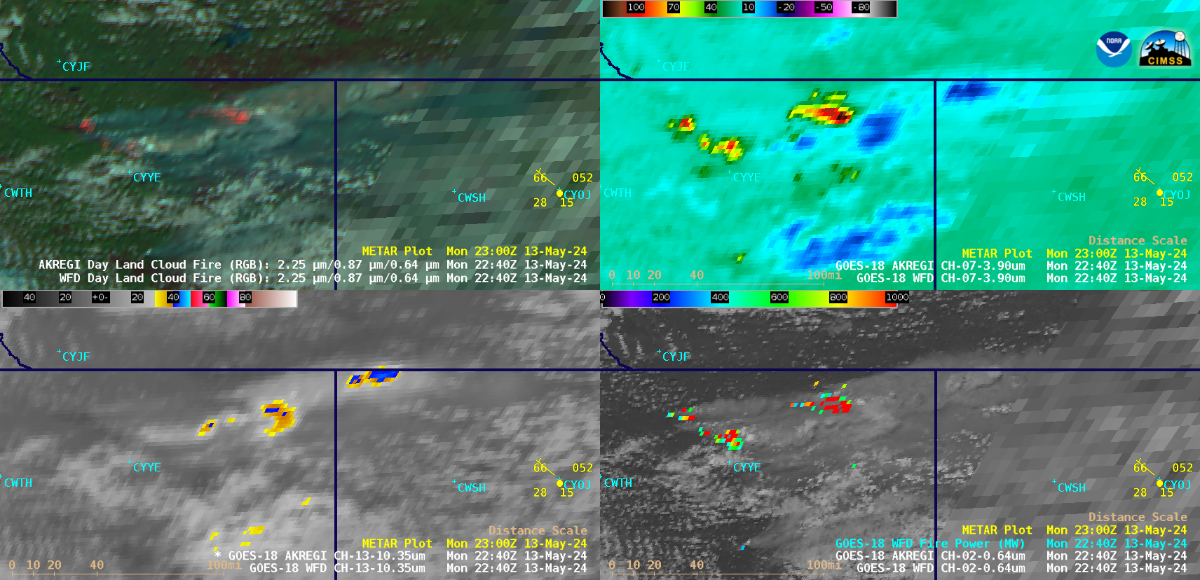
GOES-18 Day Land Cloud Fire RGB (top left), Shortwave Infrared (3.9 µm, top right), “Clean” Infrared Window (10.3 µm, bottom left) and “Red” Visible (0.64 µm) + Fire Power derived product (bottom right), from 1900 UTC on 13 May to 0040 UTC on 14 May [click to play animated GIF | MP4]
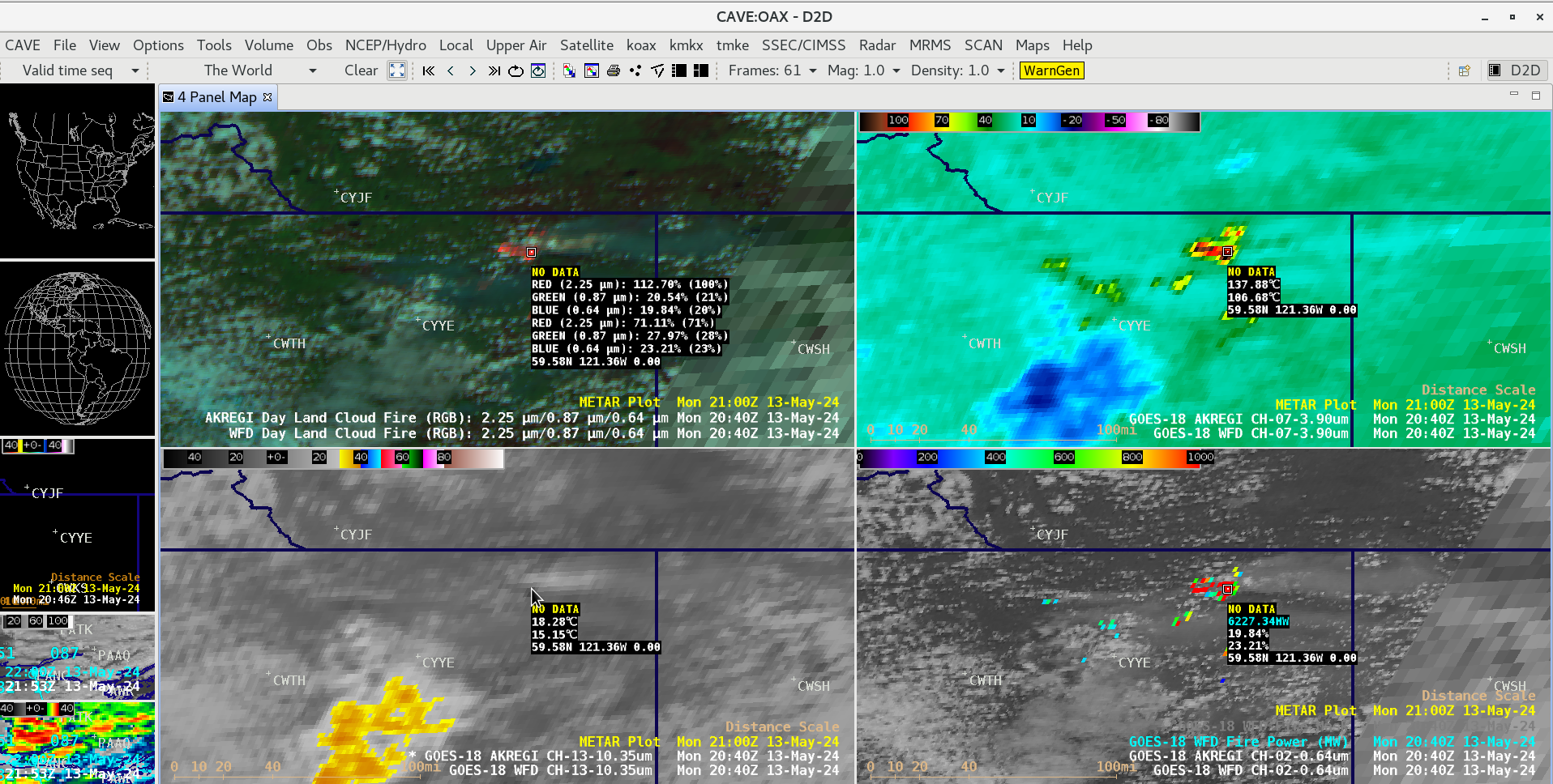
The largest of these fires burned very hot, exhibiting 3.9 µm shortwave infrared brightness temperatures of 137.88ºC (the saturation temperature of GOES-18 ABI Band 7 detectors) — with Fire Power values intermittently exceeding 6200 MW (below).

Cursor sample of GOES-18 Day Land Cloud Fire RGB (top left), Shortwave Infrared (3.9 µm, top right), “Clean” Infrared Window (10.3 µm, bottom left) and “Red” Visible (0.64 µm) + Fire Power derived product (bottom right) at 2040 UTC on 13 May [click to enlarge]


