Wet weather over American Samoa
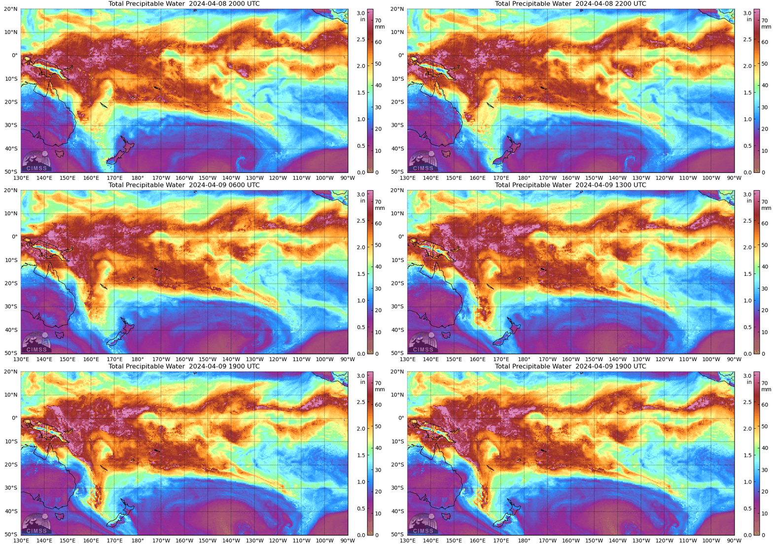
The Samoan Islands are again within a moisture-rich airmass, as shown by the MIMIC estimates of Total Precipitable Water shown below. The MIMIC fields do not show obvious gradient that might be used to estimate when rains might be especially widespead. The airport at Pago Pago American Samoa has had a little under 2″ of rain the 24 hours ending at around 9 AM Samoa Standard Time on 9 April. Flood Warnings were posted overnight on the 8th (in part because of scenes like this image from the NWS Pago Pago Slack Channel!)

Infrared imagery, below (source), from 0250 UTC to 1840 UTC (that is, 350 PM to 750 AM American Samoa Time), shows extensive overnight convection that moves from south of American Samoa northward. By the end of the animation, the focus of convection is north of the Samoan Islands with a strengthening line of westward-moving convection is also moving along 5oS latitude. Convection over the Samoan Islands weakens as the westward-propagating line strengthens.

Water Vapor imagery for the same interval, below, also shows a diminishing trend for convection over the Samoan Islands.

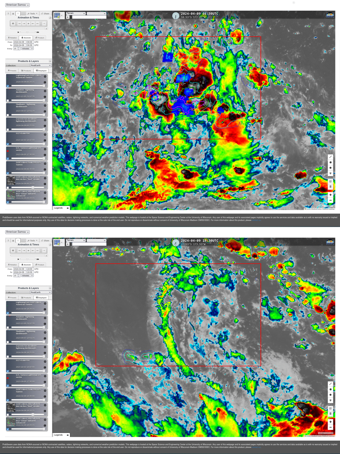
LightningCast probabilities over Amercan Samoa, below (from this site) show a big difference between 0630 and 1930 UTC on 9 April 2024. Lightning probabilities were high and lightning was active at 0630 UTC. By 1930 UTC, activity was much reduced, with elevated LightningCast probabilities confined to regions south of American Samoa. This might be a region to watch for development.

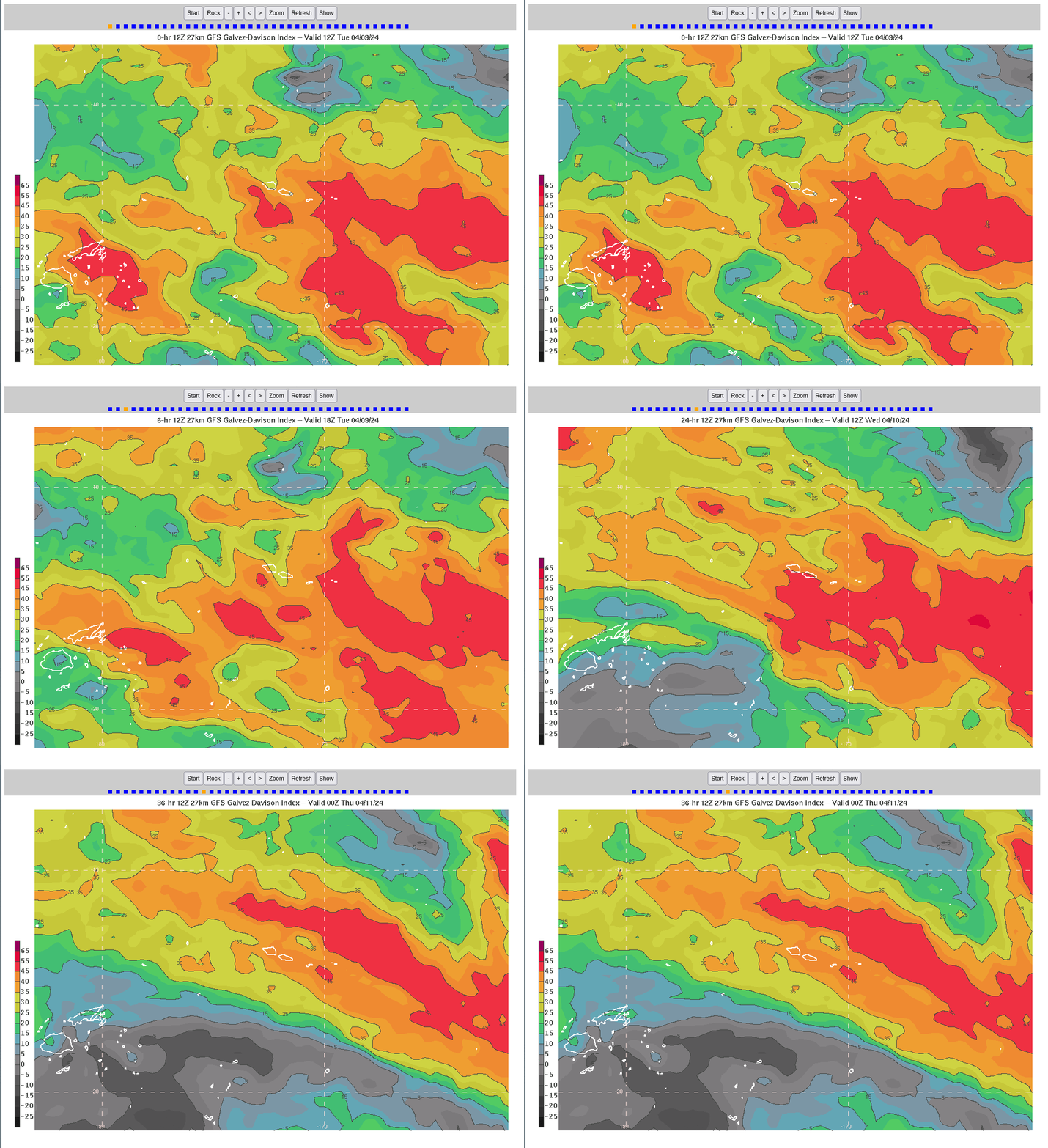
GFS estimates of the Galvez-Davison Index (GDI), below (source) from the 1200 UTC GFS run show large values (>45) of GDI persisting over and south of the Samoan Islands until about 0000 UTC on 11 April. The potential for heavy rain continues over American Samoa for another day despite the respite shown in the ABI data above. (Note from this blog author: I find forecasting for American Samoa very very difficult!) (Here is blog post comparing GDI to DSI estimates of K-Index). The 2100 UTC LightningCast probabilities (here), do show an increase in probabilities of a GLM observation (and actual GLM observations) just to the south of Tutuila, so perhaps convection is starting to become more widespread.


