Valley fog, smoke aloft, and lake breeze boundaries
No shortage of satellite meteorology topics today over the Upper Midwest and Great Lakes regions! A look at the GOES-12 visible channel animation (below, left) reveals the following features: (1) fingers of morning fog in the river valleys of southwestern Wisconsin, (2) areas of smoke aloft from wildfires burning in Canada and the Pacific Northwest, and (3) afternoon lake breeze boundaries that acted as a focus for thunderstorm development in both Wisconsin and lower Michigan.
(1) As we have noted previously, these narrow fog features are often not detected using the 4 km resolution GOES fog/stratus product, but the 1 km resolution MODIS fog/stratus product (with observations overlaid) is able to resolve the river valley fog in southwestern Wisconsin.
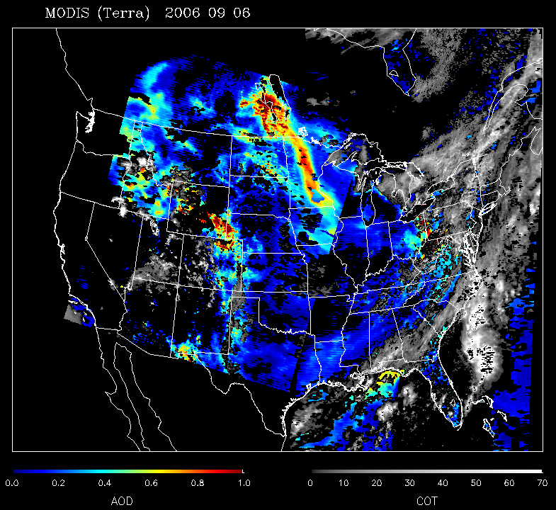
(2) While the smoke signature is subtle on the GOES-East (GOES-12) visible imagery, we can take advantage of a more favorable forward scattering geometry using the GOES-West (GOES-11) satellite to better see the areal extent of the smoke early in the day (GOES-11 animation). The smoke is also depicted as a large plume of high MODIS aerosol optical depth (AOD) extending from southern Canada to the Upper Midwest (below, right). In addition, the thick smoke contributed to a colorful sunset (and sunrise) here in Madison (photo 1 | photo 2).
(3) Narrow pockets of instability were noted on the GOES sounder lifted index (LI) derived product (values of -7 to -8 F), in the vicinity of the lake breeze boundaries in both Wisconsin and Michigan; hail up to 1 inch in diameter was reported from the afternoon lake breeze convection in Wisconsin and Michigan.


