LightningCast probabilities in the cool season

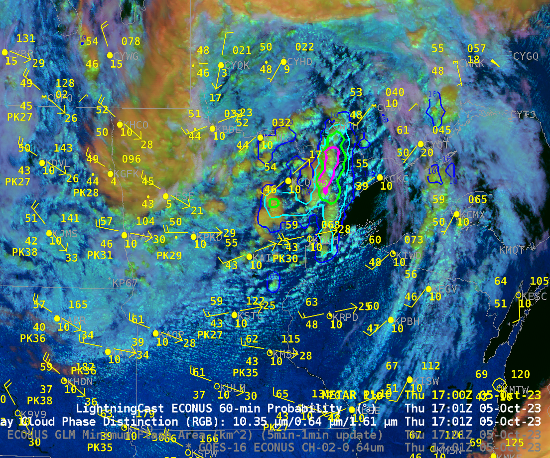
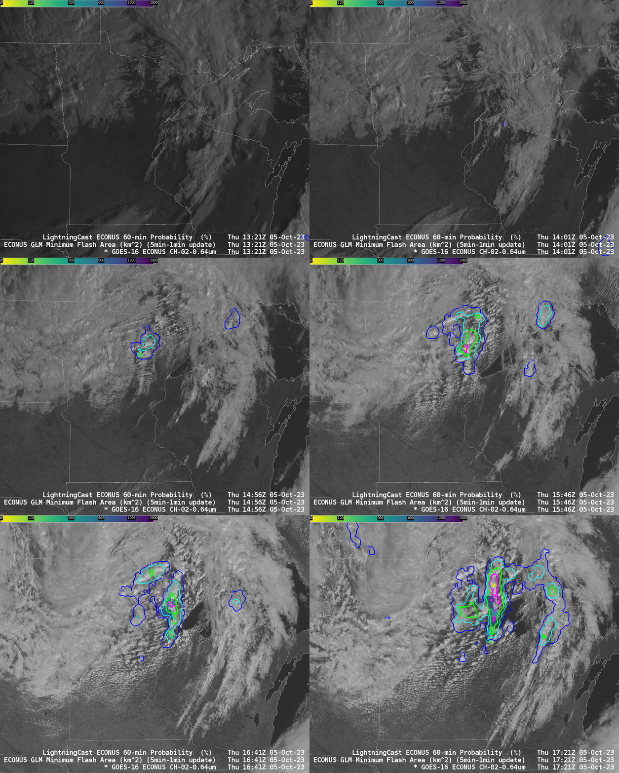
Seasonably cool Fall-like temperatures overspread the western Great Lakes and northern Plains on 5 October. The animation above shows the Day Cloud Phase Distinction overlain with LightningCast probability from 1321-1721 UTC on 5 October (that is, 8:21-12:21 CDT). SPC on this day was anticipating general thunder over northern Minnesota. Given that, and the autumnal temperatures, as shown below (dewpoints in the 40s, temperature in the 50s) — do you think lightning occurred?

Of course, you should expect lightning to occur. The training data set that was used to create the LightningCast probabilities via Machine Learning includes data from all months. Day Cloud Phase Distinction RGB is showing glaciation, and LightningCast is highlighting regions where lightning subsequently occurs. Recall that the probabilities are for lightning (in the form of a GLM observation) to occur in the next 60 minutes.

LightningCast probabilities are available online here.

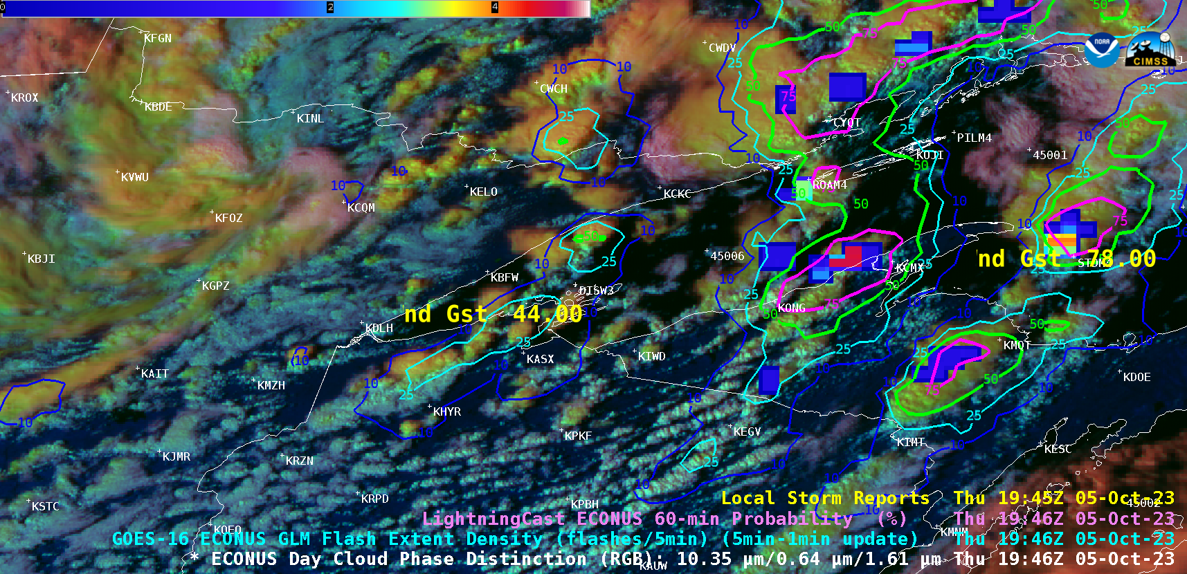
GOES-16 Day Cloud Phase Distinction RGB images with overlays of GLM Flash Extent Density, LightningCast Probability and Local Storm Reports, from 1701 UTC to 1946 UTC (courtesy Scott Bachmeier, CIMSS) [click to play animated GIF | MP4]
Looking ahead for the next 2 hours, GOES-16 Day Cloud Phase Distinction RGB images with overlays of GLM Flash Extent Density, LightningCast Probability and Local Storm Reports (above) revealed that some of the convection reached severe levels, producing wind gusts as high as 78 mph at Stannard Rock Lighthouse (identifier STDM4) in western Lake Superior at 1943 UTC (SPC Storm Reports) along with several reports of small (sub-severe) hail.
Given the relatively low GLM Flash Extent Density values associated with this cool-season convection, the default Color Table Min/Max values were changed to 0.5/5.0 (to help identify subtle lightning jumps that preceded some of the high wind reports).

