Sequential SAR views over Typhoon Koinu
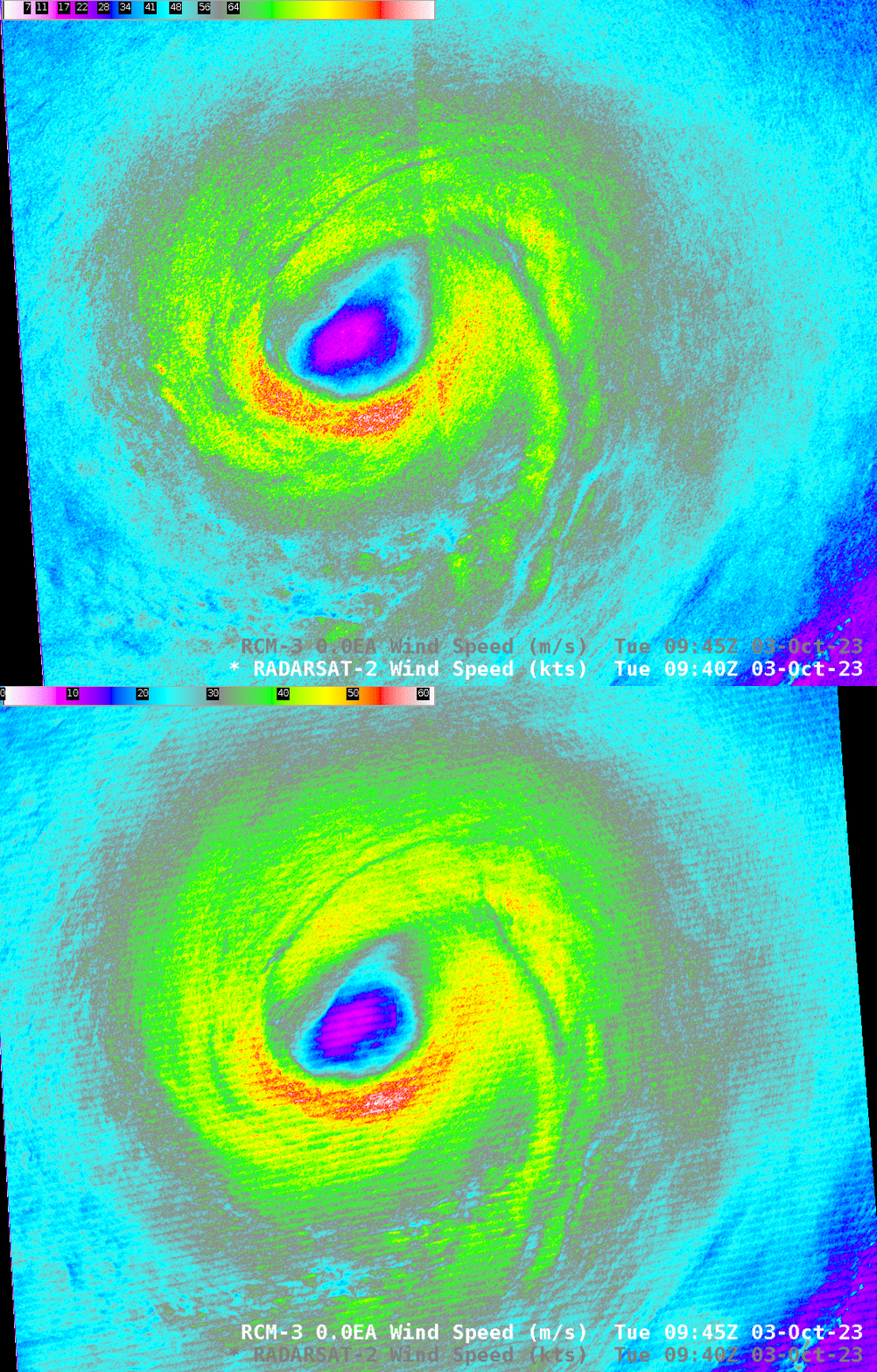
RADARSAT-2 and RCM-3 satellites had nearly simultaneous overpasses over Typhoon Koinu on 3 October 2023, as shown below. (See this blog post from 2 October for more on Koinu) Both SAR analyses showed the strongest winds (nearly 120 knots) in the southern eyewall of the storm, with long interesting wind minima features (close to 65 knots, dark cyan/green in the enhancement, surrounded by stronger winds, exceeding 80 knots, yellow in the enhancement), threading in towards the storm’s eyewall.

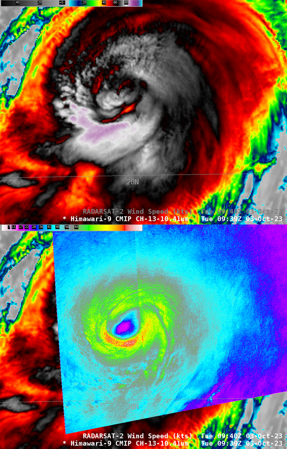
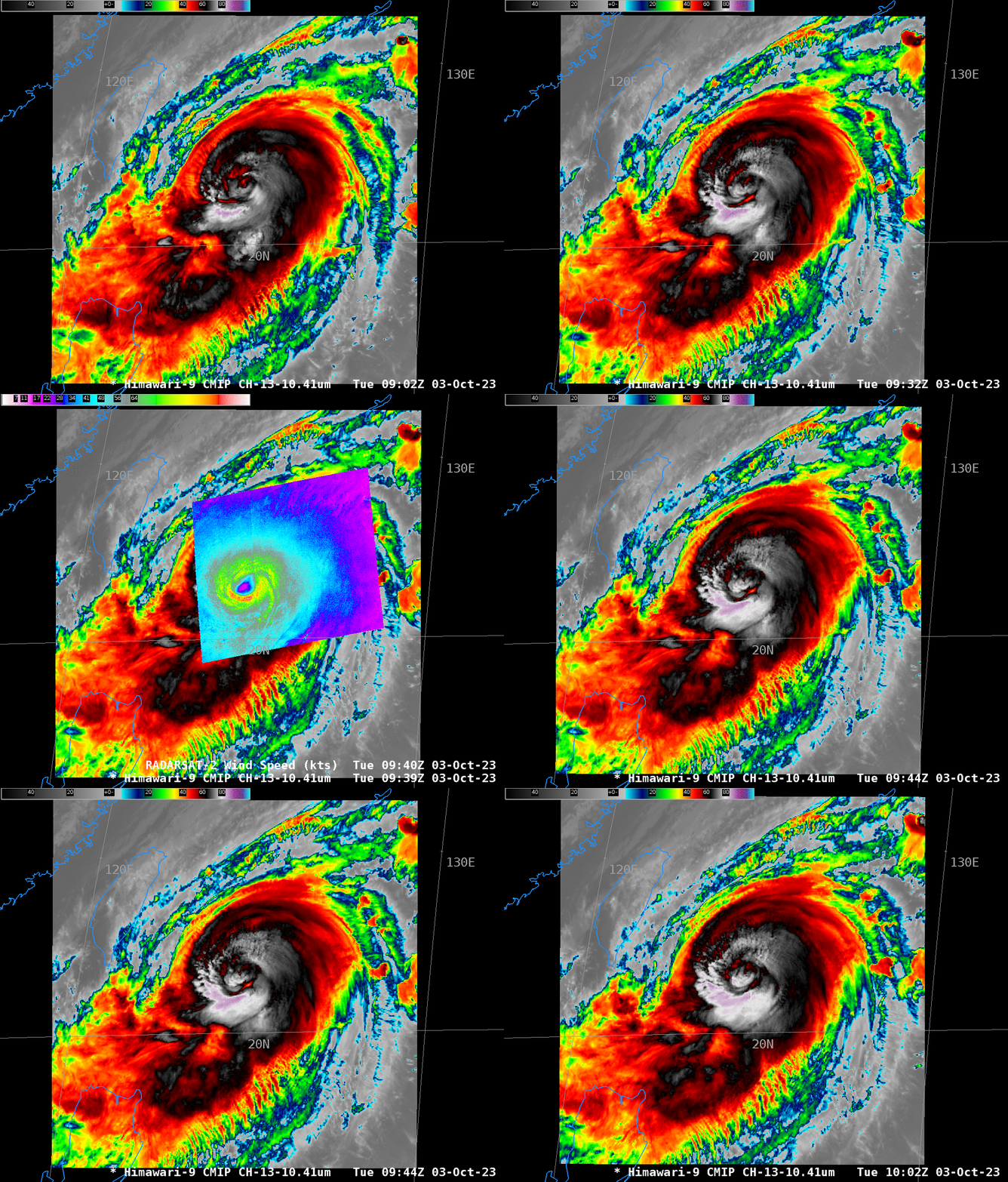
How do the SAR Wind fields compare to Himawari-9 infrared imagery? That is shown in two toggles below (0945 UTC was shortly after sunset over the storm, so visible data aren’t used here). The eye is distinct in the SAR imagery, as it was on 2 October. There is some warming in the center of the storm, and cold cloud tops are apparent in the eyewall — especially over the region of strongest SAR-diagnosed winds. An hour-long animation of the Himawari-9 target scene is below the two toggles.


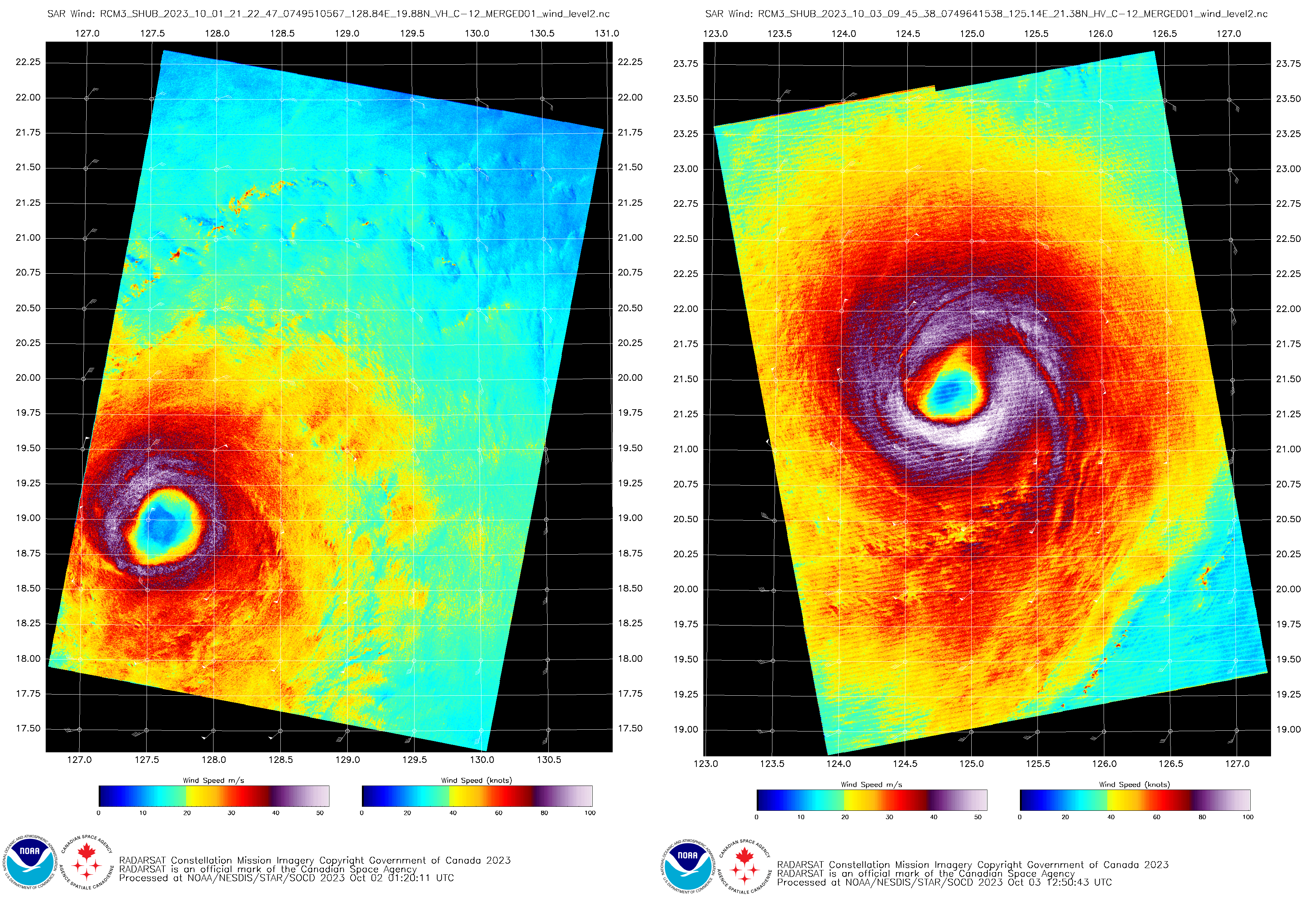
This RCM-3 SAR wind analysis (from this website) uses the same color scale as this example from this blog post. The side-by-side comparison, below, shows that peak winds have increased since 2122 UTC 01 October, and the areal extent of the winds have also broadened.


