SAR Observations around Hawai’i on 21 September 2023
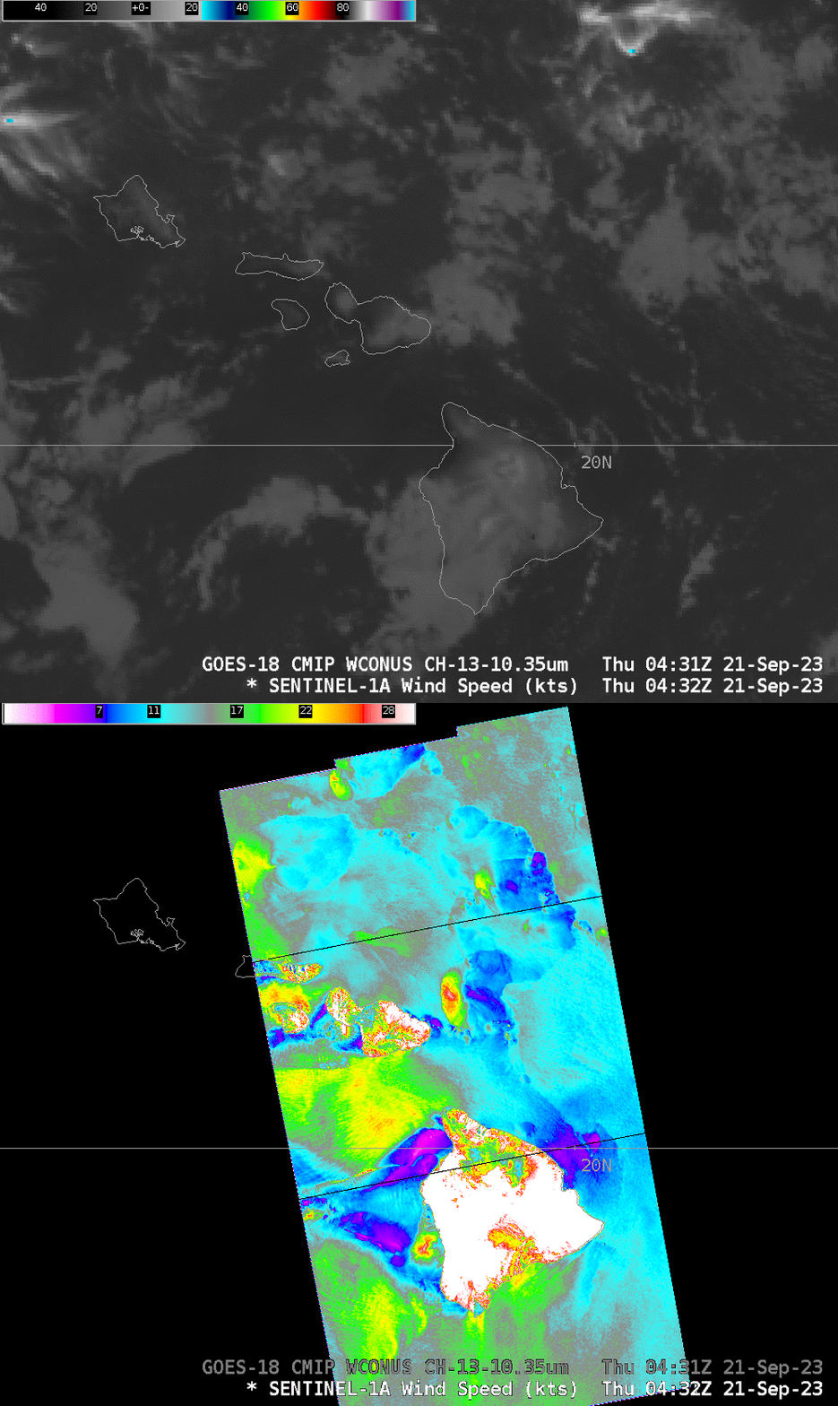
GOES-West imagery, above, from the CSPP Geosphere site, shows Hawaii in a tradewind regime (direct link to animation). The animation, from 0121 to 0556 UTC on 21 September 2023, shows the steady progression of cloud lines moving east-to-west, with embedded regions of apparent showers that generate outflow boundaries. At 0431 UTC, Sentinel-1A overflew the eastern Hawai’ian islands, and a high-resolution picture of the surface winds resulted (Data are available online as well: Normalized Radar Cross Section Data, and Winds). The three wind footprints are stitched together below.
Strong winds — nearly 30 knots — are associated with a modest looking (and decaying) convective cell just to the east of Maui. None of the convection in this scene reaches particularly high into the atmosphere; cloud top brightness temperatures are in the 5-10o C range. The Hilo Sounding at 0000 UTC on 21 September 2023 shows a tradewind inversion top at 750 hPa, suggesting the clouds reached to about that level. (The strong winds of the Alenuihaha channel are also shown!) Note also the strong winds in the lee of the Big Island of Hawai’i.

Sentinel orbits are such that exact repeats occur every 12 days. The Ocean Virtual Laboratory allows a user to track the overpasses.

