Hurricane Adrian in the Pacific

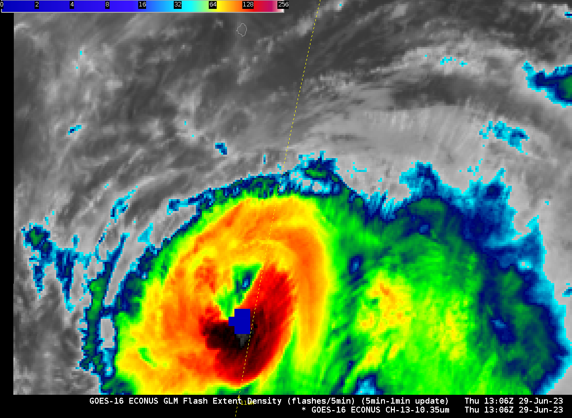
RCM1 overflew Hurricane Adrian (the 2nd latest-forming first tropical system of the eastern Pacific since the start of the satellite record) at 1300 UTC on 29 June 2023, as shown above. SAR winds derived from satellite data show a closed ring of 35- to 40-knot winds surrounding the eye. Adrian’s center at 15.9oN, 110oW in the 1300 UTC SAR image above is in the southwest corner of the GOES-16 CONUS sector, allowing for routine 5-minute scanning of the center. The animation below, from 1006 to 1641 UTC on 29 June, shows vigorous convection developing along the southern part of the eyewall. There’s even lightning detected at 1306 UTC. A distinct eye is not apparent in the GOES imagery. Given the distance between the storm and the GOES-16 sub-satellite point, viewers should be aware of the parallax shift in this image.
Adrian’s forecast takes the storm over progressively colder waters as shown below (imagery from the CIMSS Tropical Website). The storm is forecast to weaken as that happens.