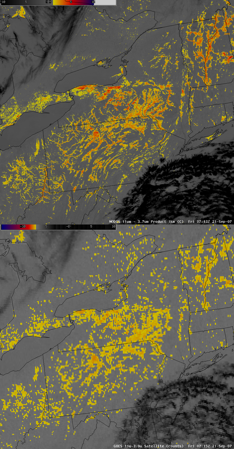
Widespread valley fog across the Northeast US
Yes, we have been posting a lot of fog/stratus product images lately, but this comparison of AWIPS images of the 4-km resolution GOES-12 and the 1-km resolution MODIS fog/stratus product from around 07:15 UTC (3:15am local time) on 21 September 2007 was deemed to be highly Blog_Worthyâ„¢. Widespread fog (yellow to orange to red enhancement) can be seen forming in valleys from Ohio and West Virginia to Vermont and New Hampshire during the overnight hours. Note that the patches of high-altitude cirrus cloud (black enhancement) appear to be located farther to the north/northwest on the GOES fog/stratus product image — this “parallax shift” is due to the large viewing angle of the geostationary satellite, which is positioned over the equator. The MODIS instrument flys aboard the polar orbiting Terra and Aqua satellites (which pass directly overhead), so the imagery does not exhibit significant parallax error for high-altitude cloud features.


