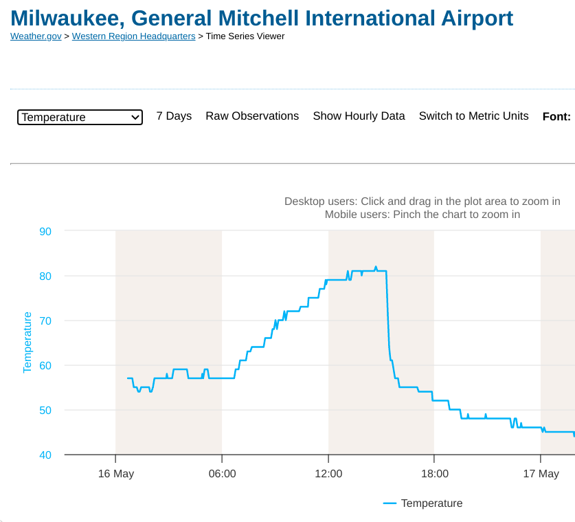
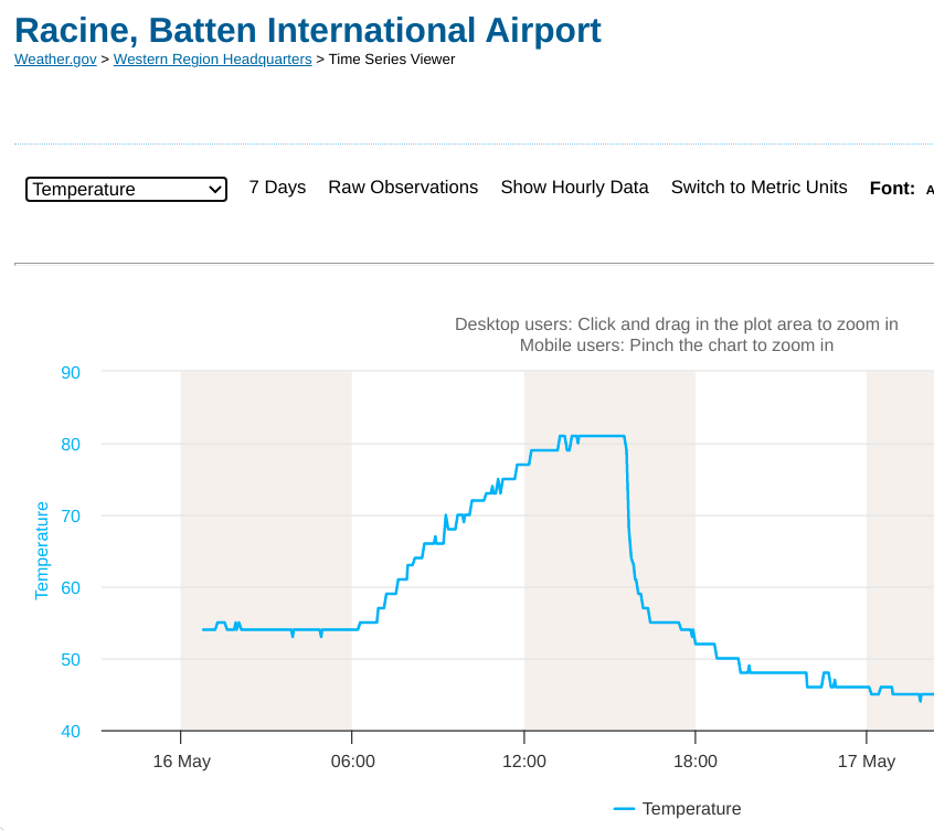
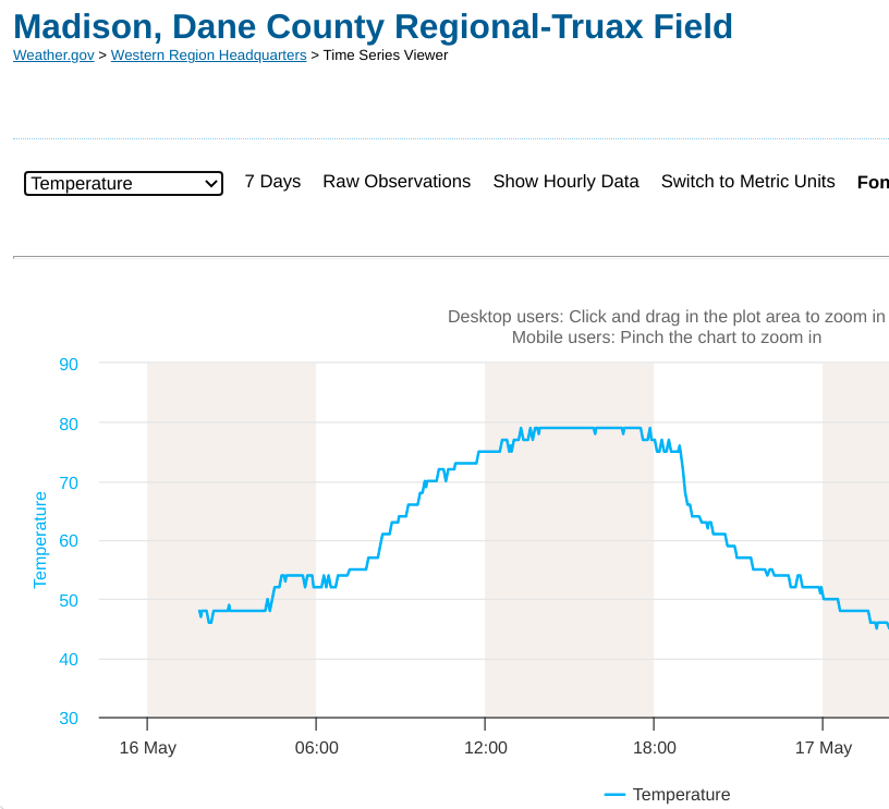
Wildfire smoke, a cold front and a “Pnuemonia Front”
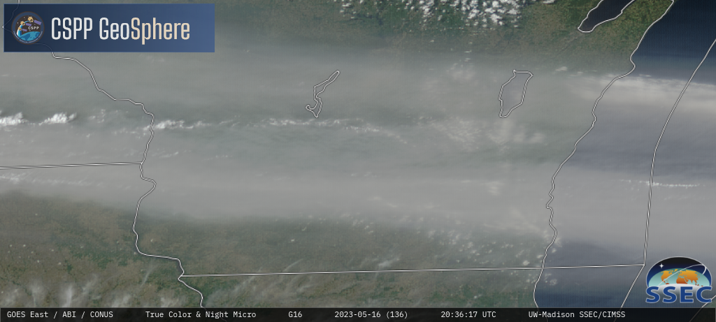
GOES-16 True Color RGB images [click to play MP4 animation]
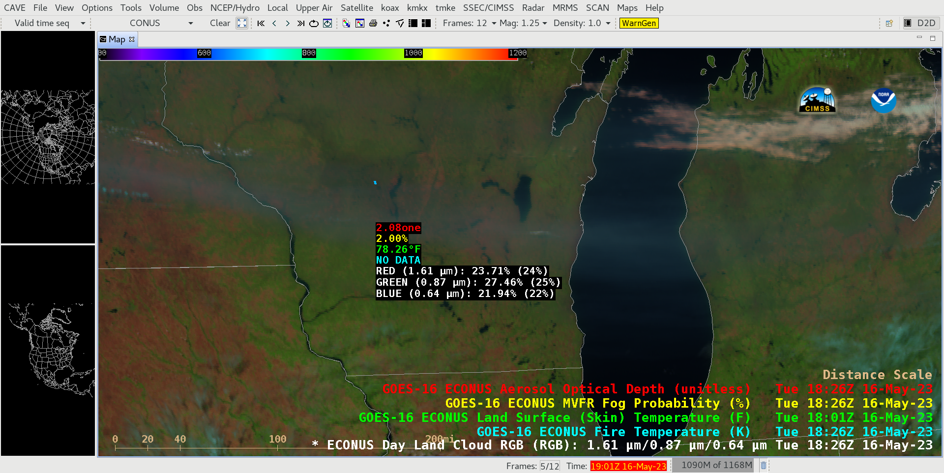
GOES-16 Day Land Cloud RGB image at 1826 UTC, with readouts of Aerosol Optical Depth, MVFR Fog Probability, Land Surface Temperature and Fire Temperature derived products for a point beneath the thick smoke layer [click to enlarge]
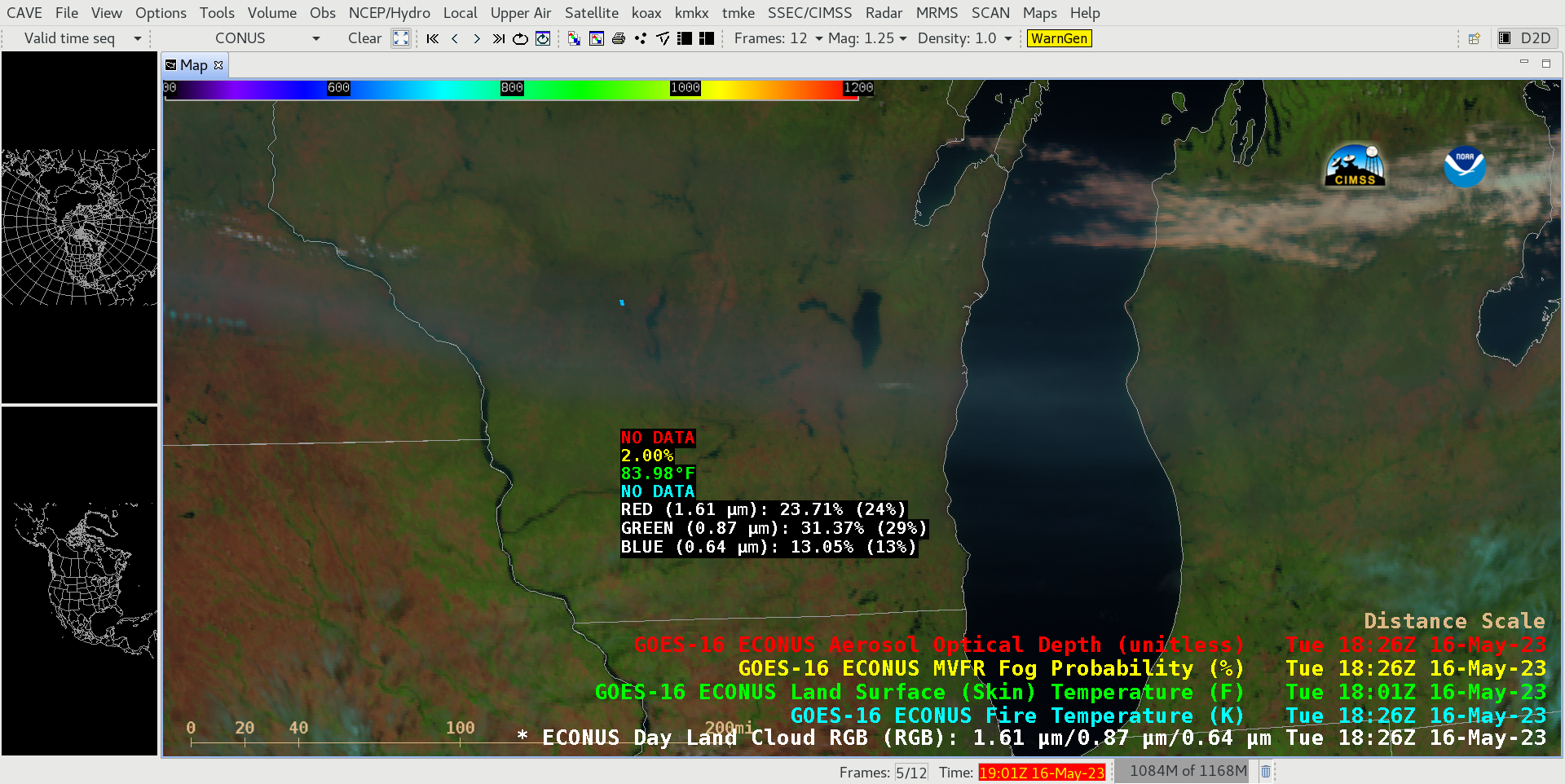
GOES-16 Day Land Cloud RGB image at 1826 UTC, with readouts of Aerosol Optical Depth, MVFR Fog Probability, Land Surface Temperature and Fire Temperature derived products for a point just south of the thick smoke layer [click to enlarge]
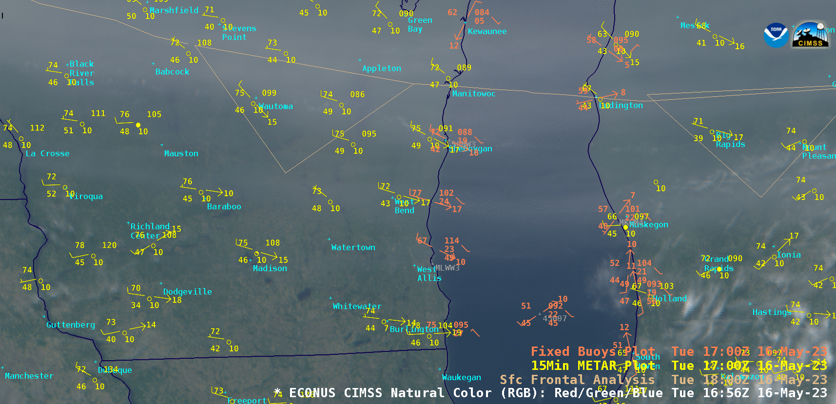
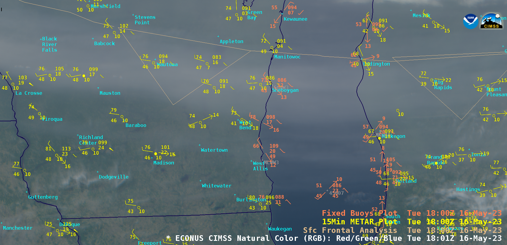
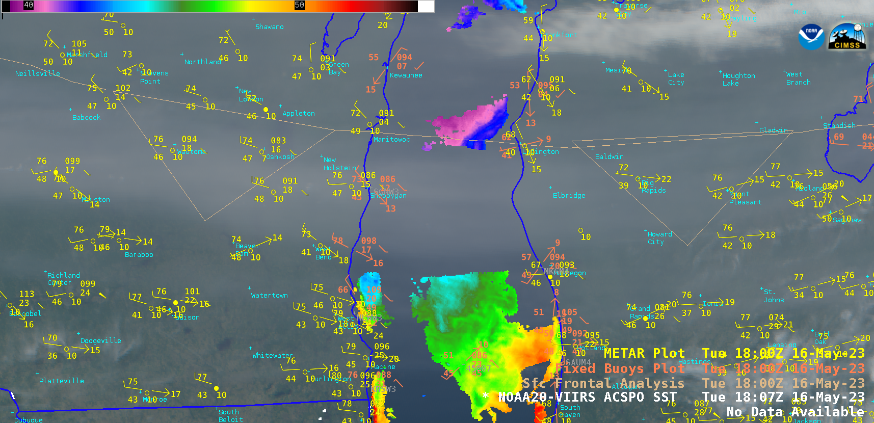
CIMSS Natural Color RGB images, with plots of surface and buoy reports along with frontal analyses [click to play animated GIF | MP4].
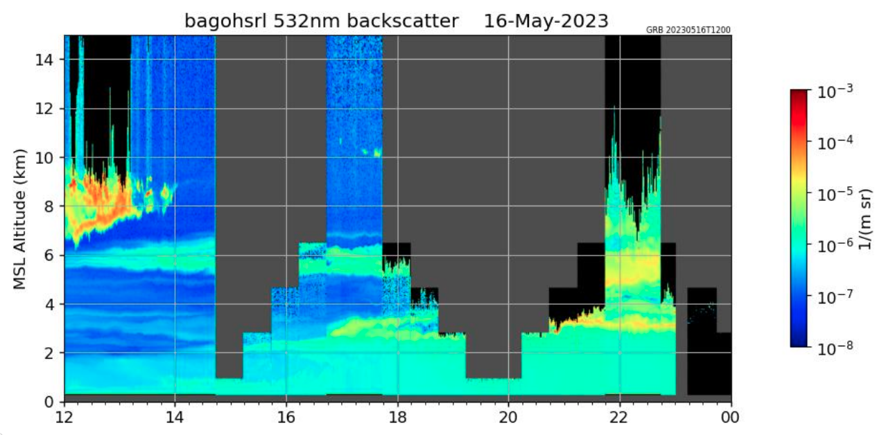
Plot of lidar backscatter at Madison, Wisconsin [click to enlarge]