SAR Winds around Kaua’i
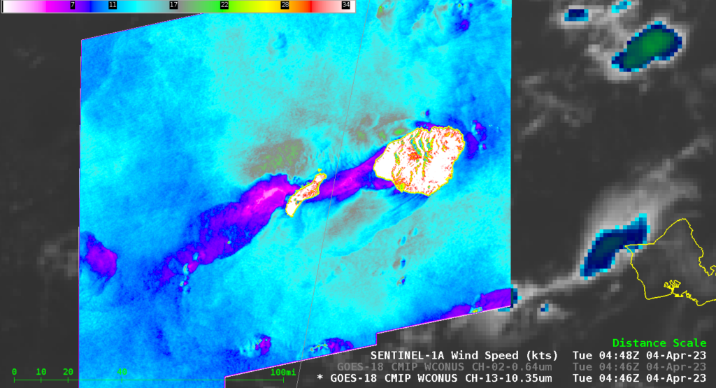
Sentinel-1A overflew the western Hawai’ian islands late on 4 April 2023, observing surface winds around the islands of Kaua’i and Ni’ihau. The image above shows the winds overlain on top of a GOES-18 infrared image. A pronounced region of light winds extends downwind of both islands — the region in purple shows winds of 5 knots or less.
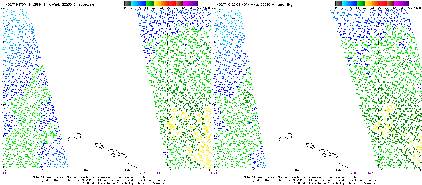
MetopB overflew the Hawai’ian island chain about 3 hours after Sentinel-1A did (link), and its overpass was also bookended by two MetopC overpasses (shown here). Those two wind plots are shown below (from this website). Neither satellite gave information where the SAR Winds occurred, and the slack winds in the lee of the islands would likely not be resolved by ASCAT’s 25-km footprint.
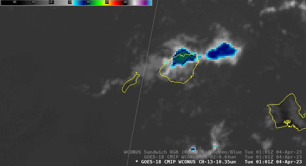
A GOES-18 animation of visible imagery before and through the SAR overpass is shown below. It is very difficult to identify a region of slack winds around the islands from the visible imagery. Modest convection forms in the lee of Ni’ihau as the sun sets. The Band 13 animation at bottom shows the convection to be short-lived.
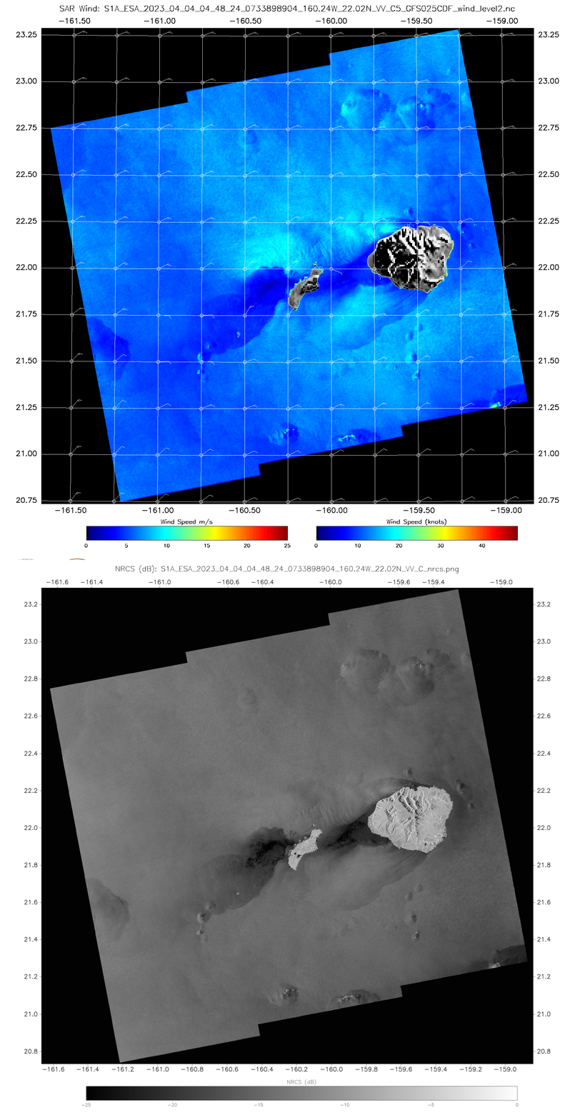
Sentinel-1A SAR winds are available at this NOAA/NESDIS/STAR website. The toggle below shows the winds and the Normalized Radar Cross Section field at 0446 UTC on 4 April from that site.
