Heavy Rain over Tutuila, American Samoa

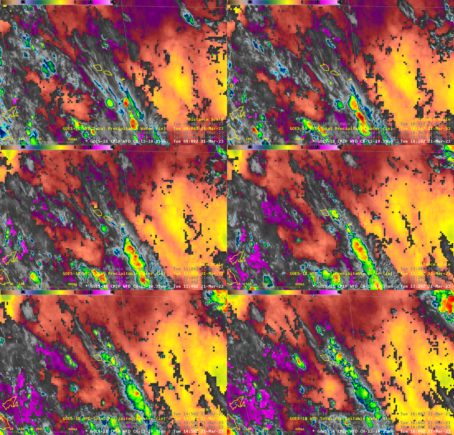
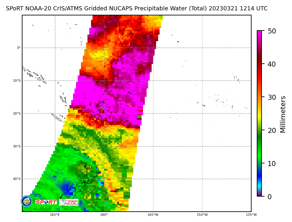
Tutuila, the large island of American Samoa, experienced very heavy rain early in the morning of 21 March 2023, especially over the western parts of the Island. (However, the raingauge at the Pago Pago airport, in central Tutuila, received only 0.15″ of rain!) The animation above shows the development of convection in a corridor of moisture as suggested by the Total Precipitable Water (TPW) fields. Values diagnosed by the GOES-R algorithm exceed 2.1″ (magenta) near the clouds vs. values around 1.8-1.9″ (yellow/orange enhancement) to the east and to the west. How confident are you that that ribbon of moisture is true, and perhaps not an artifact of the clouds? TPW fields from gridded NUCAPS, below, (from this site), also show a local maximum in TPW oriented southeast-to-northwest over the Samoan Islands. MIMIC Total Precipitable Water from 1500 UTC on the 21st, shown here, from this site, also show the local maximum.

The animation below shows GOES-18 Band 13 infrared (10.3 µm) imagery, the Level 2 Rain Rate product, and that Rain Rate product overlain on top of the low-level water vapor infrared imagery (Band 10, 7.34 µm), all centered on the island of Tutuila. Very heavy rain is diagnosed over western Tutuila, with values exceeding 1.9″/hour, values that are red in the enhancement used. This is more easily viewed in the animation at bottom.

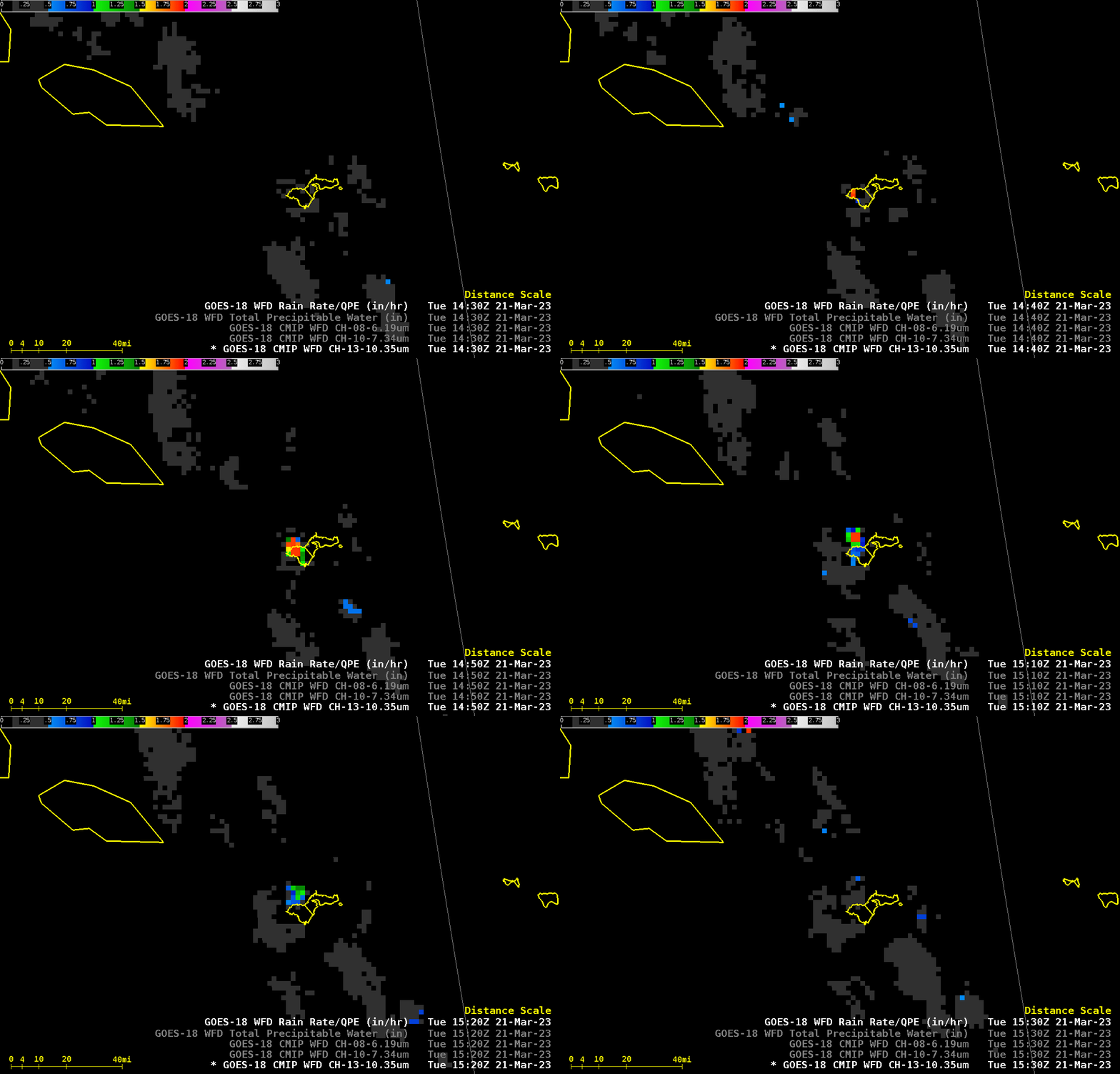
A zoomed-in look at GOES-18 Rain Rate, below, from 1430-1530 UTC, shows when the heaviest rain was falling over the island; orange/red values are close to 2″/hour. The GOES-R Rain Rate Level 2 product is not parallax-corrected, so it is displayed a bit farther from the sub-satellite point (at 137oW, or about 33o longitude from Tutuila) than it is in reality.

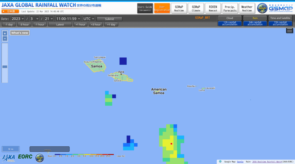
This was a case where the GOES-R product diagnosed much heavier rain than JAXA’s GsMAP (shown below in an animation) or CMORPH fields (available at RealEarth).


