Extensive SAR imagery over Freddy
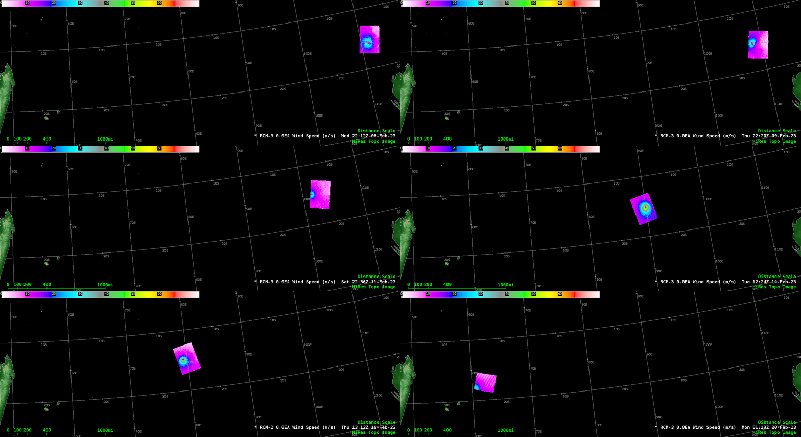
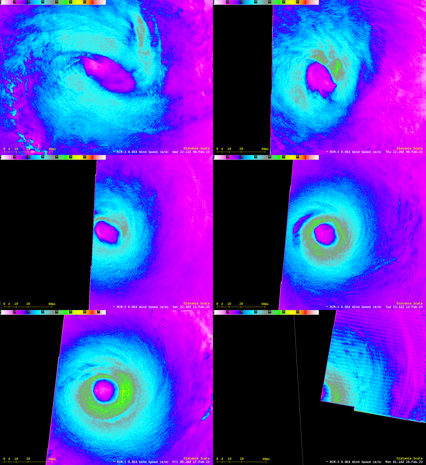
SAR data collection over Cyclone Freddy in the Indian Ocean has led to a remarkable collection of imagery. To date, more than twenty eye overpasses have occurred from RADARSAT-2 (3 overpasses), Sentinel 1A (1 overpass) and the three satellites of the RADARSAT Constellation Mission (17(!) overpasses). The animation above shows images tracking the system as it moves across the Indian Ocean towards a projected landfall in Madagascar. Eye-centered imagery, below, shows the organization and strengthening of the system.
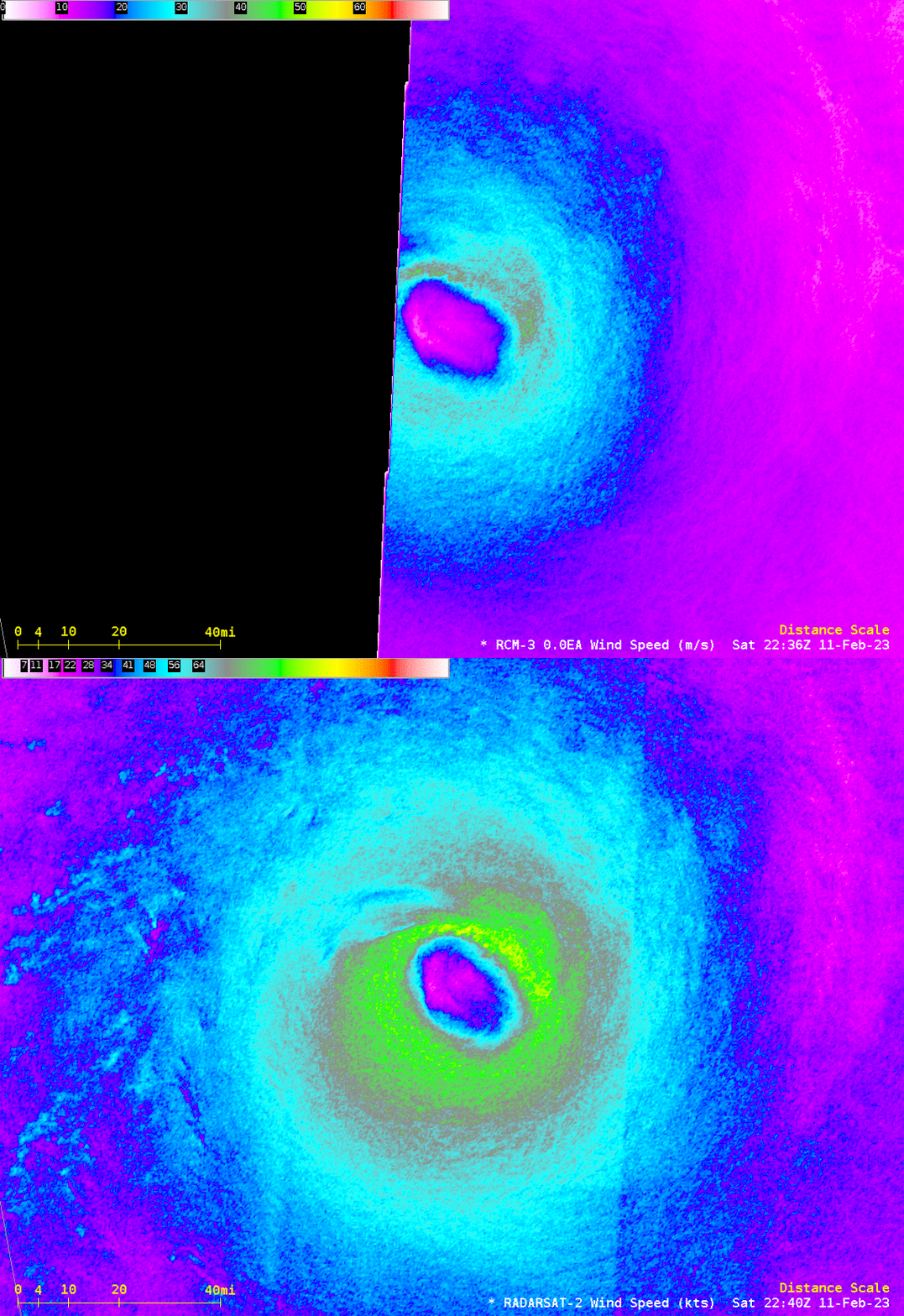
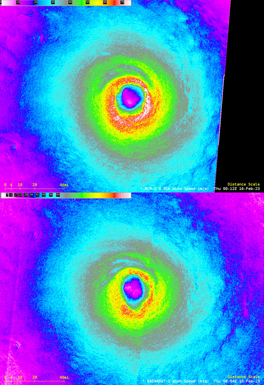
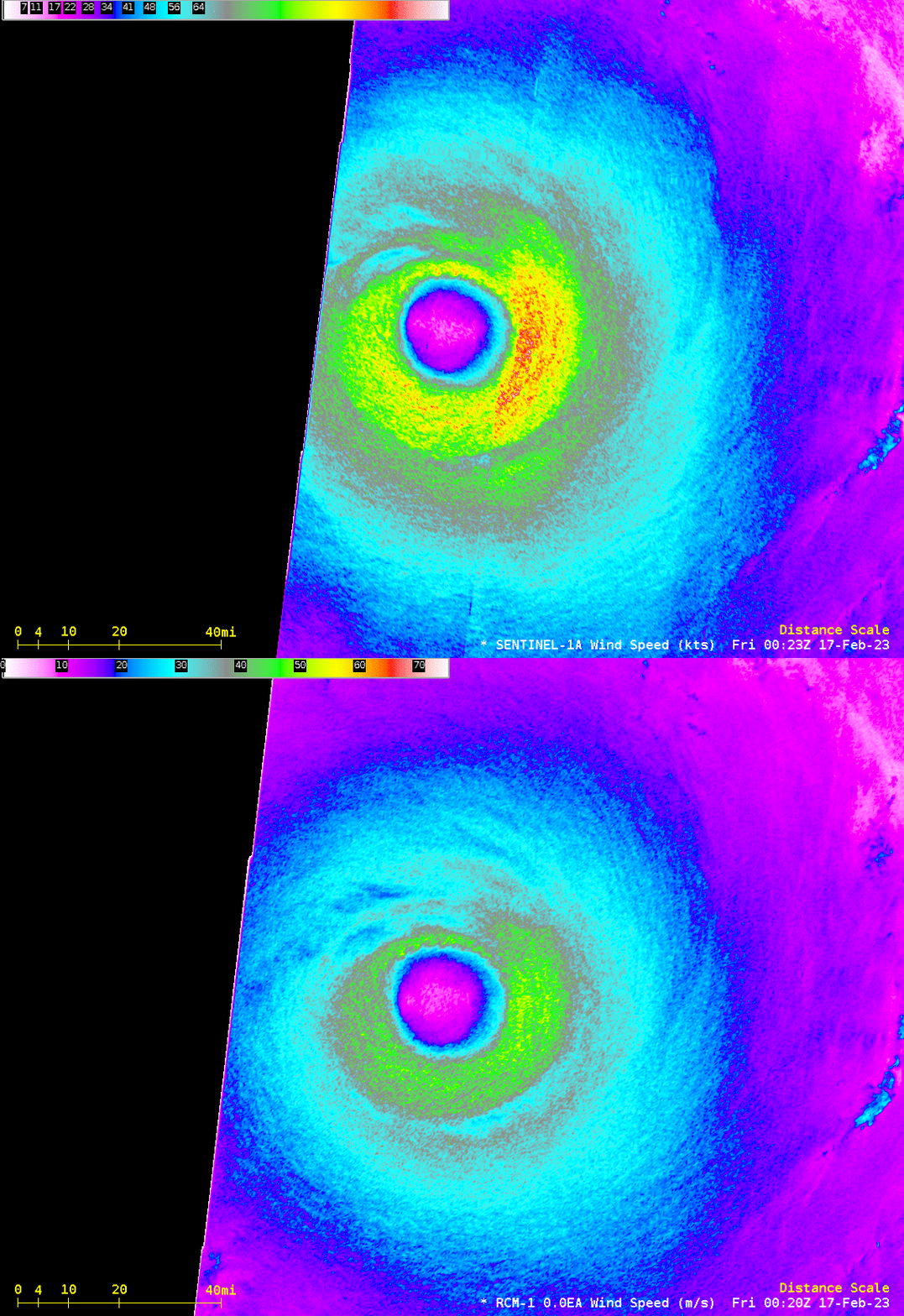
Because 5 satellites are involved, occasionally imagery that is very close in time is acquired. For example, RCM-3 and RADARSAT-2 both sampled the between 2236 and 2240 UTC on 11 February 2023; RCM-1 and RADARSAT-2 both sampled the eye near 0000 UTC on 16 February (Freddy was near its peak intensity at that time, as noted in this blog post); RCM-1 and Sentinel-1A both sampled the eye near 0020 UTC on 17 February 2023. Three toggles showing these comparisons are below. Note that winds at the edge of a scan are likely weaker than they actually are.
SAR Winds and analyses for Cyclone are Freddy are also available here. For more information on Freddy, refer to the JTWC webpages, or the RSMC in La Reunion (map of all RSMCs is here), or the SSEC/CIMSS Tropical Weather Website.

