Kona Low flooding event in Hawai’i
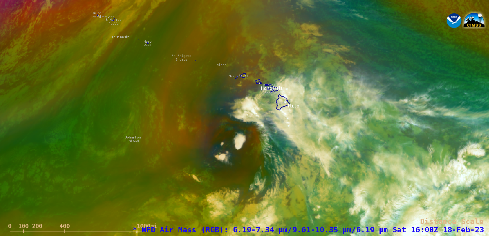
GOES-18 (GOES-West) Air Mass RGB images during the 15-19 February 2023 period (above) displayed the migration of a Kona Low from north of the main Hawaiian Island chain on 15 February toward Johnston Island on 19 February. The MIMIC Total Precipitable Water product (below) showed that the circulation of this Kona Low helped to draw a broad plume of moisture northwestward from the ITCZ and across Hawai’i — providing the fuel for a prolonged period of heavy rainfall.
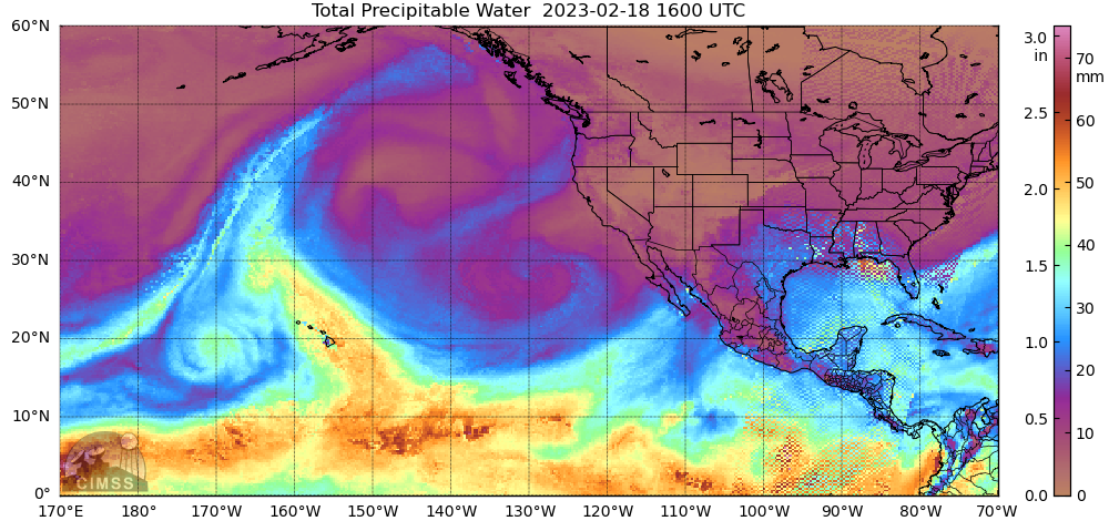
MIMIC Total Precipitable Water product, 16-19 February [click to play animated GIF | MP4]
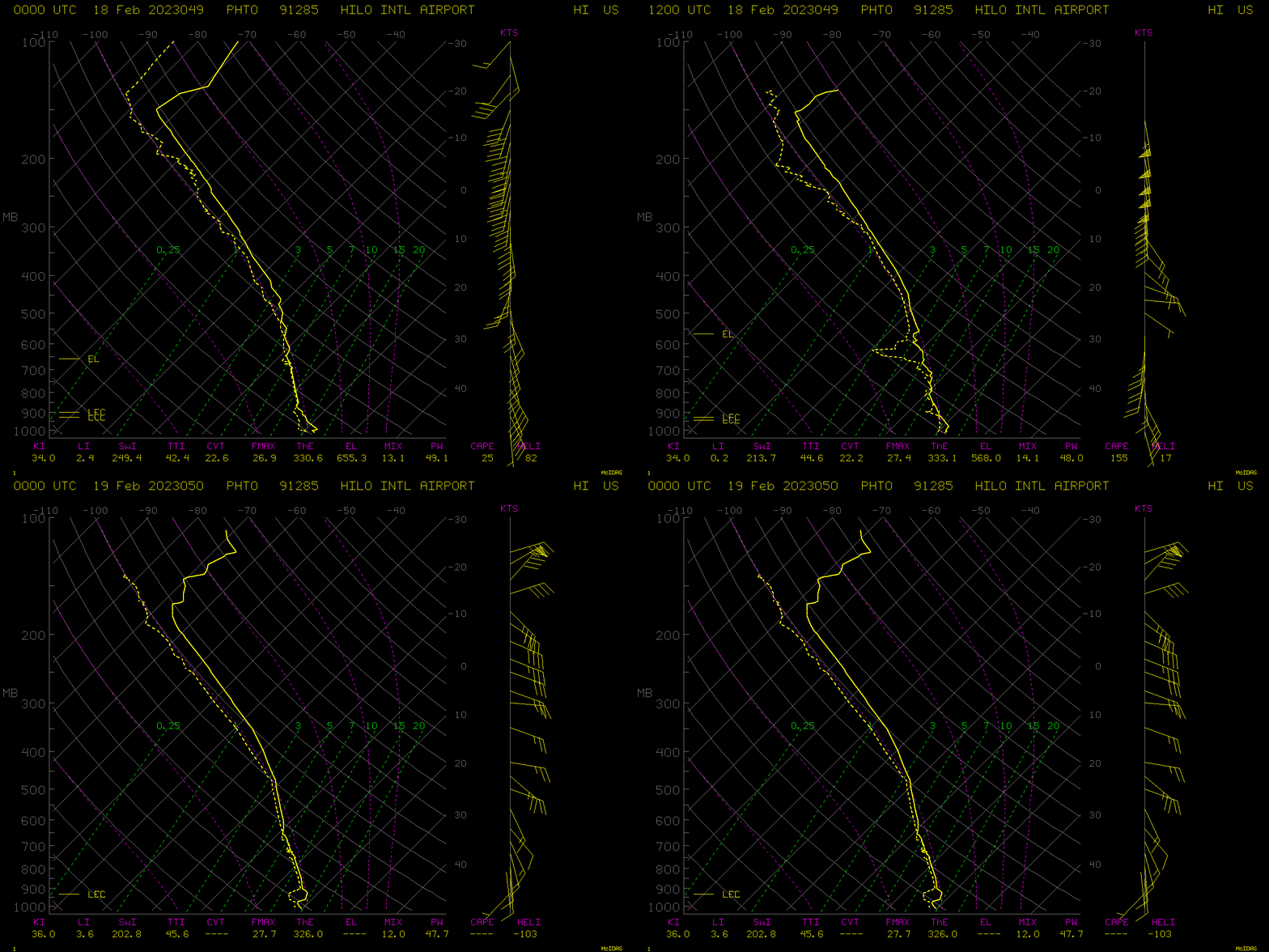
Plots of rawinsonde data from Hilo (below) revealed the deep tropical moisture that was present over the eastern portion of the Big Island from 18-19 February.
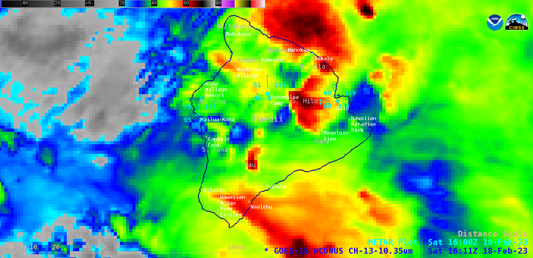
GOES-18 “Clean” Infrared Window (10.3 µm) images, from 1501-1801 UTC on 18 February [click to play animated GIF | MP4]
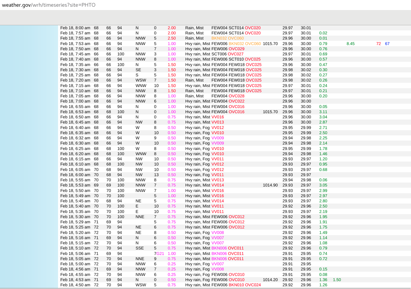
GOES-18 “Clean” Infrared Window (10.3 µm) images (above) provided a closer look at the Big Island, where the heaviest rainfall occurred across the Kau, Puna and South Hilo districts (NWS Honolulu PNS). On 18 February, Hilo experienced 2 consecutive hours with rainfall in excess of 3 inches (below).


