Ex-typhoon Merbok enters the Bering Sea

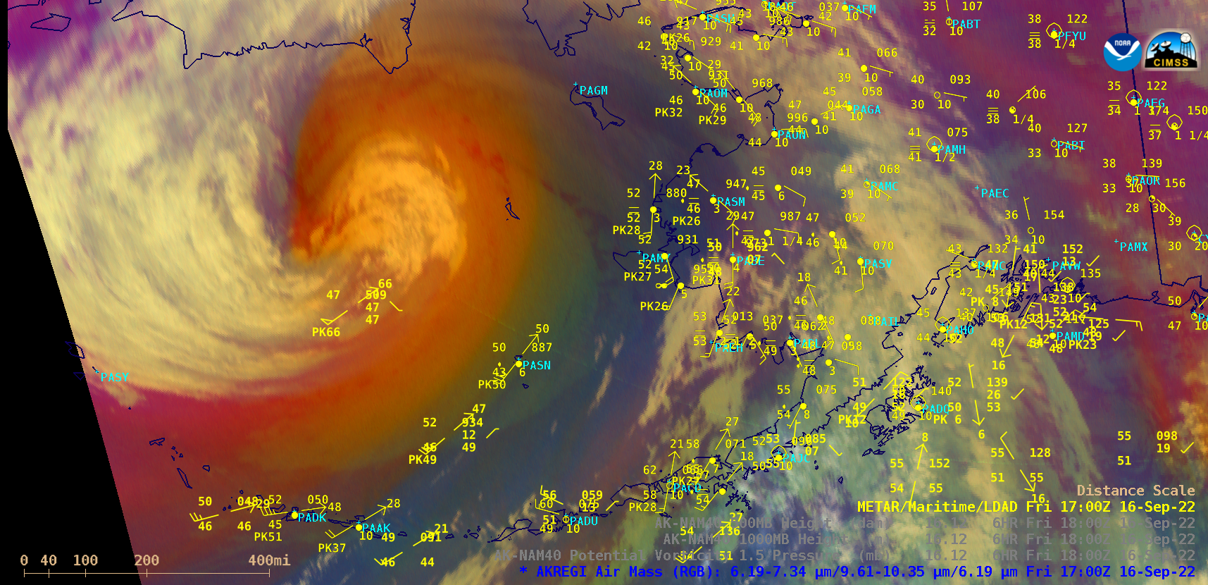
GOES-17 Air Mass RGB images, with hourly plots of surface reports [click to play animated GIF | MP4]
GOES-17 (GOES-West) Air Mass RGB images with hourly plots of surface reports (above) showed the remnants of ex-Typhoon Merbok (storm track) moving northward across the Bering Sea (surface analyses) on 16 September 2022. This strong extratropical cyclone had an anomalously-low surface pressure as it moved northward — in fact, its central Mean Sea Level Pressure set a record for the month of September in the Bering Sea:
The storm center passed just northwest of Buoy 46035, where the peak wind gust was 68 knots (78 mph) at 1800 UTC and 1900 UTC on 16 September. These strong winds caused wave heights to 52 feet, which resulted in a notable upwelling of cooler water. Such strong southwesterly surface winds in the vicinity of Buoy 46035 occurred beneath a swath of anomalously-strong 925 hPa winds within the southeast quadrant of the storm. Two particularly adverse impacts of these strong winds were coastal erosion and flooding across much of western Alaska (more of the storm’s impacts are discussed here).
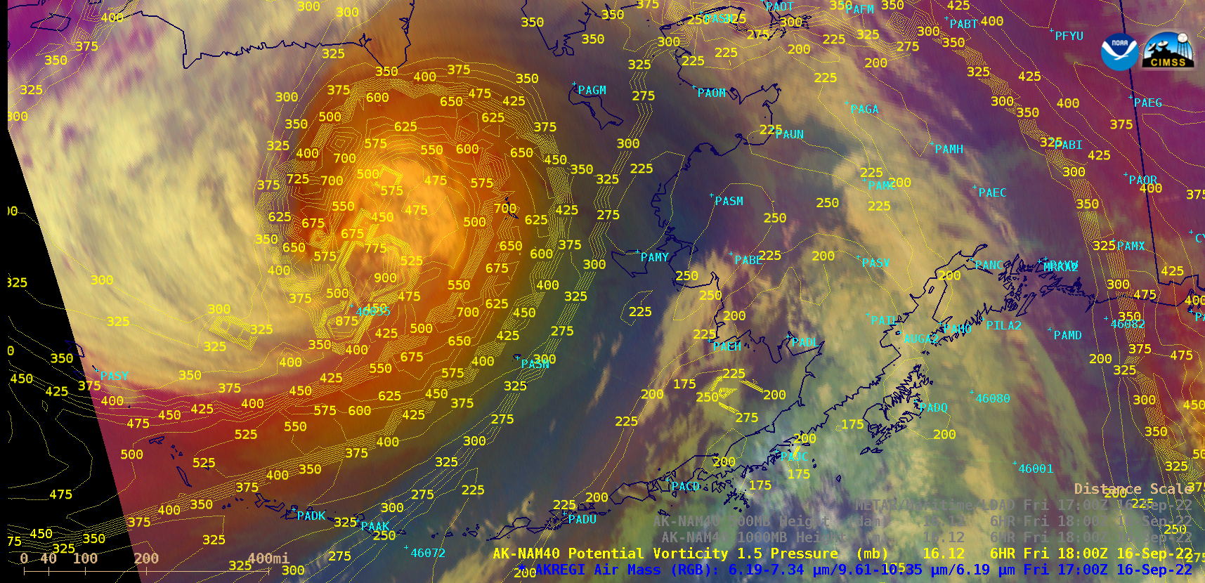
In the Air Mass RGB images, deeper shades of red-to-orange in the vicinity of the storm center vhighlighted areas where there was enhanced ozone within the atmospheric column (due to an anomalously-low tropopause ) — overlays of AK-NAM40 model Potential Vorticity (PV) 1.5 pressure (below) indicated that the “dynamic tropopause” near the storm center may have descended as low as the 900 Pa pressure level.

GOES-17 Air Mass RGB images, with overlays of AK-NAM40 model PV1.5 pressure [click to play animated GIF | MP4]
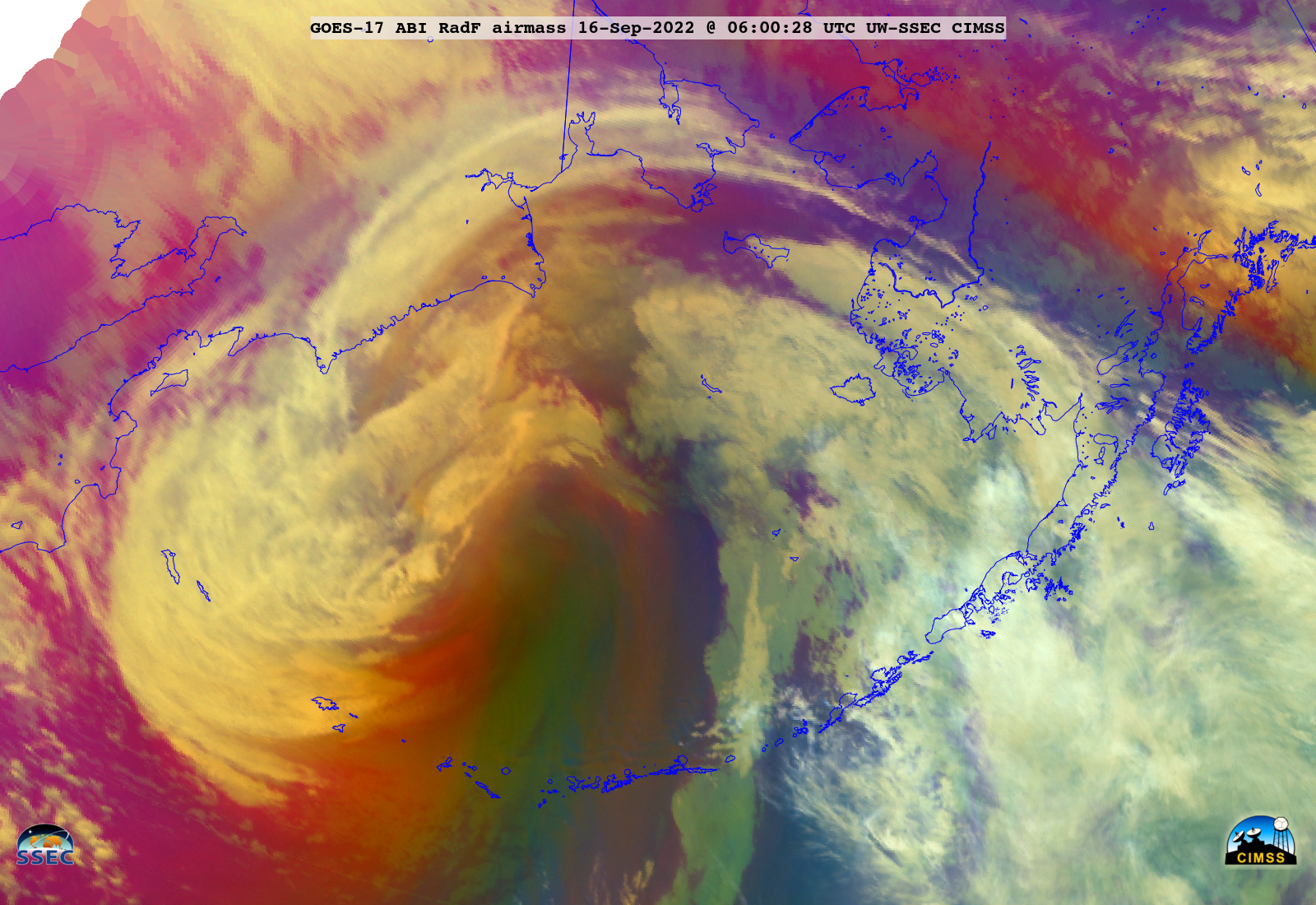
In a larger-scale view of GOES-17 Air Mass RGB images created using Geo2Grid (below), one interesting feature was a distinct plume of moist tropical air (highlighted by darker shades of green) that moved northward across the Aleutian Islands into the Bering Sea (for example, at 0600 UTC on 16 September in the warm sector of the storm).

GOES-17 Air Mass RGB images [click to play animated GIF | MP4]
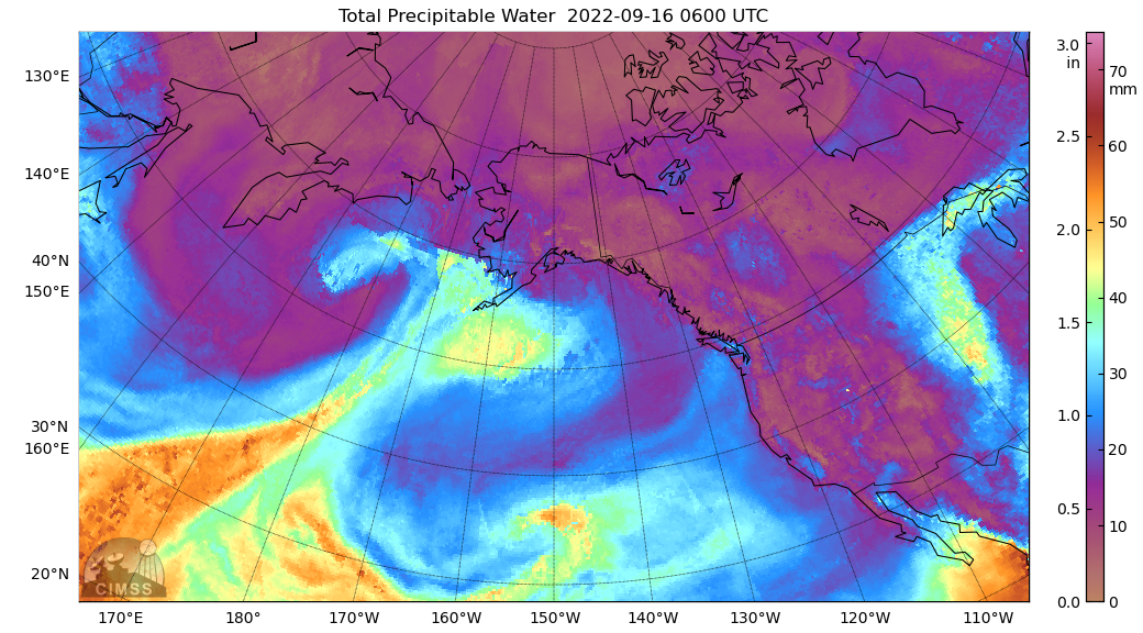
The MIMIC Total Precipitable Water product (below) showed the north-northeastward transport of tropical moisture as Typhoon Merbok transitioned to an extratropical storm.

MIMIC Total Precipitable Water product [click to play animated GIF | MP4]
Additional information pertaining to this event is available here.

