Using NUCAPS profiles before Pyrocumulus events
A CSPP Geosphere mp4 animation from late on 10 September, above (link), shows the development of a pyrocumulus cloud at the south edge of the Cedar Creek fire complex in Oregon (previously discussed here, here and here). The animation above starts at 2101 UTC, shortly after a NOAA-20 overpass above the region. NUCAPS profiles over the regions can define the thermodynamics to help forecasters determine is pyrocumulus clouds might develop. The Green points in the sounding availability plots, below, denote retrievals that converged to a solution using both microwave and infrared data from the ATMS and CrIS instruments, respectively. This includes the profiles near the very warm Cedar Creek fire pixels in east-central Oregon. (Here is a zoomed-in view over the fire with GOES-17 FDCA Fire Power observations; note the two different regions of active fire).

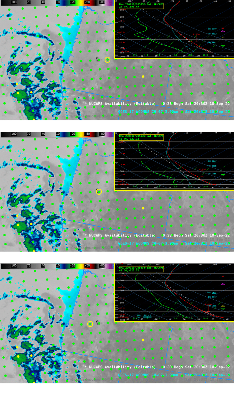
The animation below steps through 3 NUCAPS profiles near the fire. A dry atmosphere is apparent, but note also the very steep lapse rates. If convection develops, aided by the heat of the fire, there is little to inhibit its growth to the tropopause.

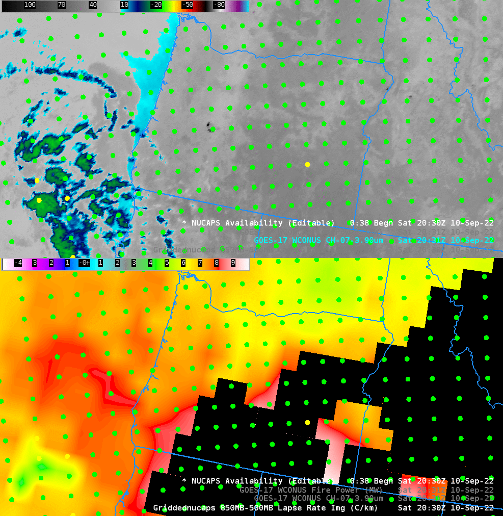
NUCAPS profiles can be gridded to provide horizontal fields of thermodynamic variables. The lapse rate computed from 850 and 500 mb temperatures, below, also shows very steep lapse rates (note that portions of Oregon are at/above 850 mb and no data are available).

One things that happens when a Pyrocumulus develops: the cloud is trackable (in contrast to any surrounding smoke). The CSPP Geosphere animation below (link) shows the Night Microphysics (at night) and True-Color (during the day) — the cloud can be tracked until is dissipates near dawn, and the true-color imagery the next day shows the smoke associated with the pyrocumulus has also moved to the east. Note also in the animation how the active fires show up in the GOES-17 Night Microphysics as different shades of magenta.
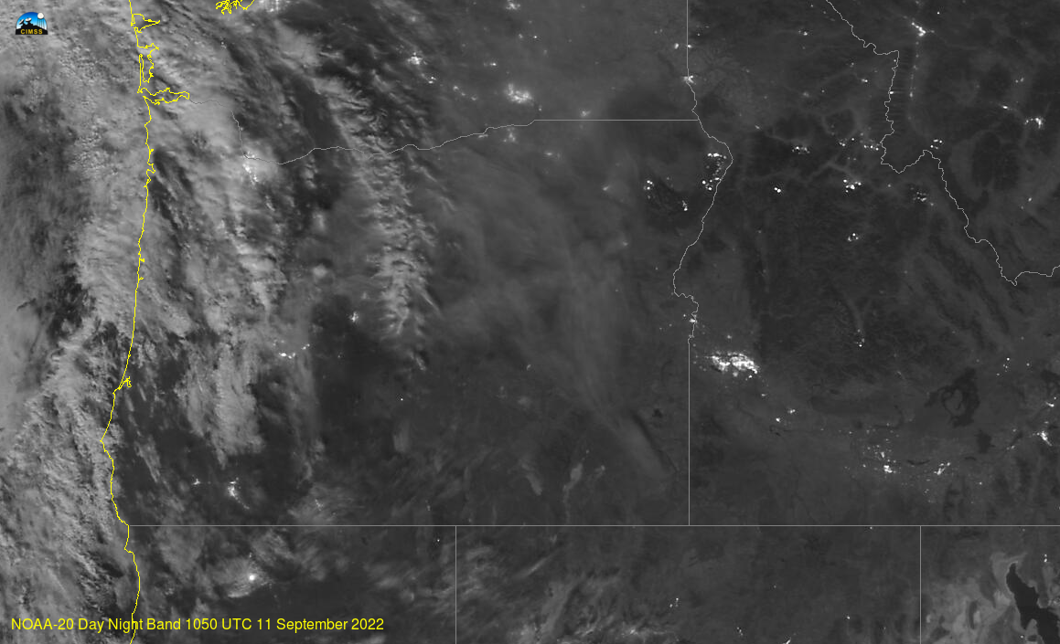
Although infrared imagery is challenged to view smoke at night, as suggested in the animation above, the VIIRS Day Night band sees it (if there is sufficient illumination by the Moon). That was the case early on 11 September, as shown below (in an image taken from the VIIRS Today website). Both the light signature from fires are apparent as is the smoke plume from the pyrocumulus.

AWIPS Satellite imagery in this blog post were created using the TOWR-S AWIPS. Thank you!

