Anomalously-deep upper low brings light snow to northwestern Alaska
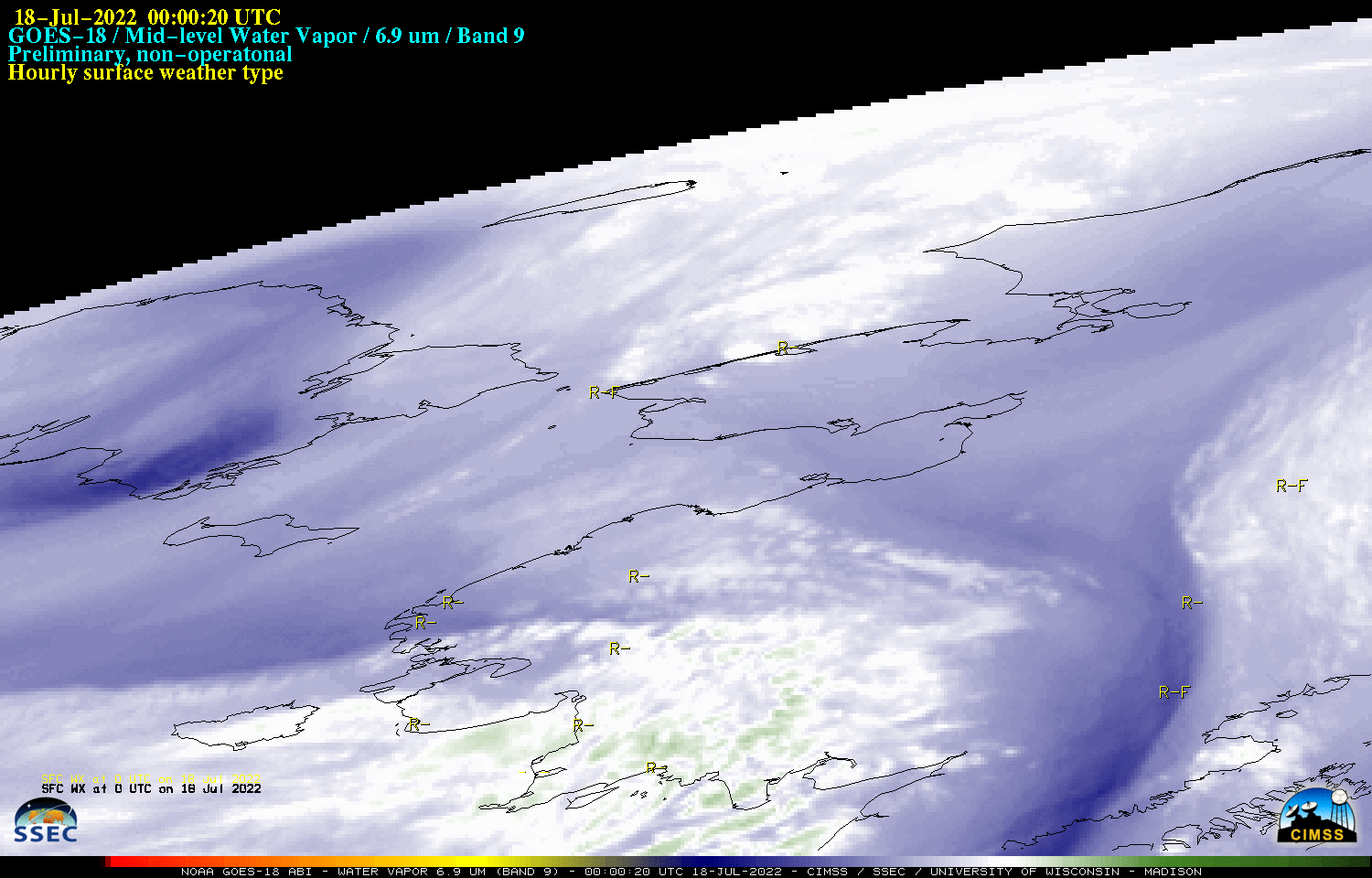
GOES-18 Mid-level (6.9 µm) Water Vapor images, with plots of hourly surface weather type [click to play animated GIF | MP4]
GOES-18 images shown in this blog post are preliminary and non-operational
GOES-18 Mid-level Water Vapor (6.9 µm) images during the 18 July – 19 July 2022 period (above) showed a series of impulses rotating within the broader circulation of an anomalously-deep low pressure system that meandered over the Bering Strait region. Anomalously-cold air associated with this deep low helped to produce brief periods of unusual July snow at some locations across the Seward Peninsula and northwestern Alaska.
In GOES-18 Air Mass RGB images created using Geo2Grid (below), brighter shades of red highlighted the core of this broad low pressure system, where high-altitude ozone levels were elevated (due to an unusually low tropopause).

GOES-18 Air Mass RGB images [click to play animated GIF | MP4]
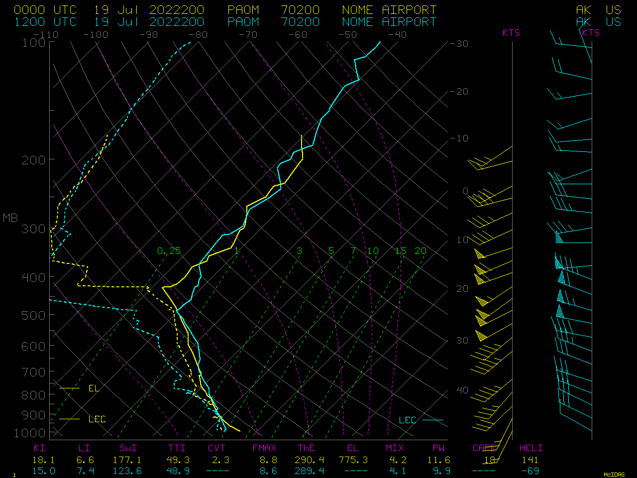
Plots of rawinsonde data at Nome, Alaska at 00 UTC and 12 UTC on 19 July 2022 [click to enlarge]
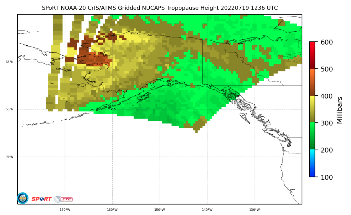
NOAA-20 Gridded NUCAPS Tropopause Height at 1236 UTC on 19 July [click to enlarge]