Forecasting storms with AI
Severe weather season is underway across the southern U.S. NOAA and CIMSS are using satellite, radar, and lightning observations of thunderstorms to develop and evaluate artificial intelligence (AI) tools that forecast and diagnose convection.The NOAA/CIMSS ProbSevere portfolio has several such tools to help forecasters keep tabs on storms.
LightningCast
ProbSevere LightningCast is a model that uses images of geostationary ABI data from GOES-16 or GOES-17 to predict where lightning will strike (as observed by the GLM) out to 60 minutes. We’ve found that the product frequently provides 15-30 minutes of lead-time to lightning initiation, measured from the 30-40% probability range (the most skillful range). LightningCast will be evaluated at the 2022 NOAA Hazardous Weather Testbed and at certain offices within the NWS. LightningCast may be able to one day aid forecasters in providing decision support services and general convective initiation situational awareness. Below is a movie of LightningCast output (contours) overlaid on the GOES-16 daytime cloud phase distinction RGB and GLM flash-extent density, for the developing severe storms in Texas on March 21st.
IntenseStormNet
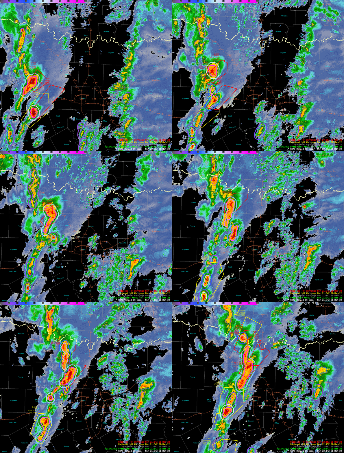
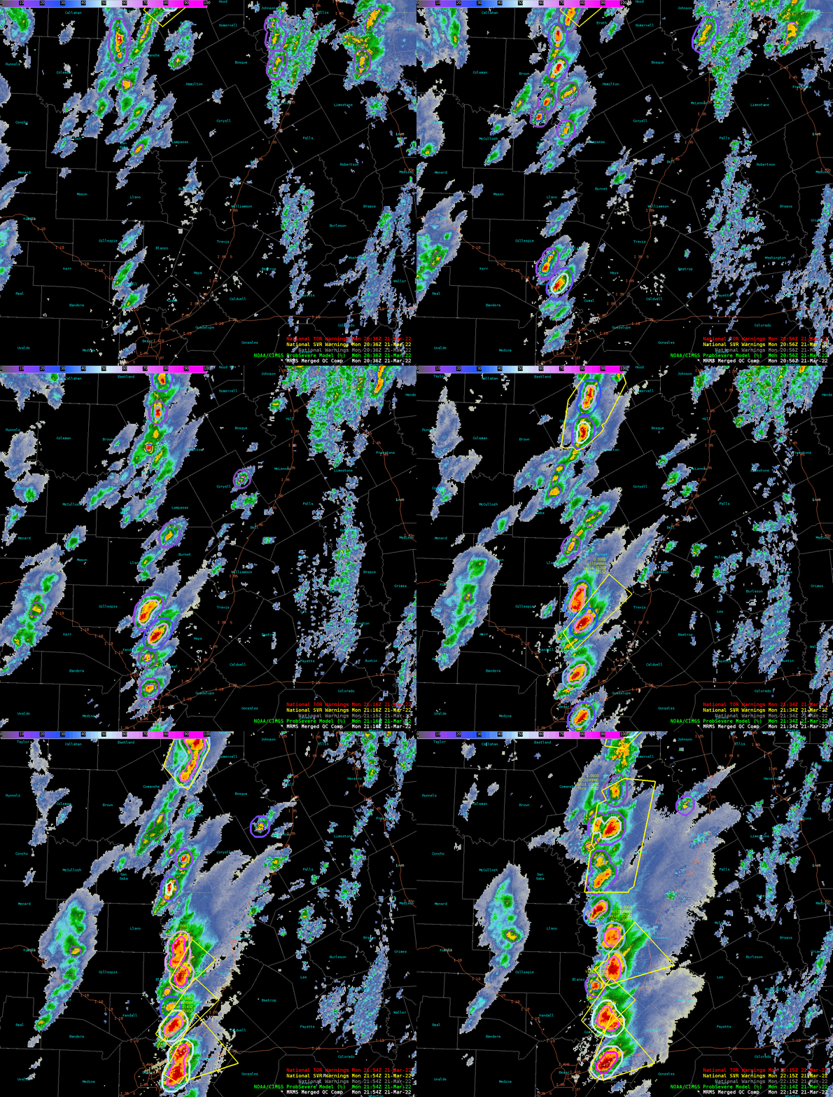
Another image-based AI model within ProbSevere is called IntenseStormNet, which seeks to identify the most intense regions of thunderstorms. It uses images of ABI and GLM data as predictors to probabilistically diagnose storm intensity from a geostationary perspective. Its goal is to identify intense parts of storms as humans do: holistically; by picking up on the spatial and multispectral features that imagery captures, such as overshooting tops, cold-U/AACP, cloud-top texture patterns, and stark cloud edges. In a paper published in 2020, we found that high probabilities from IntenseStormNet are frequently correlated with severe weather reports. Below shows IntenseStormNet output (contours) for some of the storms over Texas on March 21st, most of which spawned hail, damaging winds, and several tornadoes. IntenseStormNet contours can also be tracked over time, providing a novel way to investigate convective properties of storms.
ProbSevere v3
IntenseStormNet output is also being used as a predictor within the experimental ProbSevere v3, which uses satellite, radar, lightning, and NWP data, and machine-learning (ML) models to forecast the probabilities of hail, severe winds, and tornadoes in the next 60 minutes. While ProbSevere v2 is operational at NOAA’s Centers for Environmental Prediction, ProbSevere v3 is being evaluated by NWS forecasters at the 2022 Hazardous Weather Testbed. An analysis of thousands of storms from 2021 showed that additional predictors and the more sophisticated ML models in v3 improve upon v2 performance. ProbSevere uses multi-sensor storm tracking and feature extraction to predict probabilities of severe weather across the U.S. Below are several animations of ProbSevere v3 output in Texas on March 21st.


