Ice over the Great Lakes
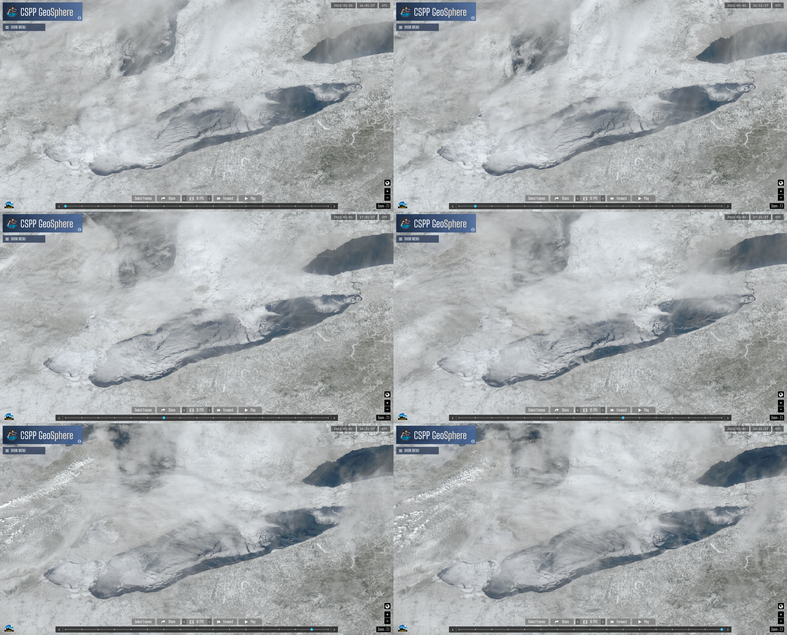
GOES-16 True-Color imagery from CSPP Geosphere (direct link to animation), above, shows high clouds over Lake Erie moving eastward as lake ice moves to the north. It is an unusual day that allows a (relatively) unobstructed view of the lake surface. Clouds are often present. Note that southern Lake Huron also seems ice-covered; western Lake Ontario is clear of ice.
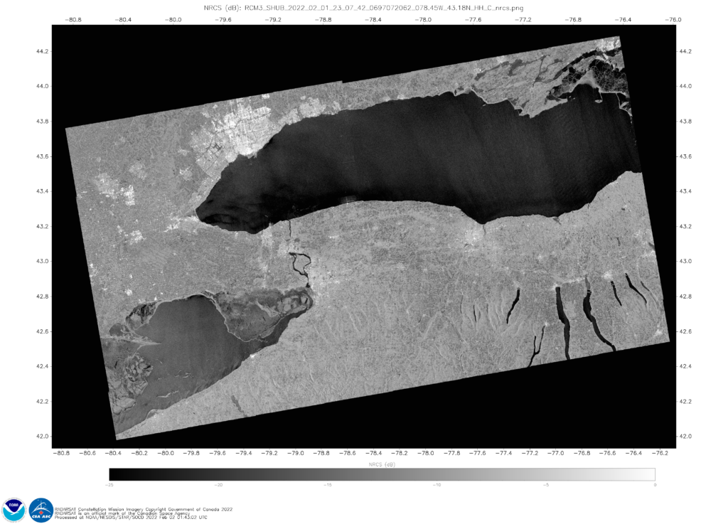
The image below shows ice over eastern Lake Erie and Lake Ontario from Synthetic Aperture Radar (SAR) data from the RADARSat Constellation Mission 3 (RCM3) satellite on 1 February (after sunset) from this website. Ice is indicated over eastern Lake Erie, and over central Lake Erie south of Long Point, Ontario. RCM orbits produce overlaps every 4 days, so a similar view occurred on 28 January; this is useful to see how things change. With practice, your eye will differentiate ice structures from wind features. This is especially true if you view the imagery daily.
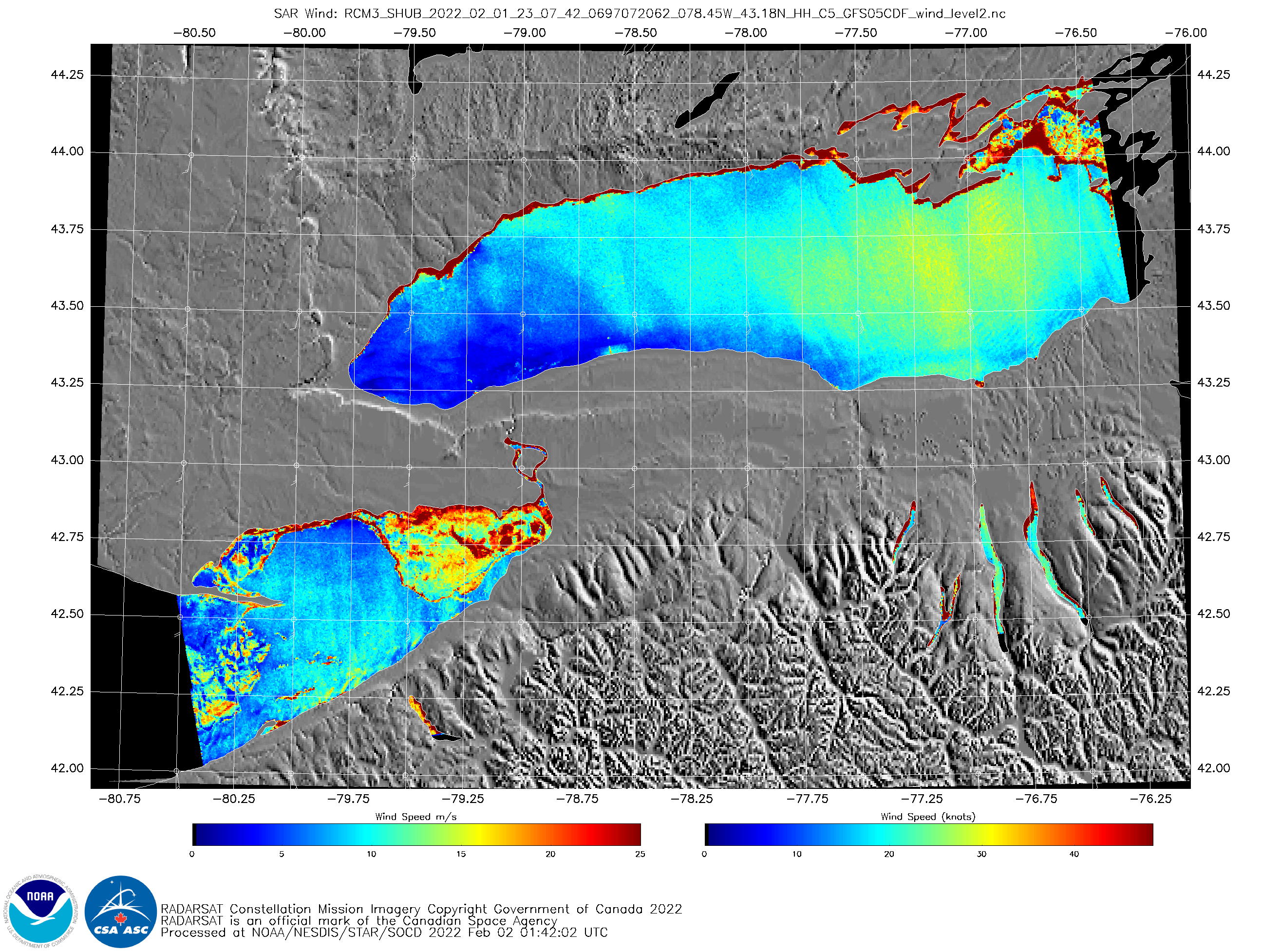
Synthetic Aperture Radar (SAR) data from RADARSAT Constellation Mission (RCM) satellites do give very high-resolution views of wind and ice over water. Wind roughens the open water surface, and the capillary waves that form on the water surface produce Bragg Scattering to which the SAR instruments are sensitive. Past blog posts that relate SAR observations to winds are here. (In the imagery above, plotted winds — in white — are from the GFS analysis) When ice starts to cover a lake, the roughness of the lake is damped, and it becomes more difficult for the wind to perturb the lake surface. In addition, a smooth ice surface will reflect microwave signals, not scatter them. However, frozen lake surfaces are not always smooth, and strong microwave signals can be reflected back to the SAR satellites, as suggested in the imagery above.
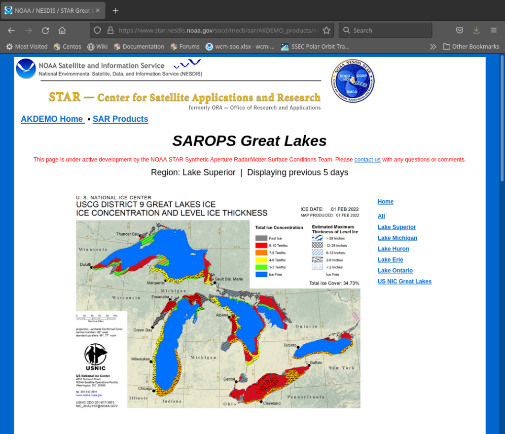
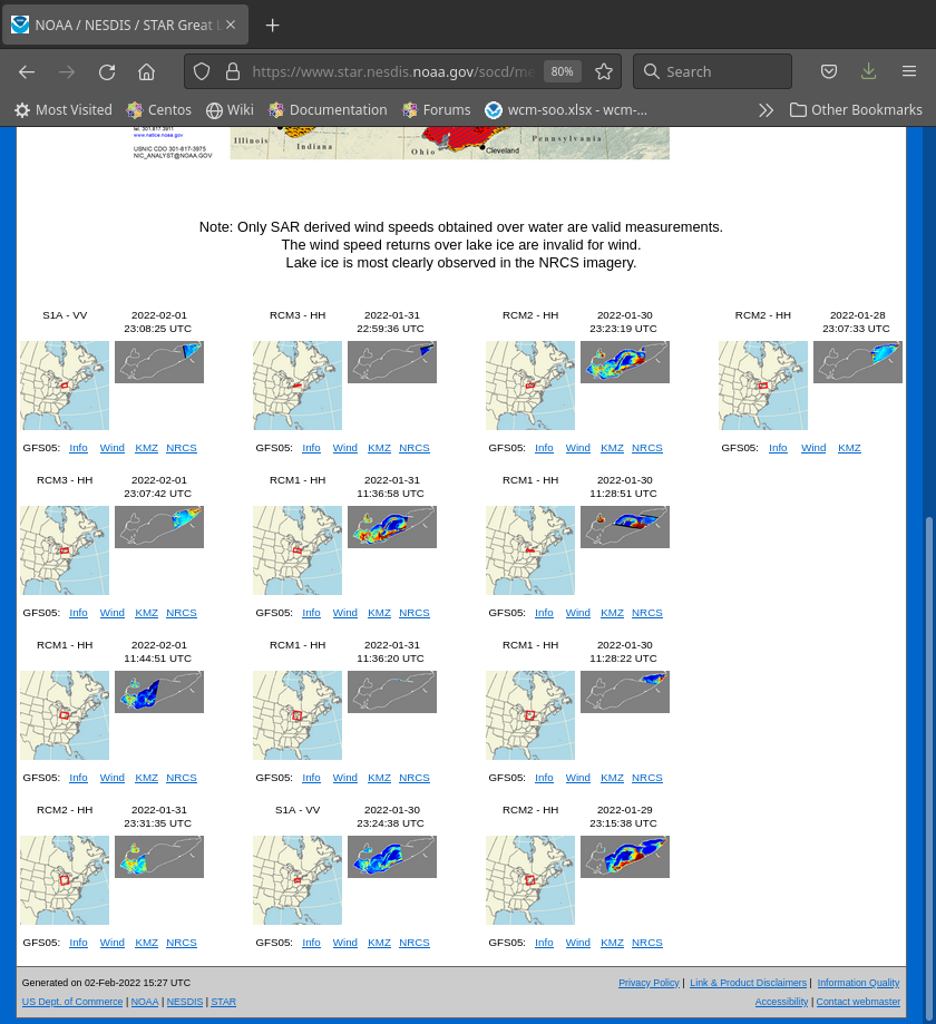
At the request of National Weather Service forecast offices, NOAA STAR’s SAR Team is creating a website that includes daily SAR imagery (when available) over the individual Great Lakes. The website is shown at bottom. Of particular interest for ice detection are the black and white NRCS (Normalized Radar Cross Section) images. The NRCS image that corresponds to the color image above is shown below. It has remarkable detail.
The Operational SAR website for the Great Lakes is shown below. Of special note are the individual Lake views that are available by clicking on the desired Great Lake. Click, and then scroll down and view all the recent SAR imagery available over that Lake, as shown below for Lake Erie.
