Tropical disturbance near Fiji

GOES-17 ABI and GLM imagery (from this NOAA STAR website), above, over the southern Pacific Ocean show a region of potential tropical cyclogenesis to the west of Fiji, near the western boundary of this mapping. This Invest Area has been percolating for much of the week. Despite low values of shear (shown below, from this website) and warm sea-surface temperatures, intensification to a tropical depression has not yet occurred (see this discussion from the Joint Typhoon Warning Center). However, GLM observations of Flash Extent Density (FED) do show occasional lightning events within the developing system.

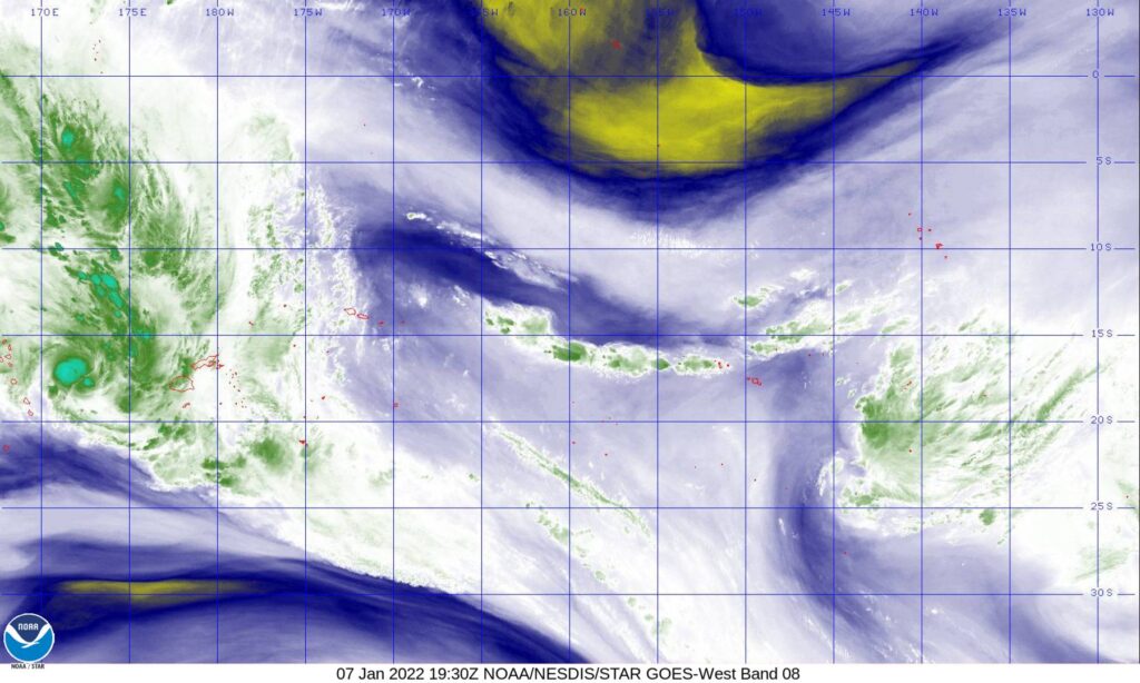
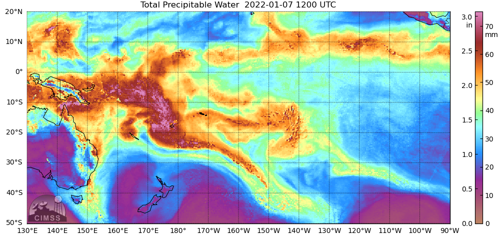
Upper-level water vapor imagery (GOES-17 Band 8, at 6.19 µm), below, from 1940 UTC, shows a distinct cirrus overcast at about 17 S, 172 E. Substantial dry air is not indicated in the water vapor imagery, nor in a MIMIC TPW mapping from 1200 UTC (downloaded from here), shown below.


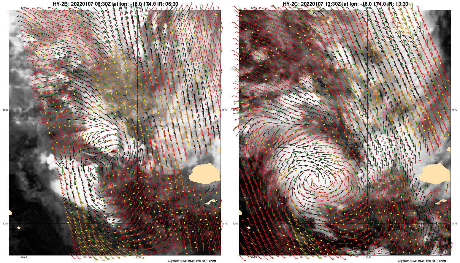
Scatterometry over this system on 7 January (downloaded from this website), show an increase in symmetry to the storm between the HY-2B overpass at 0630 UTC and the HY-2C overpass at 1330 UTC. For more information on this system over the weekend, refer to the SSEC/CIMSS Tropical Website, the Joint Typhoon Warning Center, and the Fiji Meteorological Service.


