Pyrocumulonimbus clouds spawned by the KNP Complex wildfire in California

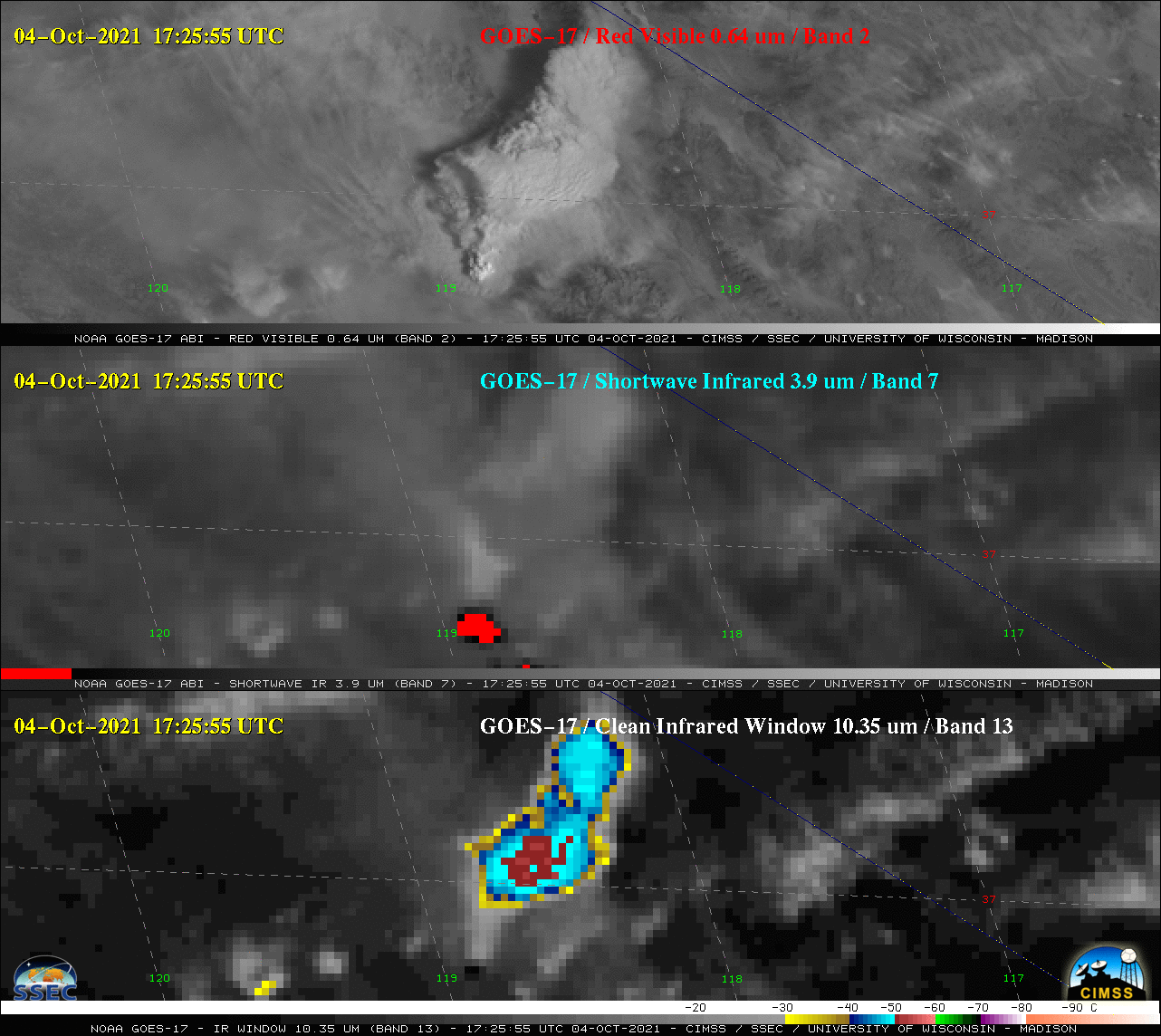
GOES-17 Visible (0.64 µm, center), Shortwave Infrared (3.9 µm, center) and Infrared Window (10.35 µm, bottom) images [click to play animation | MP4]
The KNP Complex wildfire continued to burn in central California on 04 October 2021, producing a pair of pyrocumulonimbus or pyroCb clouds — one during the atypical late morning hours (beginning around 1530 UTC, or 11:30 am PDT) and the other during the more typical late afternoon hours (beginning around 2130 UTC, or 5:30 PM PDT). 1-minute Mesoscale Domain Sector GOES-17 (GOES-West) “Red” Visible (0.64 µm), Shortwave Infrared (3.9 µm) and “Clean” Infrared Window (10.35 µm) images (above) showed the pyroCB clouds, fire thermal anomalies or “hot spots” (clusters of red pixels) and cold cloud-top infrared brightness temperatures, respectively. The minimum 10.35 µm temperatures were near -60ºC. Note the relatively warm (darker gray) appearance of the pyroCb clouds in the 3.9 µm images — this is a characteristic signature of pyroCb cloud tops, driven by the smoke-induced shift toward smaller ice particles (which act as more efficient reflectors of incoming solar radiation, contributing to the warmer 3.9 µm brightness temperatures). Note: beginning at 1700 UTC, overlapping GOES-17 Mesoscale Sectors provided imagery at 30-second intervals.
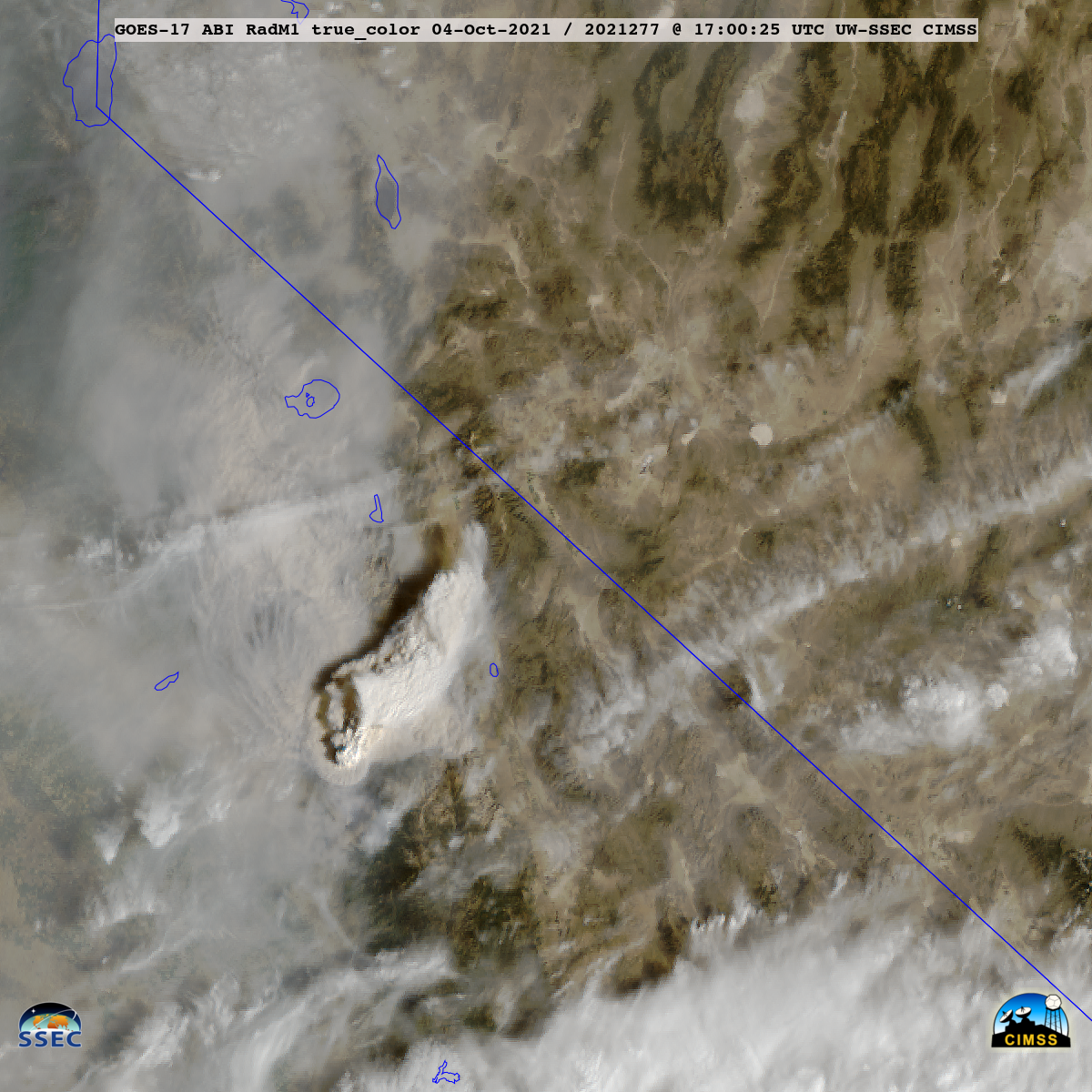
1-minute GOES-17 True Color RGB images created using Geo2Grid (below) showed the first pyroCb cloud as it continued to move northeastward across the California/Nevada border, and then the second pyroCb cloud as it moved northwestward. The change in direction of motion was influenced by the approach of an offshore closed low from the west (250 hPa analysis: 12 UTC | 00 UTC).

GOES-17 True Color RGB images [click to play animation | MP4]

